Download
Preview
Add to list
More
15.5 km
~4 hrs 53 min
1068 m
Loop
“This 16 km loop trail in England offers challenging ascents, stunning views, and rich historical context.”
Starting near Westmorland and Furness, England, this 16 km (approximately 10 miles) loop trail offers a moderately challenging hike with an elevation gain of around 1000 meters (3280 feet). The trailhead is accessible by car, with parking available near Patterdale, or by public transport with buses running from Penrith to Patterdale.
Initial Ascent to St Sunday Crag The hike begins with a steady ascent towards St Sunday Crag. As you climb, you'll gain about 600 meters (1968 feet) in elevation over the first 4 km (2.5 miles). The path is well-trodden but can be rocky and steep in sections, so sturdy hiking boots are recommended. Along the way, you'll be treated to panoramic views of Ullswater and the surrounding fells. Keep an eye out for red squirrels and various bird species, including peregrine falcons.
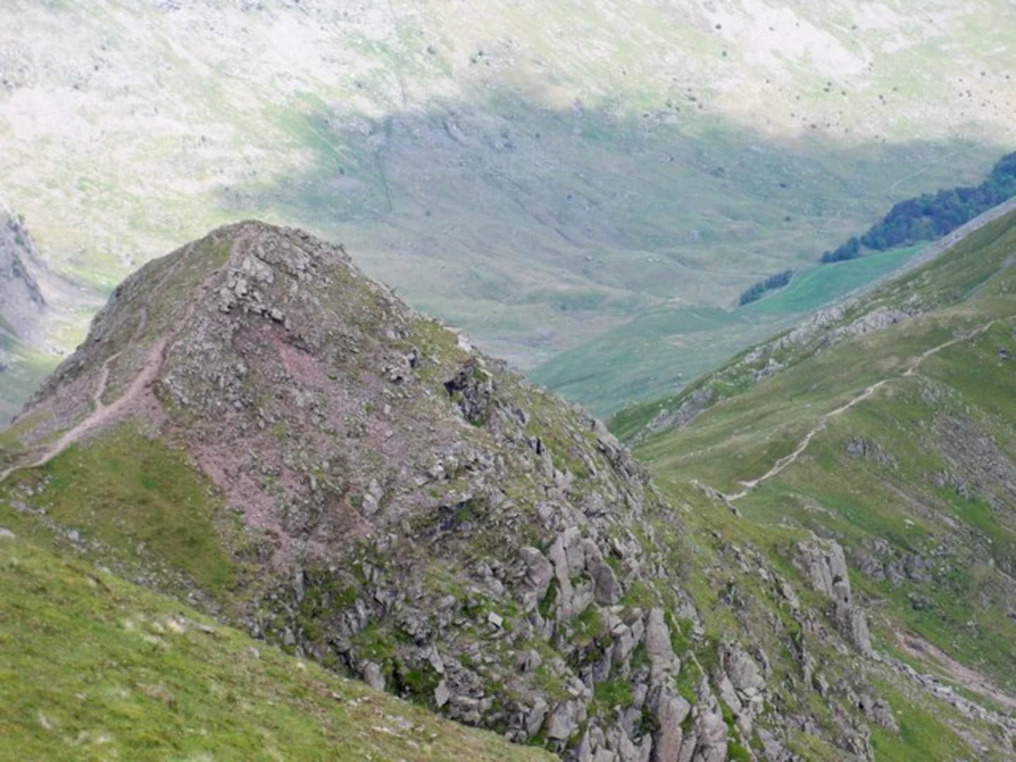
Traversing to Cofa Pike From St Sunday Crag, the trail continues towards Cofa Pike. This section is about 2 km (1.2 miles) and involves a descent followed by another ascent. The terrain here can be quite rugged, with some scrambling required. The views from Cofa Pike are spectacular, offering a 360-degree panorama of the Lake District. This area is rich in history, with ancient stone walls and remnants of old shepherding routes.
Climbing to Fairfield The next leg of the journey takes you to Fairfield, adding another 2 km (1.2 miles) and about 200 meters (656 feet) of elevation gain. The path is less steep but can be exposed to the elements, so be prepared for wind and sudden weather changes. Fairfield's summit is a broad plateau, providing ample space to rest and take in the views. Historically, this area was used for summer grazing by local farmers, and you might still see Herdwick sheep grazing.
Descent to Grisedale Tarn From Fairfield, the trail descends towards Grisedale Tarn, covering approximately 3 km (1.9 miles). The descent is gradual but can be slippery, especially after rain. Grisedale Tarn is a serene mountain lake nestled between the fells, offering a perfect spot for a break. The tarn has historical significance, as it was once considered a potential burial site for the legendary King Dunmail.
Return via Grisedale Valley The final leg of the hike takes you through Grisedale Valley, a gentle 5 km (3.1 miles) descent back to the trailhead. The path follows Grisedale Beck, a picturesque stream that meanders through the valley. This section is less strenuous, allowing you to enjoy the lush greenery and perhaps spot some roe deer. The valley is also home to several historical farmsteads, some dating back to the 17th century.
Navigation and Safety For navigation, it's advisable to use the HiiKER app, which provides detailed maps and real-time updates. The trail is generally well-marked, but weather conditions can change rapidly, so always be prepared with appropriate gear, including waterproof clothing and a first aid kit.
This loop trail offers a blend of challenging ascents, breathtaking views, and rich historical context, making it a rewarding experience for any hiker.

What to expect?
Activity types
Comments and Reviews
User comments, reviews and discussions about the St Sunday Crag, Cofa Pike, Fairfield and Grisedale Tarn, England.
5.0
average rating out of 5
3 rating(s)