Download
Preview
Add to list
More
14.3 km
~3 hrs 43 min
523 m
Loop
“This 14 km loop trail near Shap offers scenic views, historical intrigue, and a moderate hiking challenge.”
Starting near Westmorland and Furness in England, this 14 km (approximately 8.7 miles) loop trail offers a moderate challenge with an elevation gain of around 500 meters (about 1,640 feet). The trailhead is conveniently accessible by car or public transport. If driving, you can park near the village of Shap, which is the nearest significant landmark. For those using public transport, Shap is serviced by local buses from Penrith, which is well-connected by train to major cities.
Trail Overview
The trail begins with a gentle ascent through lush meadows and farmland, offering panoramic views of the surrounding countryside. As you progress, the path becomes steeper, leading you into a dense woodland area. This section is particularly beautiful in the spring and autumn when the foliage is vibrant. Keep an eye out for local wildlife, including deer and a variety of bird species.
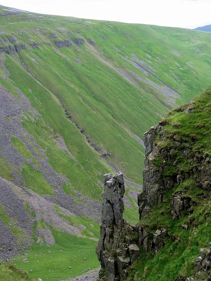
Peeping Hill
At approximately 5 km (3.1 miles) into the hike, you'll reach Peeping Hill. This vantage point provides stunning views of the Lake District to the west and the Pennines to the east. The elevation gain to this point is around 250 meters (820 feet), making it a great spot for a rest and some photography. The hill is named for its "peeping" views through the trees, offering glimpses of the landscape below.
Narrowgate Path
Continuing from Peeping Hill, the trail descends slightly before joining the Narrowgate Path. This section is characterized by its narrow, winding route through rocky terrain and open moorland. The path can be slippery after rain, so good hiking boots are essential. The elevation gain here is more gradual, adding another 150 meters (492 feet) over the next 4 km (2.5 miles).
Historical Significance
The area around Narrowgate Path is steeped in history. You'll pass by remnants of ancient stone walls and possibly even some old Roman roads. This region was historically significant as a route for Roman soldiers and later for medieval traders. The landscape has remained largely unchanged, offering a glimpse into England's past.
Final Stretch
The last 5 km (3.1 miles) of the trail loop back towards Shap, descending through open fields and past small streams. This section is relatively easy, with a gentle decline of about 100 meters (328 feet). It's a relaxing end to a moderately challenging hike, allowing you to cool down and enjoy the serene countryside.
Navigation and Safety
For navigation, it's highly recommended to use the HiiKER app, which provides detailed maps and real-time updates. The trail is well-marked, but having a reliable navigation tool ensures you stay on track, especially in the more remote sections. Always carry enough water, snacks, and a basic first aid kit. Weather in this region can be unpredictable, so layers and waterproof gear are advisable.
This trail offers a perfect blend of natural beauty, moderate physical challenge, and historical intrigue, making it a rewarding experience for any hiker.

What to expect?
Activity types
Comments and Reviews
User comments, reviews and discussions about the Peeping Hill and Narrowgate Path, England.
4.67
average rating out of 5
3 rating(s)