Download
Preview
Add to list
More
8.3 km
~2 hrs 7 min
277 m
Loop
“Embark on a scenic 8 km journey through serene woodlands and historical landmarks in Westmorland and Furness.”
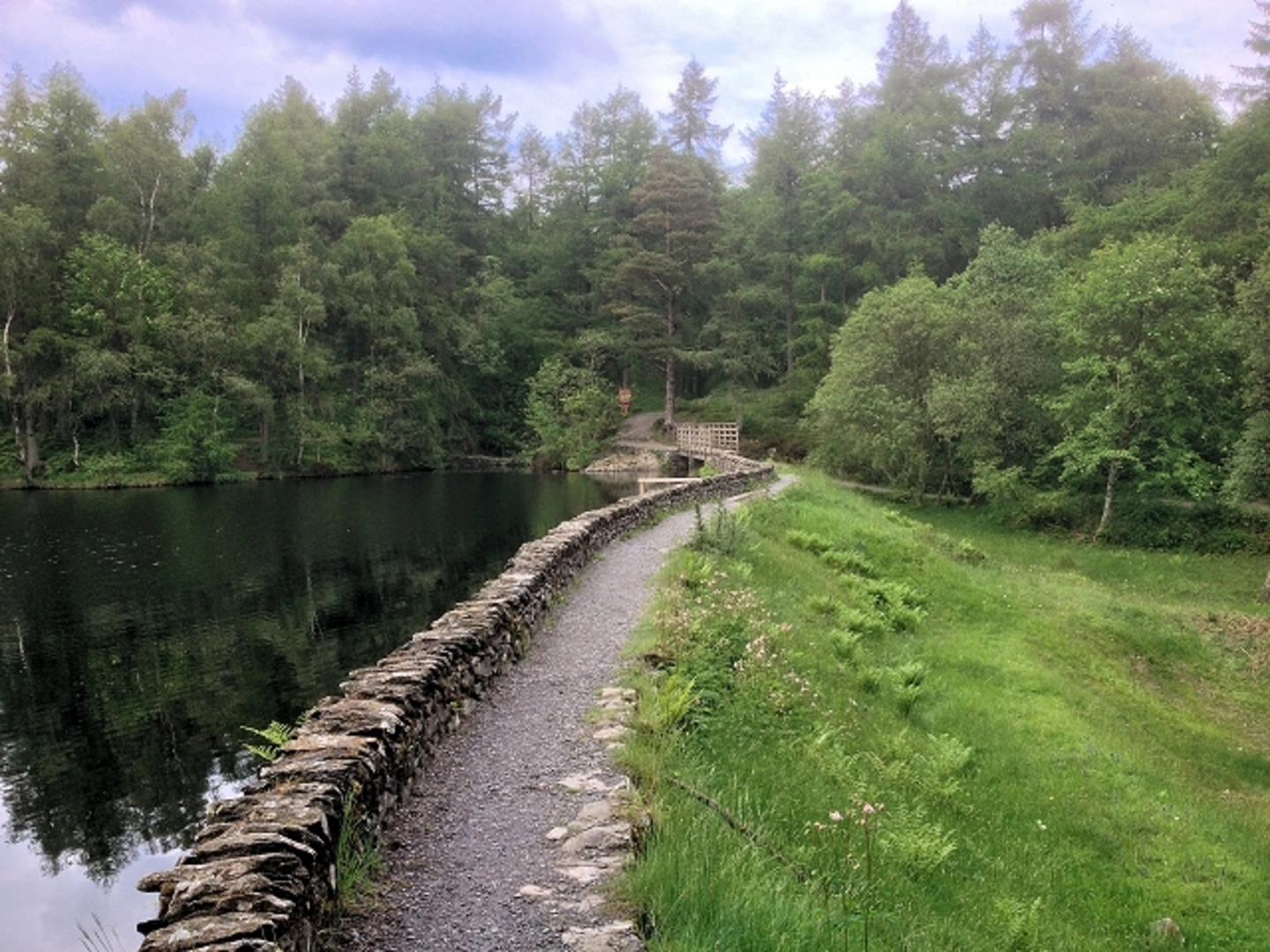
Starting near the picturesque village of Staveley-in-Cartmel, the High Dam and Parocket Height Loop offers a delightful 8 km (5 miles) journey through the serene landscapes of Westmorland and Furness, England. With an elevation gain of around 200 meters (656 feet), this loop trail is rated as medium difficulty, making it suitable for moderately experienced hikers.### Getting There To reach the trailhead, you can drive to Staveley-in-Cartmel, which is well-signposted from the A590. There is a small car park near the village where you can leave your vehicle. If you prefer public transport, the nearest train station is in Grange-over-Sands, approximately 6 km (3.7 miles) away. From there, you can take a local bus or taxi to Staveley-in-Cartmel.### Trail Overview The trail begins with a gentle ascent through mixed woodland, where you’ll be greeted by the tranquil sounds of birdsong and rustling leaves. After about 1 km (0.6 miles), you’ll reach High Dam, a serene tarn surrounded by lush greenery. This is an excellent spot for a short break, where you can enjoy the reflections of the surrounding trees on the water’s surface.### High Dam to Parocket Height Continuing from High Dam, the trail gradually climbs towards Parocket Height. The path here is well-marked but can be muddy after rain, so sturdy hiking boots are recommended. As you ascend, you’ll pass through a mix of deciduous and coniferous forests, offering a variety of flora and fauna. Keep an eye out for red squirrels and a variety of bird species, including woodpeckers and nuthatches.### Historical Significance The area around High Dam has a rich history, with evidence of human activity dating back to the Bronze Age. The dam itself was originally constructed in the 19th century to provide water for the nearby Bobbin Mill, which played a crucial role in the local economy. As you hike, you may notice remnants of old stone walls and other historical features that hint at the area’s industrial past.### Parocket Height to Trail End Upon reaching Parocket Height, you’ll be rewarded with panoramic views of the surrounding countryside, including glimpses of Lake Windermere on a clear day. This is the highest point of the trail, and the elevation gain totals around 200 meters (656 feet) by this stage. Take a moment to soak in the scenery before beginning your descent.The descent is more gradual and takes you through open meadows and past small streams. The path eventually loops back towards Staveley-in-Cartmel, passing through charming farmland and offering more opportunities to spot local wildlife.### Navigation and Safety While the trail is generally well-marked, it’s always a good idea to have a reliable navigation tool. The HiiKER app is highly recommended for this purpose, as it provides detailed maps and real-time tracking to ensure you stay on course. Additionally, be prepared for changing weather conditions, as the area can be quite unpredictable.### Final Stretch As you near the end of the loop, you’ll re-enter the woodland area, eventually arriving back at the starting point near Staveley-in-Cartmel. This final stretch is relatively flat and offers a peaceful conclusion to your hike.Whether you’re drawn by the natural beauty, the historical significance, or the chance to spot some local wildlife, the High Dam and Parocket Height Loop is a rewarding trail that offers a bit of everything.

What to expect?
Activity types
Comments and Reviews
User comments, reviews and discussions about the High Dam and Parocket Height Loop, England.
4.33
average rating out of 5
6 rating(s)