Download
Preview
Add to list
More
8.3 km
~2 hrs 5 min
261 m
Loop
“This 8 km loop in Westmorland and Furness combines stunning lakes, waterfalls, woodland, and historical intrigue.”
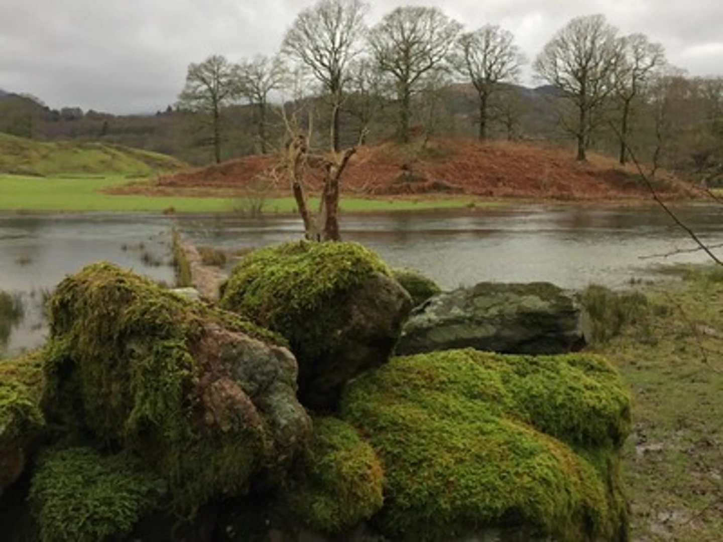
Starting near Westmorland and Furness in England, this 8 km (approximately 5 miles) loop trail offers a delightful mix of natural beauty and historical intrigue. With an elevation gain of around 200 meters (656 feet), the trail is rated as medium difficulty, making it accessible for most hikers with a moderate level of fitness.### Getting There To reach the trailhead, you can either drive or use public transport. If driving, head towards the village of Elterwater, where you can find parking options. For those using public transport, the nearest train station is Windermere. From Windermere, you can take a bus to Elterwater, which is well-connected by local bus services.### Trail Highlights#### Elter Water Starting from the village of Elterwater, the trail takes you along the serene shores of Elter Water, a small lake that offers stunning reflections of the surrounding fells. This area is a haven for birdwatchers, with species such as herons and kingfishers frequently spotted. The lake itself is a remnant of glacial activity, adding a layer of geological interest to your hike.#### Skelwith Force Approximately 1.5 km (0.9 miles) into the hike, you will encounter Skelwith Force, a powerful waterfall on the River Brathay. Despite its modest height of around 5 meters (16 feet), the force of the water is impressive, especially after heavy rains. There are several vantage points where you can safely enjoy the view and take photographs.#### Bridge How Coppice Continuing on, the trail leads you through Bridge How Coppice, a woodland area rich in biodiversity. This section of the hike is particularly enchanting in the spring when bluebells carpet the forest floor. Keep an eye out for red squirrels, a species that has become increasingly rare in the UK but still thrives in this protected habitat.### Historical Significance The region around Elterwater has a rich history, dating back to the medieval period. The village itself was once a hub for the local slate industry, and remnants of old quarries can still be seen along the trail. Additionally, the area was frequented by the famous poet William Wordsworth, who found inspiration in its natural beauty.### Navigation and Safety For navigation, it is highly recommended to use the HiiKER app, which provides detailed maps and real-time updates. The trail is well-marked, but having a reliable navigation tool ensures you stay on track and can fully enjoy the experience without any worries.### Flora and Fauna The trail offers a diverse range of flora and fauna. In addition to the aforementioned bird species and red squirrels, you might also encounter deer, badgers, and a variety of wildflowers. The mixed woodlands and open meadows provide a rich tapestry of natural beauty throughout the year.### Final Stretch As you loop back towards Elterwater, the final stretch of the trail offers panoramic views of the Langdale Pikes, a dramatic range of peaks that dominate the skyline. This section is relatively flat, allowing you to relax and take in the scenery as you make your way back to the starting point.This trail is a perfect blend of natural beauty, historical significance, and moderate physical challenge, making it a rewarding experience for any hiker.

What to expect?
Activity types
Comments and Reviews
User comments, reviews and discussions about the Elter Water, Skelwith Force and Bridge How Coppice Loop, England.
4.67
average rating out of 5
6 rating(s)