Download
Preview
Add to list
More
22.2 km
~4 hrs 40 min
141 m
Point-to-Point
“Embark on a 22 km scenic hike from Hollins Green to Golborne, rich with nature and history.”
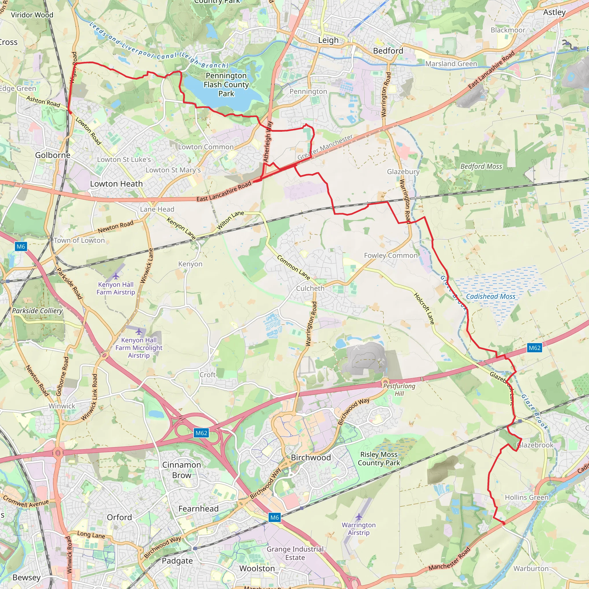
Starting near Warrington, England, the Hollins Green to Golborne Walk spans approximately 22 km (13.7 miles) with an elevation gain of around 100 meters (328 feet). This point-to-point trail is estimated to be of medium difficulty, making it suitable for moderately experienced hikers.
Getting There To reach the trailhead, you can take public transport to Warrington. Warrington Central and Warrington Bank Quay are the main train stations, with regular services from major cities like Manchester and Liverpool. From the station, local buses or taxis can take you to Hollins Green. If driving, you can park near the starting point in Hollins Green, which is easily accessible via the M6 motorway.
Trail Overview The trail begins in the quaint village of Hollins Green, known for its picturesque countryside and historic charm. As you set off, you'll traverse through a mix of rural landscapes, including open fields, woodlands, and small villages. The terrain is relatively flat with gentle undulations, making it a pleasant walk without strenuous climbs.
Key Landmarks and Points of Interest - **Rixton Clay Pits**: About 3 km (1.9 miles) into the hike, you'll come across the Rixton Clay Pits, a nature reserve known for its diverse wildlife, including various bird species and rare plants. It's a great spot for a short break and some birdwatching. - **Glazebrook**: At approximately 6 km (3.7 miles), you'll pass through the village of Glazebrook. Here, you can see the historic Glazebrook House and enjoy the serene environment of the Glazebrook Meadows. - **Pennington Flash**: Around the halfway mark, 11 km (6.8 miles) in, you'll encounter Pennington Flash, a large lake and country park. This area is a haven for birdwatchers and offers beautiful views, picnic spots, and restrooms. - **Leigh**: As you continue, you'll pass through the town of Leigh at about 15 km (9.3 miles). Leigh is rich in industrial history, with landmarks like the Leigh Spinners Mill, a testament to the town's textile heritage. - **Bickershaw Country Park**: Nearing the end of your hike, around 18 km (11.2 miles), you'll enter Bickershaw Country Park. This reclaimed colliery site has been transformed into a green space with ponds, woodlands, and meadows, perfect for a final rest before completing your journey.
Navigation and Safety Using HiiKER for navigation is highly recommended to ensure you stay on track. The trail is well-marked, but having a reliable navigation tool will help you manage any unexpected detours or changes in the route.
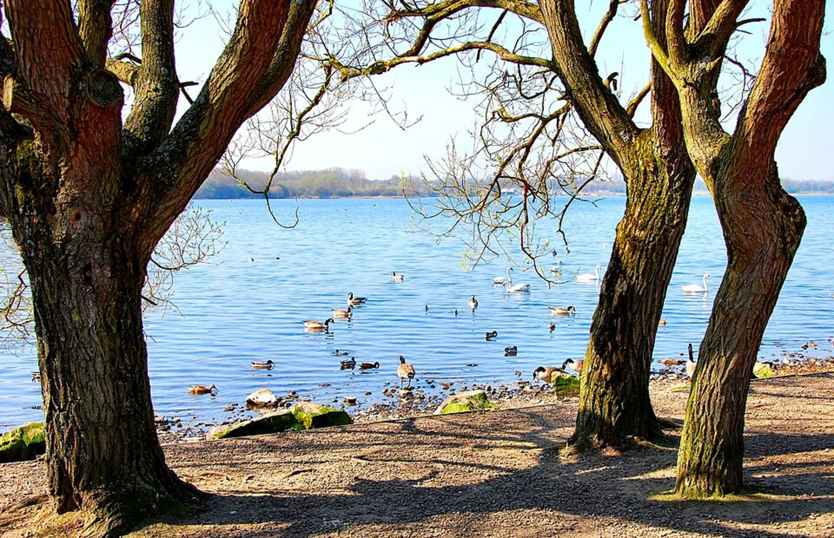
Wildlife and Flora Throughout the hike, you'll encounter a variety of wildlife, particularly in the nature reserves and country parks. Look out for birds like kingfishers, herons, and various waterfowl at Pennington Flash. The woodlands and meadows are home to deer, rabbits, and a plethora of wildflowers, especially in spring and summer.
Historical Significance The region is steeped in history, from the industrial heritage of Leigh to the ancient woodlands and historic villages along the route. The trail offers a glimpse into the past, with remnants of old mills, historic houses, and traditional English countryside.
Final Stretch The trail concludes in Golborne, a town with its own historical significance, particularly in coal mining. Golborne offers various amenities, including cafes and pubs where you can relax and reflect on your hike. Public transport options are available from Golborne back to Warrington or other nearby towns.
Prepare well, bring adequate supplies, and enjoy the diverse landscapes and rich history along the Hollins Green to Golborne Walk.
What to expect?
Activity types
Comments and Reviews
User comments, reviews and discussions about the Hollins Green to Golborne Walk, England.
4.0
average rating out of 5
1 rating(s)

