Download
Preview
Add to list
More
14.9 km
~3 hrs 42 min
443 m
Loop
“Embark on the Marley Heights via The Serpent Trail for stunning views, historical landmarks, and varied terrain.”
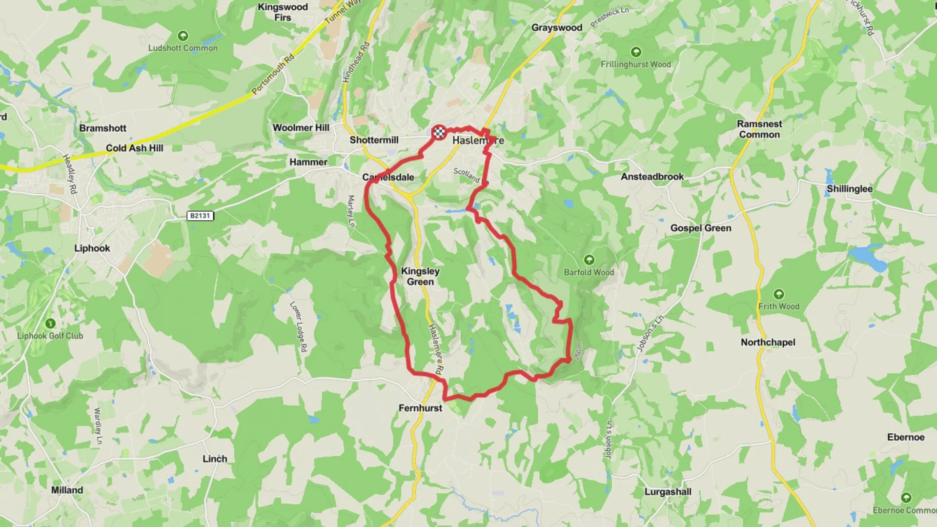
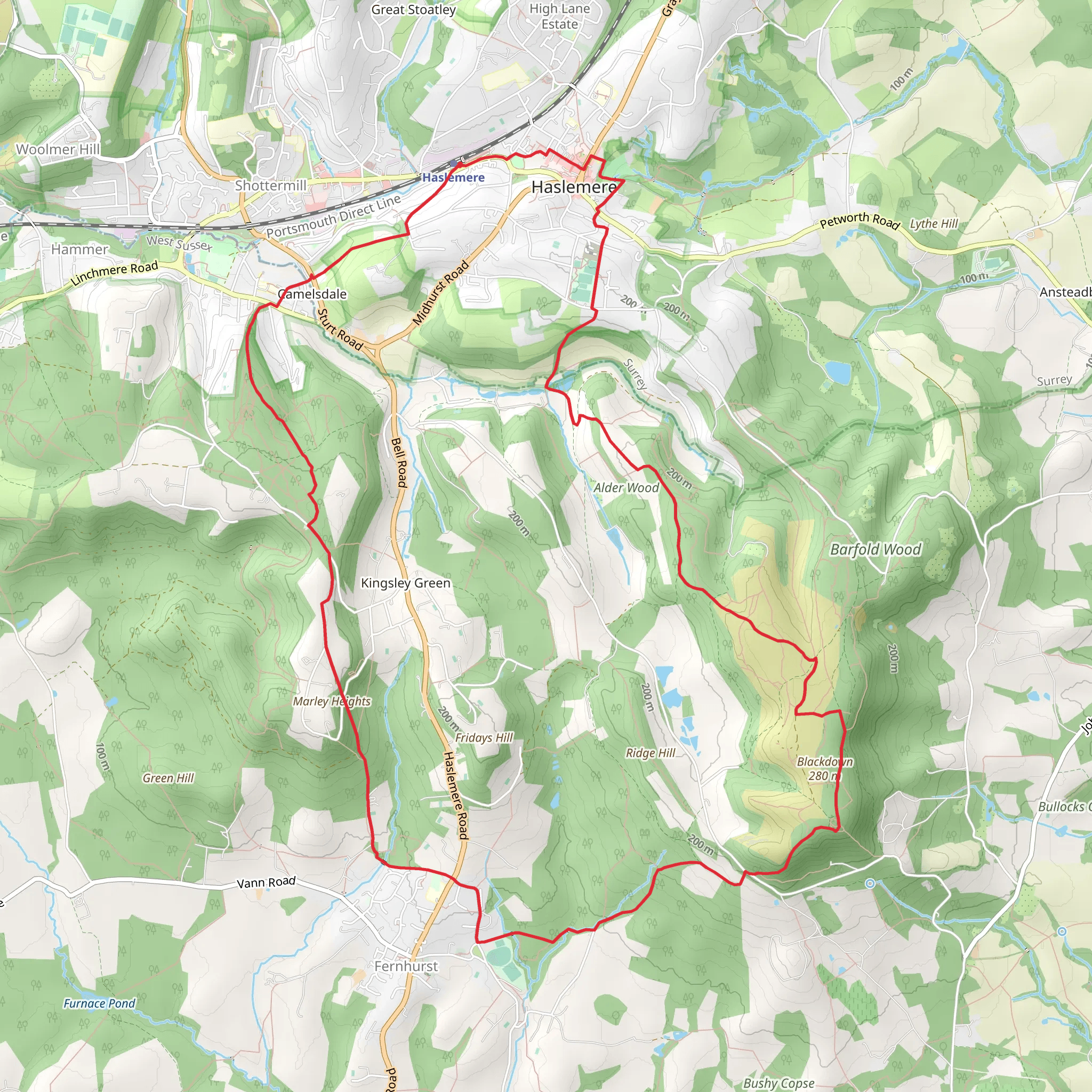
Starting near Surrey, England, this 15 km (approximately 9.3 miles) loop trail offers a moderate challenge with an elevation gain of around 400 meters (about 1,312 feet). The trailhead is conveniently located near the Marley Heights area, making it accessible for both local and visiting hikers.
Getting There To reach the trailhead, you can either drive or use public transport. If driving, set your GPS to Marley Heights, Surrey. For those using public transport, the nearest significant landmark is Haslemere Railway Station. From the station, you can take a local bus or taxi to Marley Heights, which is approximately 5 km (3.1 miles) away.
Trail Overview The Marley Heights via The Serpent Trail is a loop that takes you through a variety of landscapes, including dense woodlands, open heathlands, and scenic viewpoints. The trail is well-marked, but it's advisable to use the HiiKER app for navigation to ensure you stay on track.
Key Sections and Landmarks
#### Woodland and Heathland Starting from the trailhead, the first 3 km (1.9 miles) take you through a dense woodland area. This section is relatively flat, making it a good warm-up. Keep an eye out for local wildlife such as deer and various bird species. As you progress, the trail opens up into heathland, offering expansive views and a different type of flora, including heather and gorse.
#### Elevation Gain Around the 5 km (3.1 miles) mark, you'll begin to notice a gradual increase in elevation. This section is where you'll gain most of the 400 meters (1,312 feet) in elevation. The climb is steady but manageable, with several switchbacks to ease the ascent. Make sure to take breaks and enjoy the panoramic views of the Surrey countryside.
#### Historical Significance At approximately 7 km (4.3 miles), you'll come across a historical landmark known as the Devil's Punch Bowl. This natural amphitheater has a rich history, including tales of highwaymen and ancient folklore. It's a great spot to take a break and soak in the historical ambiance.
#### Scenic Viewpoints Continuing on, the trail offers several scenic viewpoints between the 8 km (5 miles) and 10 km (6.2 miles) marks. These spots provide excellent photo opportunities and a chance to appreciate the natural beauty of the area. On a clear day, you can see as far as the South Downs.
Final Stretch The last 5 km (3.1 miles) of the trail loop back towards Marley Heights. This section is mostly downhill, providing a pleasant and easy finish to your hike. You'll pass through more woodland areas and might even spot some more wildlife as you make your way back to the trailhead.
Preparation and Tips - **Footwear:** Sturdy hiking boots are recommended due to the varied terrain. - **Weather:** Check the weather forecast before you go, as the trail can become muddy and slippery in wet conditions. - **Supplies:** Bring enough water and snacks, especially if you plan to take breaks at the scenic viewpoints. - **Navigation:** Use the HiiKER app for real-time navigation and to stay updated on any trail changes or closures.
This trail offers a well-rounded hiking experience with a mix of natural beauty, historical landmarks, and moderate physical challenge. Whether you're a seasoned hiker or a weekend warrior, the Marley Heights via The Serpent Trail is sure to provide a memorable adventure.
What to expect?
Activity types
Comments and Reviews
User comments, reviews and discussions about the Marley Heights via The Serpent Trail, England.
4.67
average rating out of 5
3 rating(s)

