Download
Preview
Add to list
More
24.6 km
~1 day 0 hrs
611 m
Loop
“Explore a 25-km loop trail near Haslemere, offering lush woodlands, panoramic views, and rich biodiversity.”
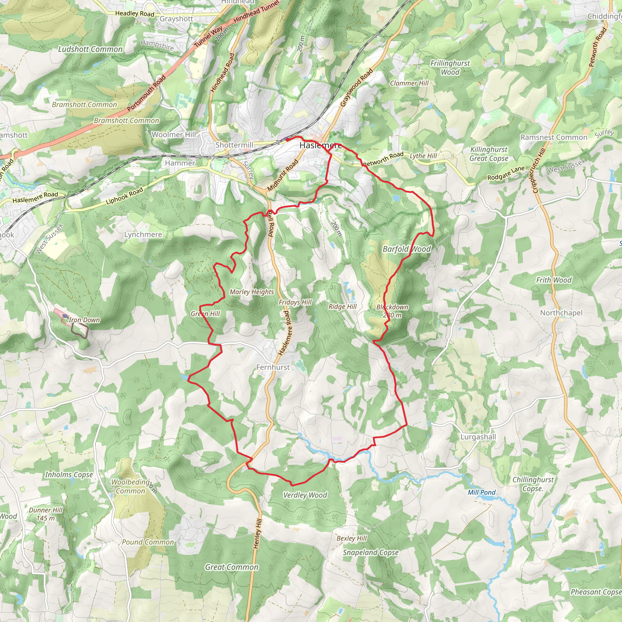
Starting near Surrey, England, this loop trail spans approximately 25 kilometers (15.5 miles) with an elevation gain of around 600 meters (1,968 feet). The trailhead is conveniently located near the village of Haslemere, which is accessible by both public transport and car. If you're traveling by train, Haslemere Station is the nearest stop, and from there, it's a short walk to the trailhead. For those driving, parking is available at the Haslemere High Street car park.### Initial Ascent and Green HillThe trail begins with a gentle ascent through lush woodlands, offering a serene start to your hike. As you climb Green Hill, you'll gain approximately 200 meters (656 feet) in elevation over the first 5 kilometers (3.1 miles). The path is well-marked and relatively easy to navigate, but it's always a good idea to have HiiKER on hand for real-time navigation.### Blackdown and Panoramic ViewsAround the 10-kilometer (6.2-mile) mark, you'll reach the highest point of the trail at Blackdown, which stands at 280 meters (919 feet). This section offers panoramic views of the South Downs and the Weald. On a clear day, you can see as far as the English Channel. Blackdown is also home to the Temple of the Winds, a viewpoint named after a Bronze Age barrow. This is a perfect spot for a rest and some photos.### Flora and FaunaThe trail is rich in biodiversity. As you traverse through heathlands and ancient woodlands, keep an eye out for native wildlife such as deer, foxes, and a variety of bird species including woodpeckers and buzzards. The flora is equally impressive, with seasonal blooms of bluebells in the spring and vibrant heather in the late summer.### Historical SignificanceThis region is steeped in history. The trail passes near several historical landmarks, including the Devil's Punch Bowl, a large natural amphitheater with a dark history of highwaymen and smugglers. Additionally, the area around Blackdown was once frequented by the famous poet Alfred Lord Tennyson, who found inspiration in its natural beauty.### Descent and ReturnThe descent begins after Blackdown, leading you through more mixed woodlands and open fields. The path can be steep in sections, so take care, especially if the ground is wet. You'll lose about 400 meters (1,312 feet) in elevation over the next 10 kilometers (6.2 miles). The final stretch of the trail brings you back to Haslemere, completing the loop.### Practical Information- Water and Supplies: There are no water sources along the trail, so bring enough water for the entire hike. Haslemere has several shops and cafes where you can stock up on supplies before you start. - Footwear: Given the varied terrain, sturdy hiking boots are recommended. - Weather: The weather can be unpredictable, so check the forecast and dress in layers.This trail offers a mix of natural beauty, historical intrigue, and moderate physical challenge, making it a rewarding experience for any hiker.
What to expect?
Activity types
Comments and Reviews
User comments, reviews and discussions about the Green Hill and Blackdown Loop, England.
4.0
average rating out of 5
5 rating(s)

