Download
Preview
Add to list
More
59.8 km
~3 days
499 m
Multi-Day
“Embark on the Downs Link, a scenic and historic 60km trail through England's serene countryside.”
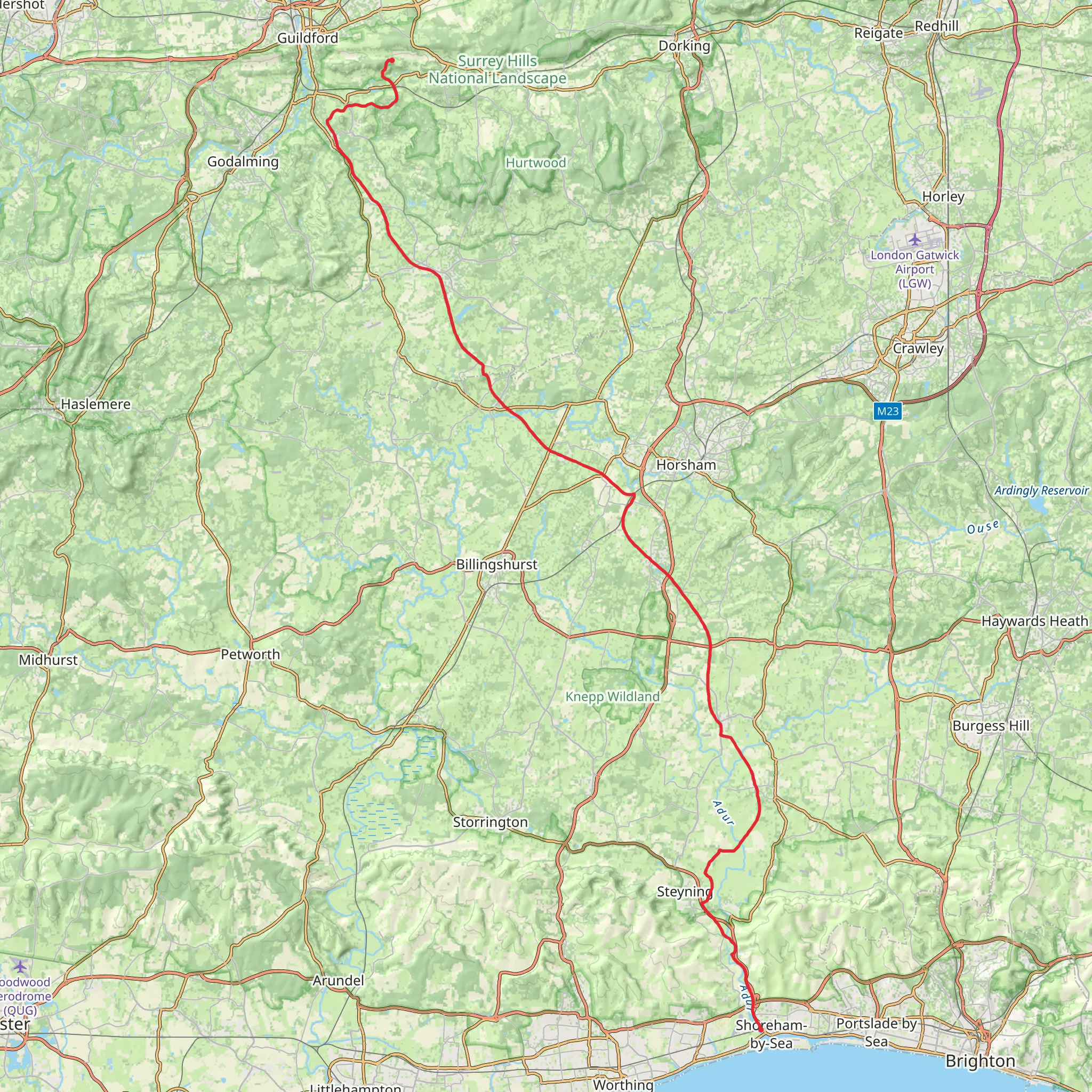
The Downs Link offers a unique journey through the picturesque countryside of Southern England, connecting the North Downs Way with the South Downs Way. Spanning approximately 60 kilometers (around 37 miles), with an elevation gain of roughly 400 meters (about 1,300 feet), this trail is a medium-difficulty adventure suitable for both seasoned hikers and those looking to immerse themselves in the tranquility of rural landscapes.
Getting to the Trailhead
The trailhead is conveniently located near Surrey, England. For those opting for public transport, the nearest train stations are in Guildford and Horsham, from which you can take a taxi or a local bus to reach the starting point. If you're driving, parking is available near St. Martha's Hill, Guildford, which is a good place to start your hike.
Navigating the Trail
As you embark on the Downs Link, you'll find the path well-marked and maintained, making navigation straightforward. For added assurance, HiiKER is an excellent tool to keep you on track, providing detailed maps and waypoints throughout your journey.
Historical Significance and Landmarks
The trail itself is steeped in history, following disused railway lines that once connected the towns of Guildford and Shoreham-by-Sea. Along the way, you'll encounter remnants of this industrial past, including old station platforms and railway bridges that have been repurposed for the trail.
Natural Beauty and Wildlife
The Downs Link meanders through a variety of landscapes, from serene woodland to open fields and riverbanks. It's a haven for wildlife enthusiasts, with opportunities to spot deer, foxes, and a plethora of bird species. The changing seasons bring different hues and flora, with bluebells carpeting the woods in spring and golden leaves in the autumn.
Key Sections of the Trail
- St. Martha's Hill to Cranleigh (0-14 km / 0-8.7 miles): Starting near St. Martha's Hill, the trail descends into the valley, offering views of the Tillingbourne stream and the surrounding hills. This section is relatively flat and passes through meadows and small woodlands.
- Cranleigh to West Grinstead (14-36 km / 8.7-22.4 miles): As you continue, the trail becomes more rural, with expansive views of the Sussex Weald. This stretch includes the crossing of the River Adur and the chance to explore the historic village of West Grinstead.
- West Grinstead to Shoreham-by-Sea (36-60 km / 22.4-37.3 miles): The final leg takes you closer to the coast, with the landscape opening up to reveal the South Downs in the distance. The trail ends near the vibrant town of Shoreham-by-Sea, where you can enjoy the seaside atmosphere before concluding your journey.
Preparation and Planning
Before setting out, ensure you have appropriate footwear and clothing for the varied terrain and weather conditions. Pack plenty of water and snacks, as there are stretches of the trail with limited facilities. It's also wise to carry a small first aid kit and a fully charged phone with the HiiKER app downloaded for navigation and emergency use.
The Downs Link is a trail that offers a blend of natural beauty, historical intrigue, and a peaceful escape from the hustle and bustle of daily life. Whether you're looking to complete it in sections or as a multi-day trek, it promises an enriching experience for all who walk its path.
What to expect?
Activity types
Comments and Reviews
User comments, reviews and discussions about the Downs Link, England.
4.89
average rating out of 5
9 rating(s)

