Download
Preview
Add to list
More
19.3 km
~4 hrs 8 min
166 m
Loop
“Discover Suffolk's charm on the Stanton to Wattisfield Loop, a historic hike through England's bucolic splendor.”
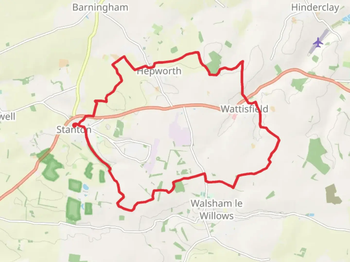
The Stanton to Wattisfield Loop is a scenic trail that meanders through the picturesque countryside of Suffolk, England. Spanning approximately 19 kilometers (about 12 miles) with an elevation gain of roughly 100 meters (328 feet), this loop offers a medium difficulty level, making it accessible to hikers with a moderate level of fitness.Starting near the village of Stanton, hikers can find the trailhead easily accessible by car, with parking available in the vicinity. For those opting for public transport, local bus services can be used to reach Stanton, from where the trailhead is a short walk away.Navigating the TrailAs you embark on the Stanton to Wattisfield Loop, you'll traverse a variety of terrains, including well-trodden footpaths, agricultural fields, and quiet country lanes. The use of a navigation tool like HiiKER can be invaluable in ensuring you stay on the correct path, as the trail can be interspersed with local footpaths and bridleways.Historical Significance and LandmarksThe region is steeped in history, with the trail passing close to several historical landmarks. One of the highlights is the small village of Wattisfield, which has a rich heritage dating back to the Roman times. Keep an eye out for the medieval church of St. Margaret, which stands as a testament to the area's long-standing religious significance.Flora and FaunaNature enthusiasts will appreciate the diverse wildlife and plant life along the trail. The hedgerows and woodlands are home to a variety of bird species, while the open fields may offer sightings of deer and other mammals. The changing seasons bring different flora to the forefront, with spring and summer showcasing a vibrant array of wildflowers.Preparation and PlanningBefore setting out, ensure you have adequate water and food supplies, as there are limited facilities along the route. The trail is well-defined in most places, but weather conditions can affect the trail's terrain, so appropriate footwear and clothing are recommended. Check the weather forecast in advance and be prepared for the changeable English weather.Getting to the TrailheadThe trailhead is located near the village of Stanton, which is accessible via the A143 road if you're driving. There is parking available in the village, from where you can start your hike. If you're using public transport, the nearest train station is in Bury St Edmunds, and from there, you can catch a bus to Stanton.Remember to respect the countryside code, leave no trace, and enjoy the serene beauty of the Suffolk landscape as you embark on the Stanton to Wattisfield Loop.

What to expect?
Activity types
Comments and Reviews
User comments, reviews and discussions about the Stanton to Wattisfield Loop, England.
4.0
average rating out of 5
2 rating(s)