Download
Preview
Add to list
More
6.3 km
~1 hrs 24 min
94 m
Loop
“The Berryhill Fields Circular Walk is a scenic, accessible 6 km trail rich in nature and history.”
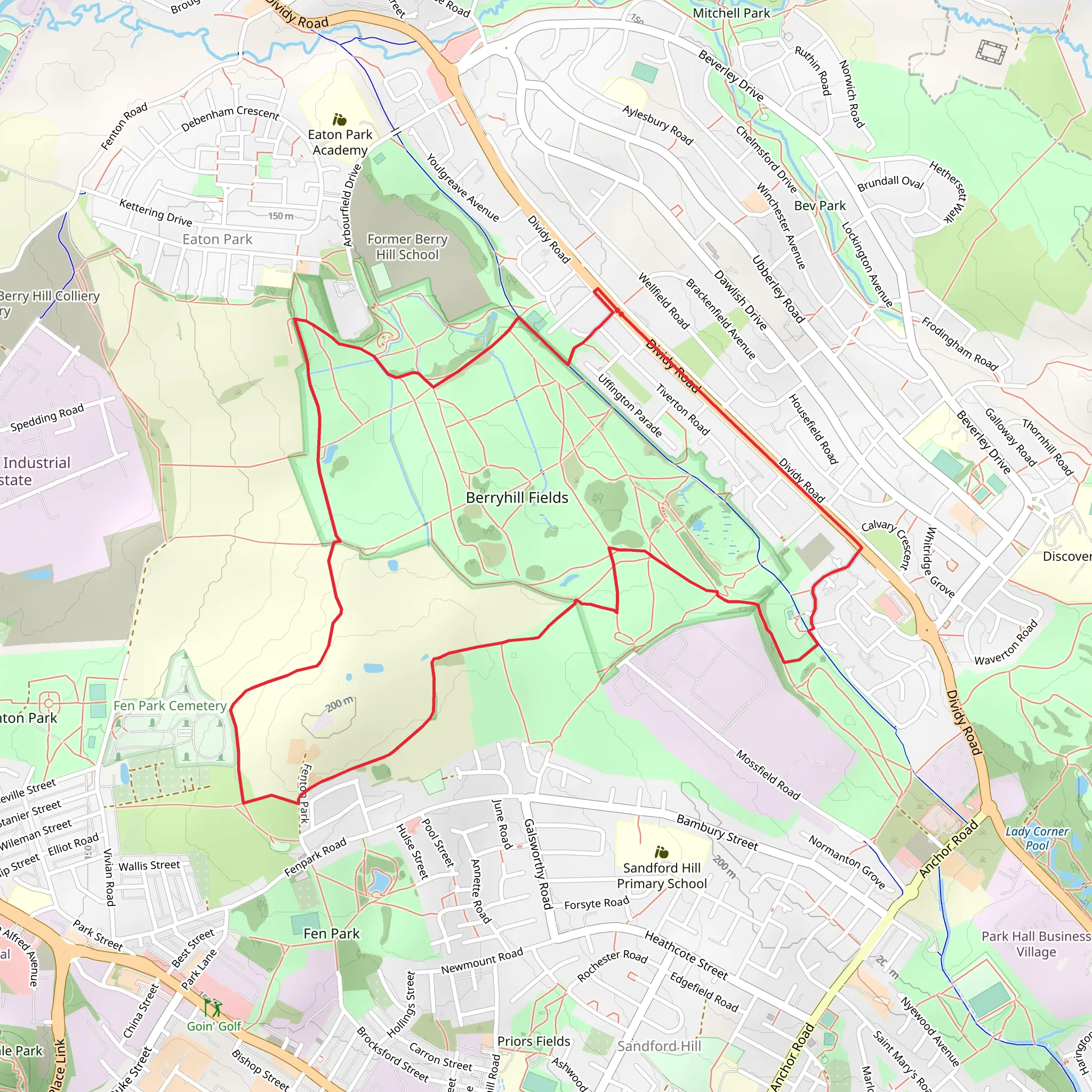
Starting near Stoke-on-Trent, England, the Berryhill Fields Local Nature Reserve Circular Walk is a delightful 6 km (approximately 3.7 miles) loop trail with no significant elevation gain, making it accessible for a wide range of hikers. The trailhead is conveniently located near the Berryhill Fields Local Nature Reserve, which can be accessed by car or public transport. If driving, you can park at the Berryhill Fields car park. For those using public transport, the nearest bus stop is at Dividy Road, which is a short walk from the trailhead.
Trail Overview
The Berryhill Fields Circular Walk offers a mix of open fields, woodland areas, and scenic views of the surrounding countryside. The trail is well-marked and maintained, making navigation straightforward. However, it’s always a good idea to have a reliable navigation tool like HiiKER to ensure you stay on track.
Flora and Fauna
As you embark on the trail, you'll notice the rich biodiversity of the area. The nature reserve is home to a variety of plant species, including wildflowers that bloom in the spring and summer months. Keep an eye out for common species such as bluebells, primroses, and foxgloves. The woodland sections are dominated by oak, ash, and birch trees, providing a lush canopy overhead.
Wildlife enthusiasts will be pleased to know that Berryhill Fields is a haven for birdwatching. Species such as the skylark, kestrel, and green woodpecker are frequently spotted. If you're lucky, you might even catch a glimpse of a roe deer or a fox darting through the underbrush.
Significant Landmarks
Approximately 2 km (1.2 miles) into the hike, you'll come across the Berryhill Fields viewpoint. This spot offers panoramic views of the surrounding landscape, including the cityscape of Stoke-on-Trent in the distance. It's an excellent place to take a break and enjoy the scenery.
Another notable landmark is the historic Berryhill Colliery site, located around 4 km (2.5 miles) into the trail. This area was once a bustling coal mining site and now serves as a poignant reminder of the region's industrial heritage. Informational plaques provide insight into the history and significance of the colliery, making it a fascinating stop for history buffs.
Trail Conditions and Safety
The trail is generally flat with well-trodden paths, but certain sections can become muddy after rainfall, so appropriate footwear is recommended. While the trail is rated as medium difficulty, it is suitable for families and hikers of all skill levels. Always carry a map or use HiiKER to navigate, especially if you are unfamiliar with the area.
Getting There
To reach the Berryhill Fields Local Nature Reserve, you can drive and park at the Berryhill Fields car park. For those relying on public transport, the nearest bus stop is at Dividy Road, which is serviced by several local bus routes. From the bus stop, it's a short walk to the trailhead.
This trail offers a perfect blend of natural beauty, wildlife, and historical significance, making it a rewarding experience for anyone looking to explore the great outdoors near Stoke-on-Trent.
What to expect?
Activity types
Comments and Reviews
User comments, reviews and discussions about the Berryhill Fields Local Nature Reserve Circular Walk, England.
average rating out of 5
0 rating(s)

