Download
Preview
Add to list
More
107.9 km
~6 days
1114 m
Multi-Day
“Explore the Saffron Trail's scenic vistas and historical wonders from coastal Southend-on-Sea to heritage-rich Saffron Walden.”
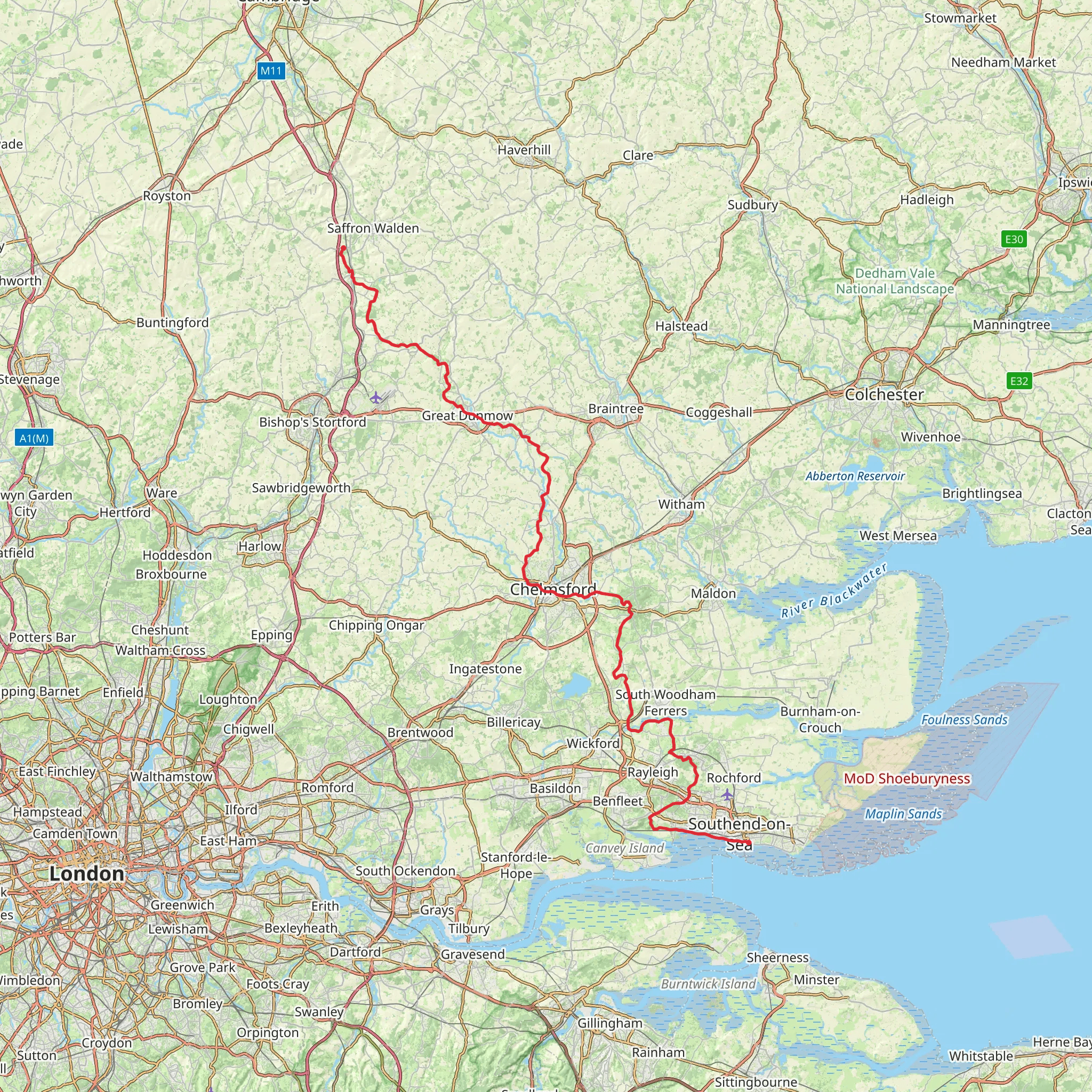
Embarking on the Saffron Trail, hikers will traverse approximately 108 kilometers (about 67 miles) of varied landscapes, starting near the coastal town of Southend-on-Sea and culminating in the historic market town of Saffron Walden. With an elevation gain of around 1100 meters (approximately 3600 feet), the trail offers a medium difficulty rating, suitable for hikers with some experience.
Getting to the Trailhead The trailhead is conveniently located near Southend-on-Sea, which is well-connected by public transport. Hikers can take a train to Southend Victoria or Southend Central stations from London and then a short bus or taxi ride to the official starting point. For those driving, parking is available in the town, and from there, it's a short walk to the trailhead.
Trail Overview The Saffron Trail begins near the seafront, offering views of the Thames Estuary before heading inland through the picturesque Essex countryside. The route meanders through a tapestry of farmland, ancient woodlands, and riverside paths, showcasing the rural beauty of the region.
Historical Significance The trail's namesake, Saffron Walden, is steeped in history, with its roots in the medieval saffron trade. As hikers approach the town, they'll be walking in the footsteps of traders who once cultivated the precious saffron crocus here. The trail itself doesn't shy away from historical landmarks, passing by several old churches, historic buildings, and sites like Hadleigh Castle, which dates back to the early 13th century.
Landmarks and Nature One of the early highlights is the Hadleigh Park, which includes the ruins of Hadleigh Castle, offering panoramic views over the Essex marshes to the Kent coastline. Further along, the path crosses the River Crouch and later the River Chelmer, providing opportunities to spot local wildlife, including various bird species.
As the trail progresses, hikers will encounter the Danbury Ridge Nature Reserves, a collection of ancient woodlands and meadows that are home to a diverse range of flora and fauna. The reserves are a haven for birdwatchers and nature enthusiasts, with the spring and summer months bringing a burst of wildflowers and butterflies.
Navigation and Preparation Hikers should prepare for a mix of terrain, including footpaths, bridleways, and occasional sections on quiet country lanes. The trail is waymarked, but carrying a detailed map or using a navigation tool like HiiKER is recommended to stay on track. It's also wise to check the weather forecast and pack accordingly, as conditions can change rapidly.
Accommodation and Supplies There are several villages and towns along the route where hikers can find accommodation, ranging from campgrounds to B&Bs. It's advisable to book in advance, especially during peak seasons. Supplies can be replenished in these settlements, with local shops and pubs offering a taste of the regional produce.
End of the Trail The Saffron Trail concludes in the historic town of Saffron Walden, where hikers can explore the market square, the impressive church of St. Mary's, and the remains of Walden Castle. Public transport is available for the return journey, with regular bus services connecting to nearby railway stations for onward travel.
What to expect?
Activity types
Comments and Reviews
User comments, reviews and discussions about the Saffron Trail, England.
4.5
average rating out of 5
8 rating(s)

