Download
Preview
Add to list
More
17.2 km
~4 hrs 8 min
429 m
Point-to-Point
“The Reeth to Richmond Walk offers a picturesque, moderately challenging 17 km hike through Yorkshire's stunning dales and historic sites.”
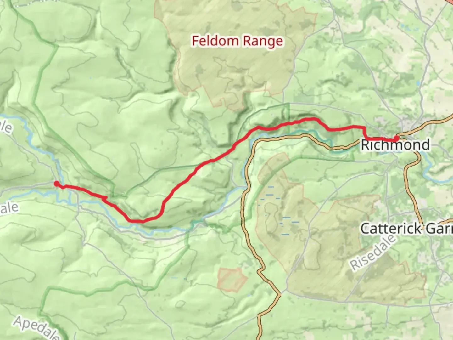
Starting near the charming village of Reeth in North Yorkshire, England, the Reeth to Richmond Walk spans approximately 17 km (10.5 miles) with an elevation gain of around 400 meters (1,312 feet). This point-to-point trail is rated as medium difficulty, making it suitable for moderately experienced hikers.
Getting There To reach the trailhead in Reeth, you can either drive or use public transport. If driving, Reeth is accessible via the A6108 from Richmond or the B6270 from Leyburn. For those opting for public transport, the nearest major train station is in Darlington. From there, you can take a bus to Richmond and then another bus to Reeth. The bus services are relatively frequent, but it's advisable to check the latest schedules in advance.
Trail Overview The trail begins in Reeth, a picturesque village known for its traditional stone buildings and vibrant community. As you set off, you'll be greeted by the serene beauty of the Yorkshire Dales. The initial part of the trail is relatively flat, allowing you to ease into the hike while enjoying the lush green meadows and the gentle flow of the River Swale.
Key Landmarks and Elevation At around the 3 km (1.9 miles) mark, you'll start to encounter a gradual ascent. This section offers stunning views of the surrounding dales and is a great spot for photography. Keep an eye out for local wildlife such as red grouse and curlews, which are commonly seen in this area.
By the time you reach the 8 km (5 miles) point, you'll have gained significant elevation, approximately 200 meters (656 feet). Here, the trail meanders through moorlands, characterized by heather and peat bogs. This part of the hike can be a bit challenging due to uneven terrain, so sturdy hiking boots are recommended.
Historical Significance As you approach the halfway mark, you'll come across Marrick Priory, a former Benedictine nunnery founded in the 12th century. The ruins are a poignant reminder of the region's rich history and offer a peaceful spot to take a break and soak in the historical ambiance.
Final Stretch to Richmond The last 5 km (3.1 miles) of the trail involve a descent towards Richmond. This section is less strenuous and allows you to enjoy the scenic beauty of the Swaledale Valley. As you near Richmond, you'll pass through woodlands and open fields, eventually leading you to the historic market town.
Richmond itself is a treasure trove of history, with its Norman castle, Georgian architecture, and cobbled streets. The Richmond Castle, dating back to the 11th century, is a must-visit landmark that offers panoramic views of the surrounding area.
Navigation and Safety For navigation, it's highly recommended to use the HiiKER app, which provides detailed maps and real-time updates. The trail is well-marked, but having a reliable navigation tool ensures you stay on track and can easily find alternative routes if needed.
Wildlife and Flora Throughout the hike, you'll encounter a variety of flora and fauna. The moorlands are home to heather, bilberry, and cotton grass, while the woodlands feature oak, ash, and hazel trees. Wildlife enthusiasts can look forward to spotting red squirrels, roe deer, and a variety of bird species.
Final Tips Ensure you carry enough water and snacks, as there are limited facilities along the trail. Weather in the Yorkshire Dales can be unpredictable, so pack layers and waterproof gear. Always inform someone of your hiking plans and expected return time for safety.
This trail offers a perfect blend of natural beauty, historical landmarks, and moderate physical challenge, making it a rewarding experience for any hiker.

What to expect?
Activity types
Comments and Reviews
User comments, reviews and discussions about the Reeth to Richmond Walk, England.
4.86
average rating out of 5
7 rating(s)