Download
Preview
Add to list
More
78.7 km
~5 days
1663 m
Multi-Day
“The Mendip Way: a scenic 49-mile trek through Somerset's diverse landscapes and rich history, suited for experienced hikers.”
The Mendip Way is a captivating long-distance footpath that traverses the Mendip Hills in Somerset, England. Stretching approximately 79 kilometers (about 49 miles), with an elevation gain of around 1600 meters (approximately 5249 feet), this trail offers a medium difficulty level that appeals to hikers with a reasonable level of fitness and experience.
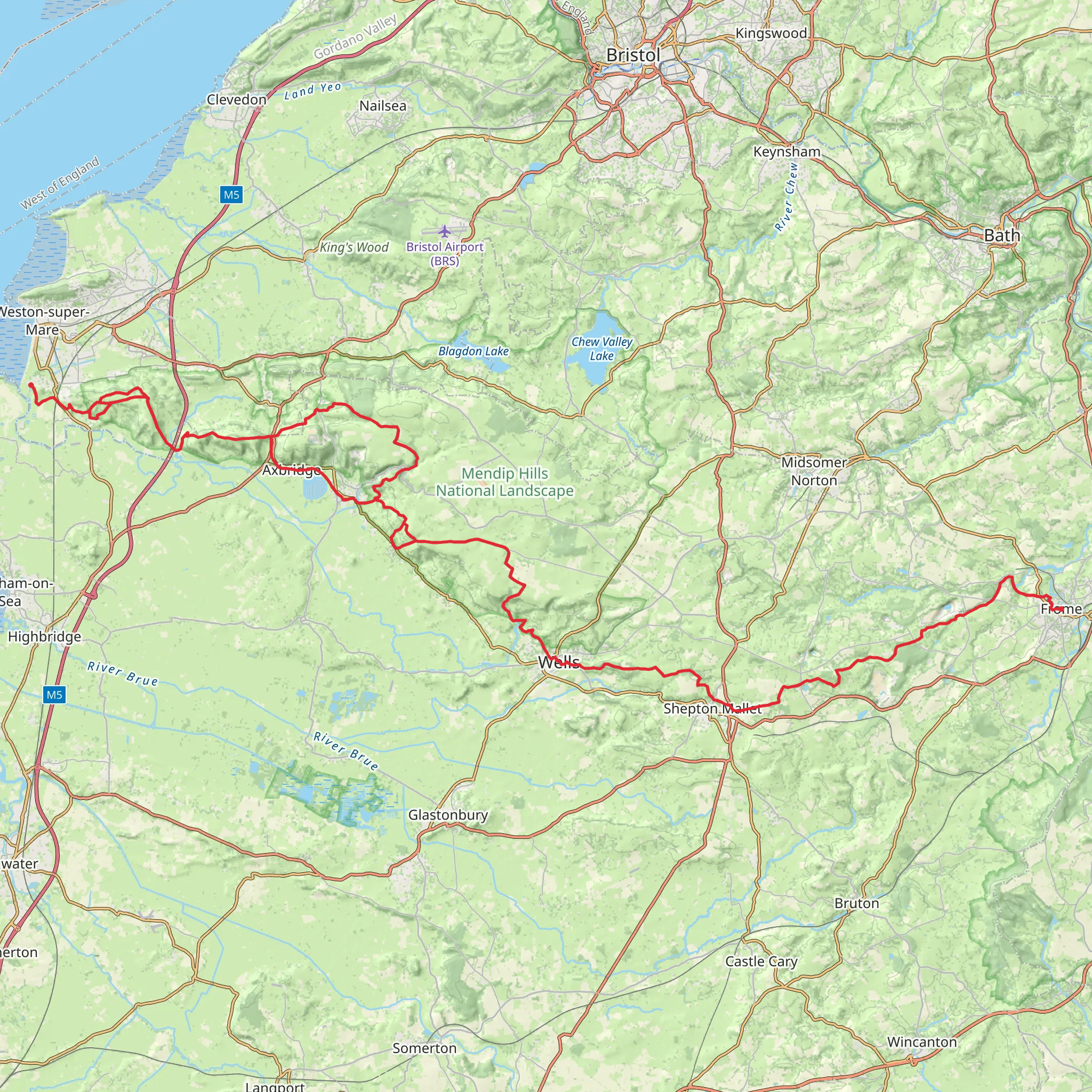
Starting near the town of Weston-super-Mare in North Somerset, the trail head is accessible by public transport, with local buses serving the area. For those arriving by car, parking is available near the start of the trail. The Mendip Way then winds its way eastward, concluding in the historic city of Frome.
Navigating the Trail
To navigate the Mendip Way, hikers can utilize the HiiKER app, which provides detailed maps and GPS coordinates to ensure you stay on the correct path. The trail is well-marked with acorn symbols, indicative of a National Trail, but having a digital tool like HiiKER can be invaluable for planning and staying on track.
Landmarks and Scenery
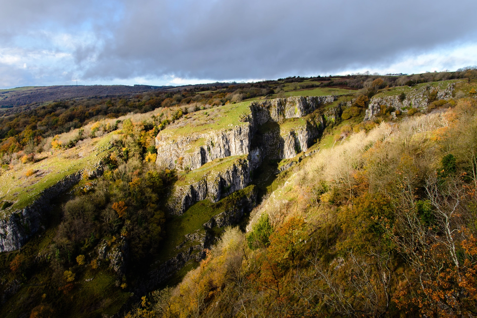
As you embark on the Mendip Way, you'll encounter a variety of landscapes, from the limestone grasslands to the dense woodlands. The trail offers panoramic views of the Somerset countryside, including the Bristol Channel and the Somerset Levels. Notable landmarks include the Cheddar Gorge, an impressive limestone gorge with cliffs rising over 450 feet, and the Wookey Hole Caves, a series of limestone caverns with a rich history.
Wildlife and Nature
The Mendip Hills are a haven for wildlife enthusiasts. The diverse habitats along the trail support a variety of species, including rare butterflies and birds of prey. Keep an eye out for the peregrine falcon and the lesser horseshoe bat, both of which are protected species in the UK.
Historical Significance
The region is steeped in history, with evidence of human occupation dating back to the prehistoric era. The Mendip Way passes through several sites of historical interest, including ancient burial mounds and Roman lead mines. The city of Wells, near the midpoint of the trail, is home to the magnificent Wells Cathedral, which dates back to the 12th century.
Trail Sections
The Mendip Way can be tackled in sections, allowing hikers to explore at their own pace. The western section, from Weston-super-Mare to Cheddar, is characterized by coastal views and rolling hills. The central section, leading to Wells, becomes more rugged, with steep climbs and descents. The eastern section, from Wells to Frome, passes through more pastoral landscapes, with quaint villages and historic sites.
Preparation and Planning
Before setting out, ensure you have appropriate gear for the varied terrain and weather conditions, which can change rapidly. Waterproof clothing, sturdy hiking boots, and a map or navigation device are essential. It's also advisable to carry plenty of water and snacks, as some sections of the trail have limited facilities.
For those looking to complete the trail in one go, there are several accommodation options along the route, including campsites, B&Bs, and hotels. It's recommended to book these in advance, especially during peak hiking season.
Access and Transport
To reach the start of the Mendip Way, take a train to Weston-super-Mare and then a local bus to the trail head. If driving, the start is near the A370, with parking available in the area. The end of the trail in Frome is also well-served by public transport, making it easy to return to your starting point or continue your journey.
What to expect?
Activity types
Comments and Reviews
User comments, reviews and discussions about the Mendip Way, England.
4.29
average rating out of 5
7 rating(s)

