Download
Preview
Add to list
More
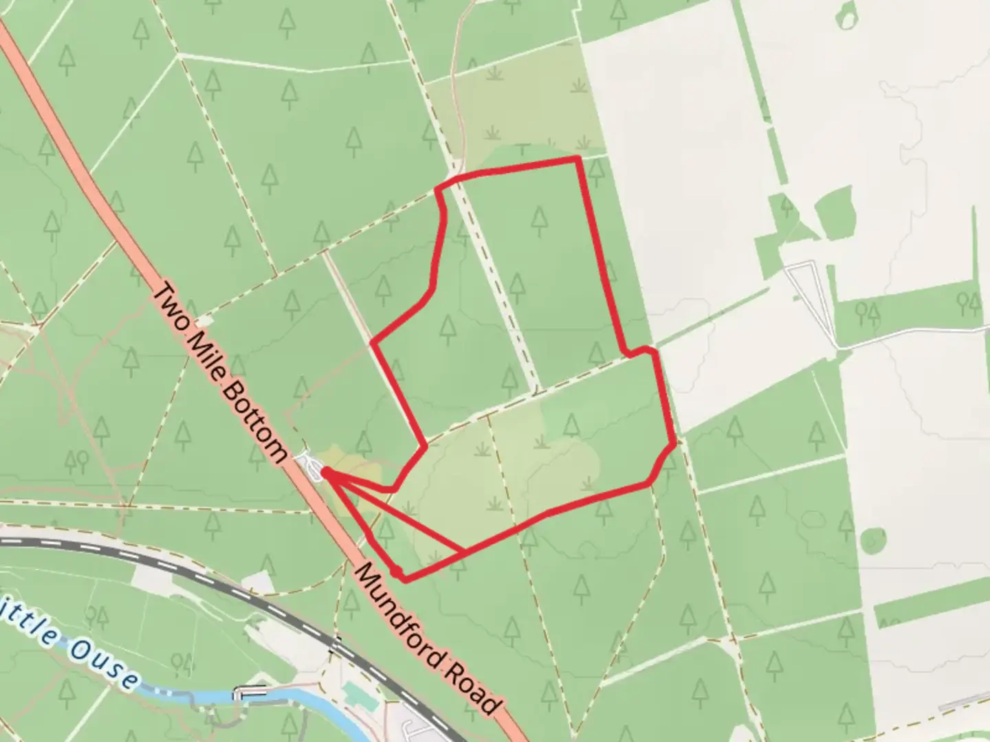
3.3 km
~44 min
41 m
Point-to-Point
“The Yellow Route Loop offers scenic, gentle hiking through Thetford Forest with diverse landscapes and historical sites.”
Starting near the picturesque town of Norfolk, England, the Yellow Route Loop is a delightful 3 km (approximately 1.86 miles) trail that offers a gentle and accessible hiking experience with no significant elevation gain. This point-to-point trail is estimated to be of medium difficulty, making it suitable for a wide range of hikers, from beginners to those looking for a leisurely walk.### Getting There To reach the trailhead, you can either drive or use public transport. If driving, set your GPS to the nearest known address: Thetford Forest Park, Brandon, Suffolk IP27 0AF, which is a well-known landmark close to the trailhead. For those using public transport, you can take a train to Brandon Station, which is approximately 3 miles (4.8 km) from the trailhead. From the station, a short taxi ride or a local bus can get you to Thetford Forest Park.### Trail Navigation For navigation, it's highly recommended to use the HiiKER app, which provides detailed maps and real-time updates to ensure you stay on track throughout your hike.### Trail Highlights As you embark on the Yellow Route Loop, you'll find yourself immersed in the serene beauty of Thetford Forest, one of the largest lowland pine forests in Britain. The trail meanders through a diverse landscape of towering pine trees, open heathland, and lush meadows, offering a variety of scenery to enjoy.### Flora and Fauna The forest is home to an array of wildlife, so keep an eye out for deer, rabbits, and a variety of bird species, including the elusive nightjar and woodlark. The undergrowth is rich with ferns, wildflowers, and fungi, particularly in the autumn months.### Historical Significance Thetford Forest has a rich history, having been established in the aftermath of World War I to ensure a strategic timber reserve for the nation. The forest also contains remnants of ancient human activity, including flint mines dating back to the Neolithic period. As you walk, you might come across some of these historical sites, adding an educational aspect to your hike.### Points of Interest Around the halfway mark, approximately 1.5 km (0.93 miles) into the trail, you'll encounter a charming picnic area. This is an excellent spot to take a break, enjoy a snack, and soak in the tranquil surroundings. Further along, the trail passes by Lynford Arboretum, a beautiful collection of trees and shrubs that is particularly stunning in the autumn when the leaves change color.### Practical Tips Given the trail's moderate difficulty, it's advisable to wear sturdy walking shoes and bring along water and snacks. The trail can be muddy after rain, so waterproof footwear is recommended. While the trail is well-marked, having the HiiKER app will provide additional peace of mind.The Yellow Route Loop offers a perfect blend of natural beauty, wildlife, and historical intrigue, making it a rewarding hike for anyone looking to explore the Norfolk countryside.

What to expect?
Activity types
Comments and Reviews
User comments, reviews and discussions about the Yellow Route Loop, England.
4.5
average rating out of 5
6 rating(s)