Download
Preview
Add to list
More
14.3 km
~3 hrs 3 min
120 m
Point-to-Point
“From bustling Manchester to serene Woodley, this 14 km trail offers urban charm and natural beauty.”
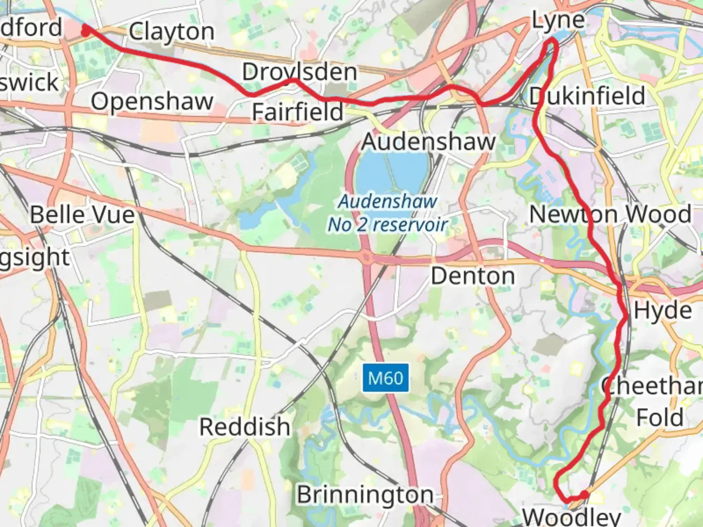
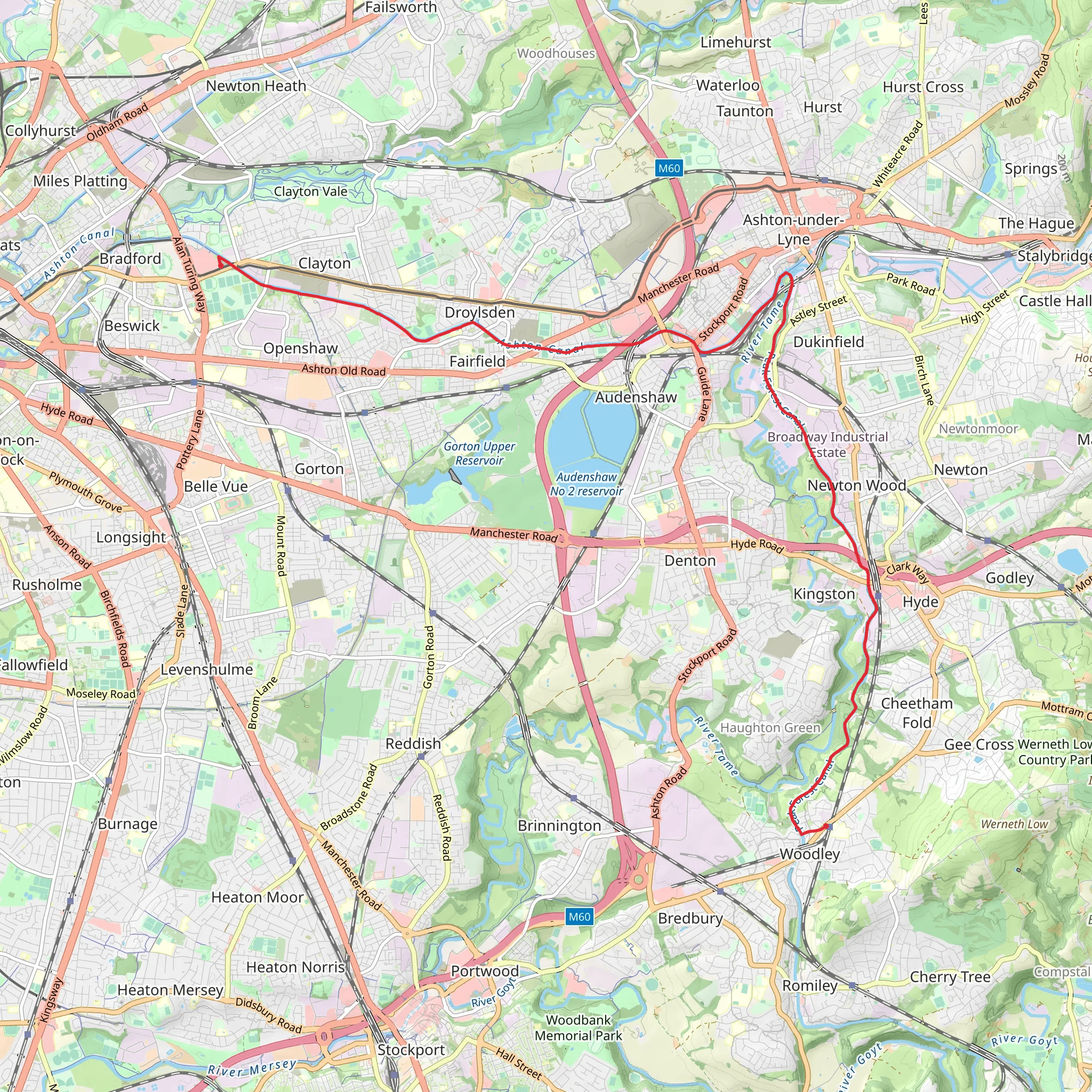
Starting near the iconic Etihad Stadium in Manchester, England, this 14 km (approximately 8.7 miles) point-to-point trail offers a moderate challenge with an elevation gain of around 100 meters (328 feet). The trailhead is easily accessible by public transport, with several bus and tram routes serving the Etihad Campus area. If you're driving, there are parking facilities available at the stadium.
Initial Stretch: Urban to Green Transition The journey begins in an urban setting, with the bustling energy of Manchester gradually giving way to more serene surroundings. As you leave the stadium, you'll head east, passing through the vibrant neighborhoods of Beswick and Clayton. This section is relatively flat, making it a good warm-up for the rest of the hike. Keep an eye out for Clayton Hall, a historic 15th-century manor house, which is a fascinating detour if you have the time.
Clayton Vale and Medlock Valley Around 3 km (1.9 miles) into the hike, you'll enter Clayton Vale, a beautiful green space that offers a stark contrast to the urban environment you started in. The trail here follows the River Medlock, providing a peaceful riverside walk. This area is rich in wildlife; you might spot kingfishers, herons, and various species of butterflies. The path is well-marked and maintained, making navigation straightforward.
Droylsden and Fairfield Continuing east, you'll reach Droylsden after about 6 km (3.7 miles). This suburban area offers a mix of residential streets and small parks. The Fairfield Moravian Settlement, a unique 18th-century village, is a notable landmark here. It's worth a short detour to explore its well-preserved buildings and learn about its historical significance.
Gorton Reservoirs and Debdale Park Around the 9 km (5.6 miles) mark, the trail takes you past the Gorton Reservoirs and into Debdale Park. This section involves a slight elevation gain, but the views over the water and the surrounding greenery make it worthwhile. Debdale Park is a great spot for a rest, with plenty of benches and picnic areas. The park is also home to various bird species, so birdwatchers should bring their binoculars.
Final Stretch to Woodley The last 5 km (3.1 miles) of the trail lead you through the scenic Tame Valley, following the course of the River Tame. This section is relatively flat and easy to navigate. As you approach Woodley, you'll pass through several small woodlands and open fields, offering a tranquil end to your hike. The trail concludes near Woodley, where you can catch a train back to Manchester from the nearby Woodley Station or arrange for a pick-up.
Navigation and Safety For navigation, it's highly recommended to use the HiiKER app, which provides detailed maps and real-time updates. The trail is generally well-marked, but having a reliable navigation tool will ensure you stay on track. Always carry sufficient water, snacks, and a basic first aid kit. Weather in this region can be unpredictable, so dress in layers and be prepared for rain.
This trail offers a diverse experience, transitioning from urban landscapes to serene natural settings, with plenty of historical and natural landmarks along the way. Whether you're a local or a visitor, this hike provides a unique perspective on the Greater Manchester area.
What to expect?
Activity types
Comments and Reviews
User comments, reviews and discussions about the Etihad Stadium to Woodley Walk, England.
4.6
average rating out of 5
5 rating(s)
