Download
Preview
Add to list
More
8.4 km
~1 hrs 53 min
122 m
Loop
“Explore the Browns Wood and Ashleys Wood Loop for a scenic, moderately challenging 8 km hike near Leicestershire.”
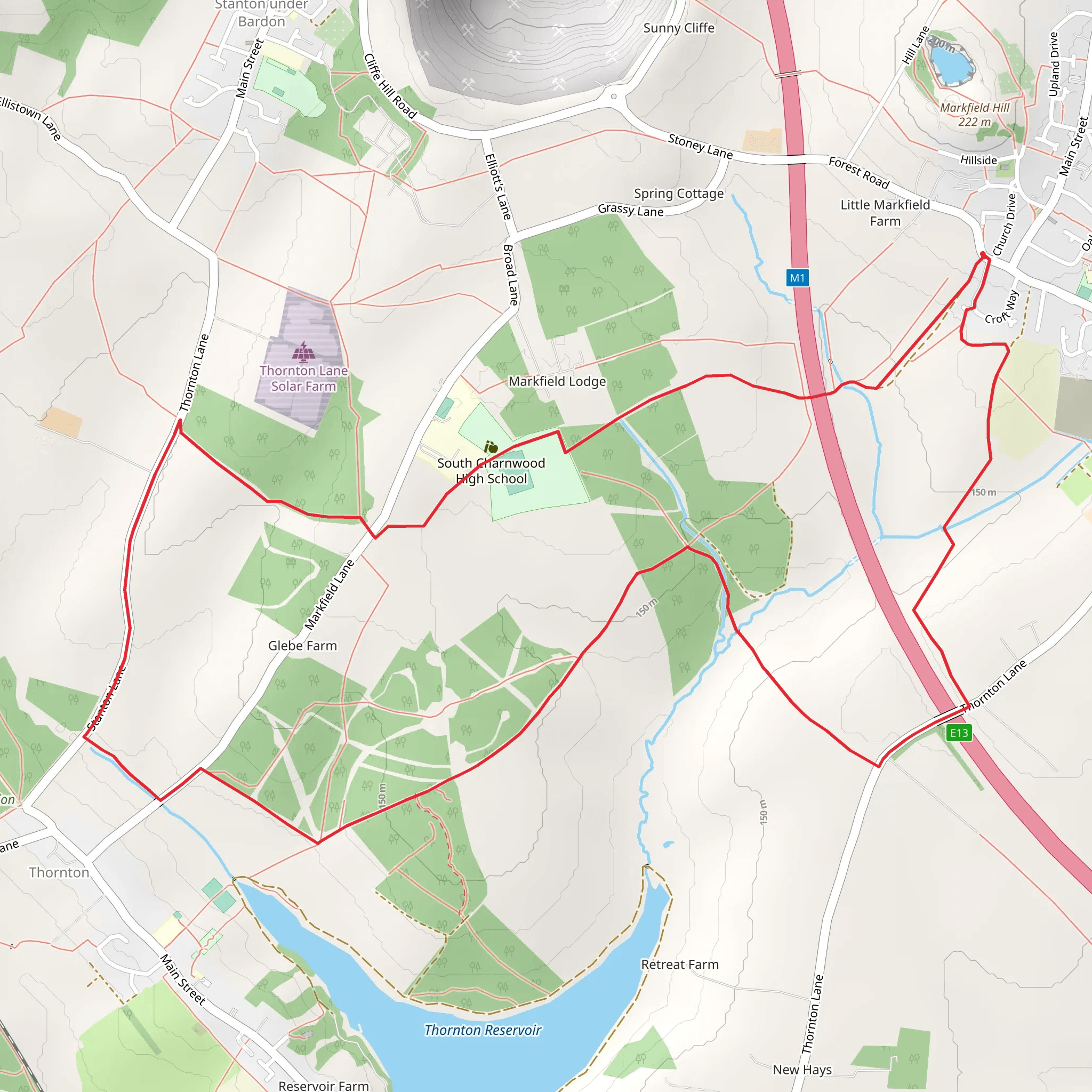
Starting near Leicestershire, England, the Browns Wood and Ashleys Wood Loop is an 8 km (approximately 5 miles) trail with an elevation gain of around 100 meters (328 feet). This loop trail is estimated to be of medium difficulty, making it suitable for moderately experienced hikers.
Getting There To reach the trailhead, you can drive or use public transport. If driving, set your GPS to the nearest known address, which is close to the village of Woodhouse Eaves. For those using public transport, the nearest significant landmark is Loughborough Railway Station. From there, you can take a local bus or taxi to Woodhouse Eaves.
Trail Overview The trail begins near Woodhouse Eaves and quickly immerses you in the serene beauty of Browns Wood. The initial section is relatively flat, allowing you to ease into the hike. As you progress, you'll encounter a gentle ascent, gaining about 50 meters (164 feet) in the first 2 km (1.2 miles).
Points of Interest #### Browns Wood Browns Wood is a picturesque area filled with ancient oak and beech trees. This section of the trail is particularly beautiful in the autumn when the leaves turn vibrant shades of red and gold. Keep an eye out for local wildlife, including deer and various bird species.
#### Ashleys Wood Around the 4 km (2.5 miles) mark, you'll transition into Ashleys Wood. This area is slightly more rugged, with a mix of deciduous and coniferous trees. The trail here can be a bit more challenging due to the uneven terrain, but the effort is well worth it. Ashleys Wood is known for its rich biodiversity, including rare plants and fungi.
Historical Significance The region around Leicestershire has a rich history dating back to Roman times. While the trail itself doesn't feature any specific historical landmarks, the surrounding area is steeped in history. Nearby Woodhouse Eaves has several historical buildings, including the 19th-century St. Paul's Church.
Navigation and Safety For navigation, it's highly recommended to use HiiKER, which provides detailed maps and real-time updates. The trail is well-marked, but having a reliable navigation tool can help you stay on track, especially in the denser sections of Ashleys Wood.
Final Stretch The final 2 km (1.2 miles) of the trail bring you back towards the starting point near Woodhouse Eaves. This section is mostly downhill, offering a pleasant and relaxing end to your hike. As you descend, you'll pass through open fields and meadows, providing a stark contrast to the wooded areas earlier in the hike.
Wildlife and Flora Throughout the trail, you'll encounter a variety of wildlife. Common sightings include foxes, badgers, and a plethora of bird species such as woodpeckers and owls. The flora is equally diverse, with seasonal wildflowers adding splashes of color to the landscape.
Preparation Tips Given the medium difficulty rating, it's advisable to wear sturdy hiking boots and bring plenty of water. The trail can be muddy in sections, especially after rain, so waterproof gear is recommended. Always check the weather forecast before heading out and let someone know your hiking plans.
This trail offers a delightful mix of natural beauty, moderate physical challenge, and a touch of historical context, making it a rewarding experience for any hiker.
What to expect?
Activity types
Comments and Reviews
User comments, reviews and discussions about the Browns Wood and Ashleys Wood Loop, England.
4.67
average rating out of 5
3 rating(s)

