Download
Preview
Add to list
More
8.9 km
~2 hrs 3 min
171 m
Loop
“Embark on the Slaidburn Loop - West for 9 km of scenic countryside, wildlife, and historical charm.”
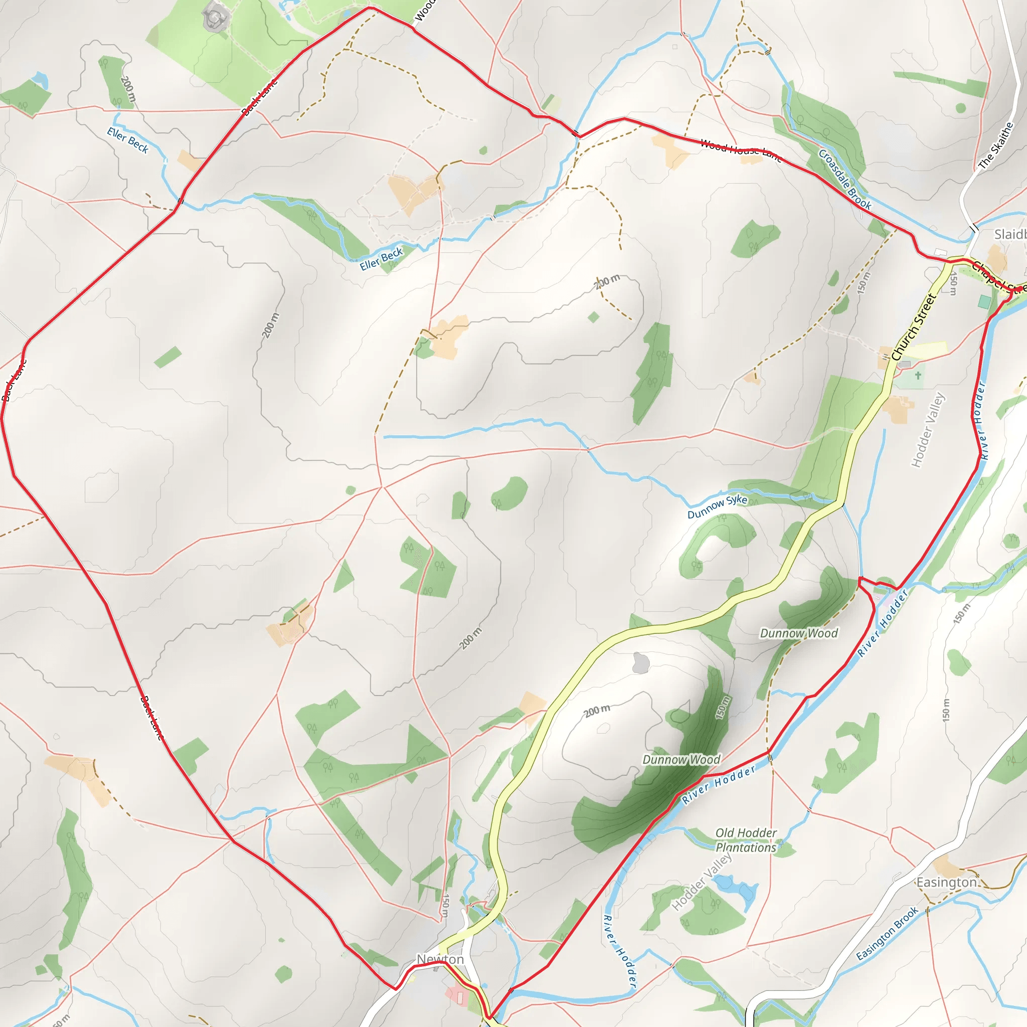
Starting near the charming village of Slaidburn in Lancashire, England, the Slaidburn Loop - West is a delightful 9 km (approximately 5.6 miles) loop trail with an elevation gain of around 100 meters (328 feet). This trail is rated as medium difficulty, making it suitable for moderately experienced hikers.
Getting There To reach the trailhead, you can drive to Slaidburn, which is accessible via the A59 and B6478 roads. There is parking available in the village. For those using public transport, the nearest major town is Clitheroe, which has a train station. From Clitheroe, you can take a bus to Slaidburn. The bus service is relatively infrequent, so be sure to check the schedule in advance.
Trail Navigation For navigation, it is highly recommended to use the HiiKER app, which provides detailed maps and real-time GPS tracking to ensure you stay on the correct path.
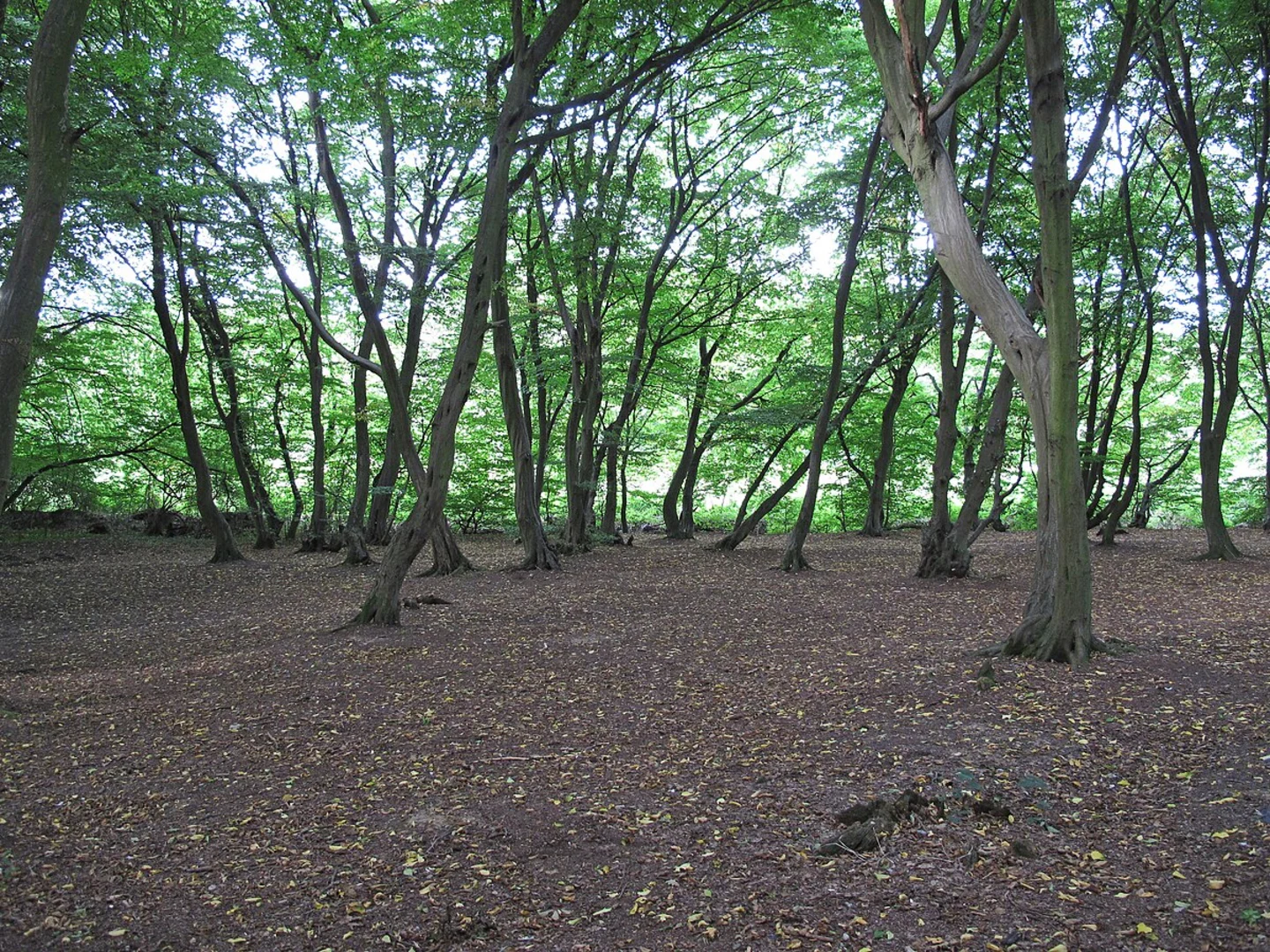
Trail Description The trail begins near the Slaidburn Village Hall, a notable landmark in the area. As you set off, you'll immediately be immersed in the picturesque countryside of the Forest of Bowland, an Area of Outstanding Natural Beauty (AONB).
#### First Section: Slaidburn to Easington Fell The initial part of the trail takes you through lush meadows and along the banks of the River Hodder. After approximately 2 km (1.2 miles), you will start a gentle ascent towards Easington Fell. This section offers stunning views of the surrounding hills and valleys. Keep an eye out for local wildlife, including roe deer and various bird species such as curlews and lapwings.
#### Midway Point: Easington Fell At around the 4 km (2.5 miles) mark, you will reach the highest point of the trail on Easington Fell. The elevation gain here is about 100 meters (328 feet), providing panoramic views of the Forest of Bowland. This is an excellent spot for a short break and some photography.
#### Descent and Return: Easington Fell to Slaidburn The descent begins gently, leading you through ancient woodlands and past historical farmsteads. At approximately 6 km (3.7 miles), you will come across the remnants of old stone walls and barns, offering a glimpse into the area's agricultural past. The trail then meanders back towards Slaidburn, following a series of well-marked paths and bridleways.
Points of Interest - **Slaidburn Village Hall:** A historical building that serves as a community hub. - **River Hodder:** A serene river that provides a habitat for various aquatic species. - **Easington Fell:** Offers panoramic views and is a great spot for birdwatching. - **Historical Farmsteads:** Scattered along the trail, these structures provide insight into the region's farming history.
Historical Significance Slaidburn itself is steeped in history, with roots dating back to the medieval period. The village was once a significant market town and has retained much of its historical charm. The surrounding area has been inhabited for centuries, and you may come across ancient stone walls and farm buildings that tell the story of the region's agricultural heritage.
Wildlife and Nature The Forest of Bowland is a haven for wildlife. Along the trail, you might encounter roe deer, hares, and a variety of bird species. The area is also known for its rich plant life, including wildflowers and ancient trees.
Final Tips Ensure you have appropriate footwear, as some sections can be muddy, especially after rain. Carry enough water and snacks, and always check the weather forecast before setting out. Using the HiiKER app will help you stay on track and make the most of your hiking experience.
What to expect?
Activity types
Comments and Reviews
User comments, reviews and discussions about the Slaidburn Loop - West, England.
4.67
average rating out of 5
3 rating(s)

