Download
Preview
Add to list
More
20.3 km
~4 hrs 42 min
399 m
Loop
“Explore the scenic 20 km Otford to Eynsford Loop, blending history, nature, and moderate hiking challenges.”
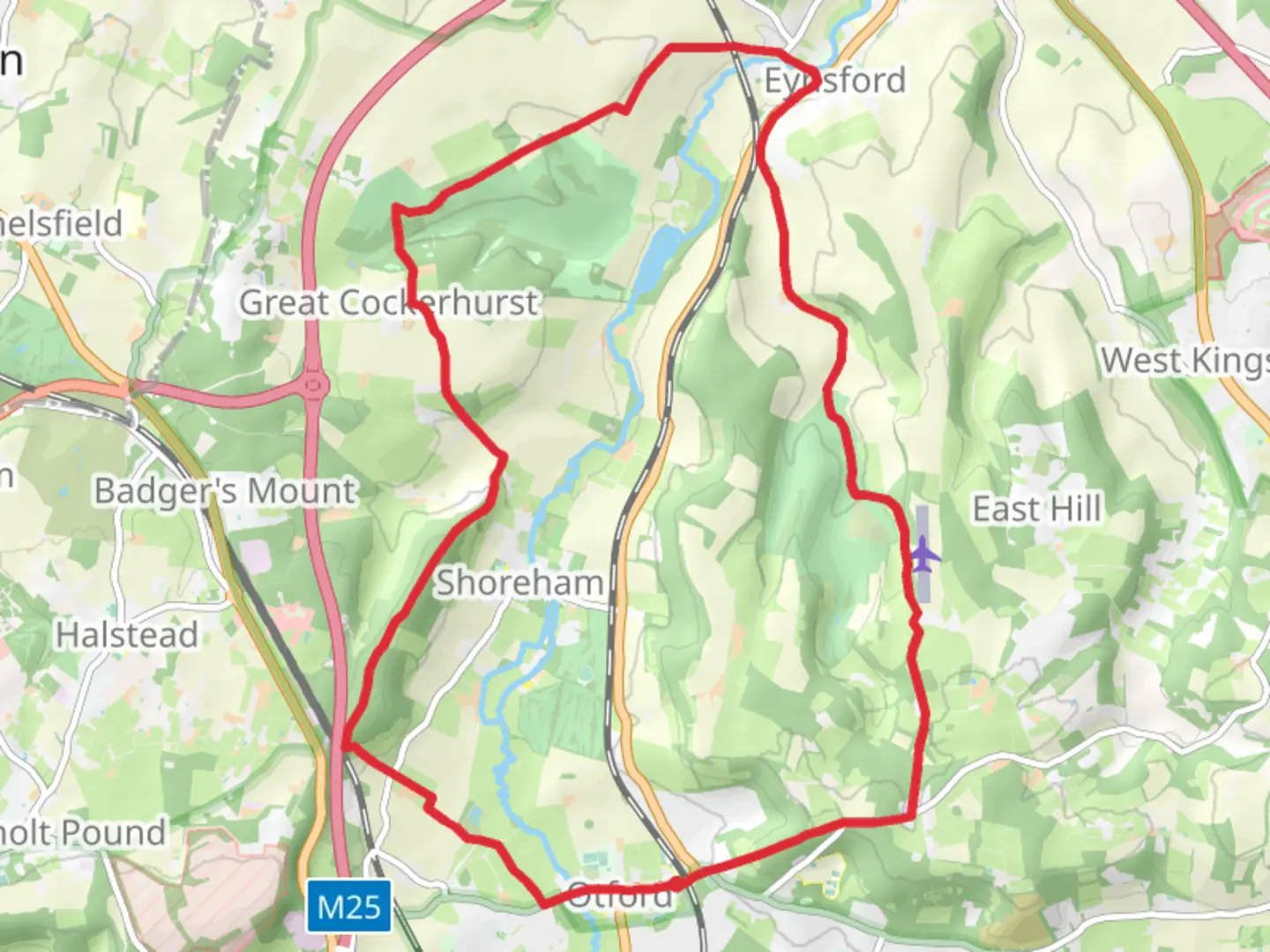
Starting near the charming village of Otford in Kent, England, the Otford to Eynsford Loop is a picturesque 20 km (approximately 12.4 miles) trail with an elevation gain of around 300 meters (984 feet). This loop trail offers a moderate challenge, making it suitable for hikers with some experience.
Getting There To reach the trailhead, you can take a train to Otford Station, which is well-connected via Southeastern services from London Victoria or Blackfriars. If you're driving, Otford is accessible via the M25 motorway, and there are parking facilities available near the village center.
Trail Overview The trail begins in Otford, a village known for its historical significance and charming Tudor-style houses. As you set off, you'll quickly find yourself immersed in the lush greenery of the Kent Downs, an Area of Outstanding Natural Beauty (AONB).
Key Landmarks and Sections
#### Otford to Shoreham The first segment of the trail takes you from Otford to the village of Shoreham, approximately 4 km (2.5 miles) into the hike. This section is relatively flat and follows the River Darent, offering serene riverside views. Shoreham itself is a quaint village with a rich history, including the Shoreham Aircraft Museum, which commemorates the Battle of Britain.
#### Shoreham to Lullingstone Continuing from Shoreham, the trail ascends gently towards Lullingstone, adding about 5 km (3.1 miles) to your journey. This part of the hike includes a visit to Lullingstone Country Park, where you can explore ancient woodlands and meadows. The park is also home to Lullingstone Roman Villa, a significant archaeological site with well-preserved mosaics and artifacts.
#### Lullingstone to Eynsford From Lullingstone, the trail leads you to the village of Eynsford, another 3 km (1.9 miles) stretch. Eynsford is famous for its medieval Eynsford Castle and the picturesque ford crossing the River Darent. This section involves a moderate climb, offering panoramic views of the surrounding countryside.
#### Eynsford to Otford The final leg of the loop takes you back to Otford, covering the remaining 8 km (5 miles). This part of the trail includes a mix of woodland paths and open fields, with some gentle ascents and descents. Keep an eye out for local wildlife, including deer and various bird species, as you make your way back to the starting point.
Navigation and Safety For navigation, it's highly recommended to use the HiiKER app, which provides detailed maps and real-time updates. The trail is well-marked, but having a reliable navigation tool will ensure you stay on track.
Historical Significance The region is steeped in history, from the Roman era to medieval times. Otford itself was once the site of a significant palace belonging to the Archbishops of Canterbury. The trail also passes through areas that played crucial roles during the Battle of Britain, adding a layer of historical depth to your hike.
Flora and Fauna The Kent Downs are renowned for their biodiversity. Expect to see a variety of wildflowers, especially in the spring and summer months. The woodlands are home to ancient oak and beech trees, and the meadows are often filled with butterflies and other pollinators.
Preparation Tips Given the moderate difficulty of the trail, ensure you have sturdy hiking boots and sufficient water. Weather in Kent can be unpredictable, so pack a waterproof jacket and layers. The trail can be muddy in sections, especially after rain, so be prepared for varying trail conditions.
This hike offers a blend of natural beauty, historical landmarks, and moderate physical challenge, making it a rewarding experience for those looking to explore the Kent countryside.

What to expect?
Activity types
Comments and Reviews
User comments, reviews and discussions about the Otford to Eynsford Loop, England.
4.43
average rating out of 5
7 rating(s)