Download
Preview
Add to list
More
3.8 km
~51 min
58 m
Loop
“Explore Ventnor Downs and Luccombe Down Loop, a 4 km scenic, moderately challenging trail with stunning views.”
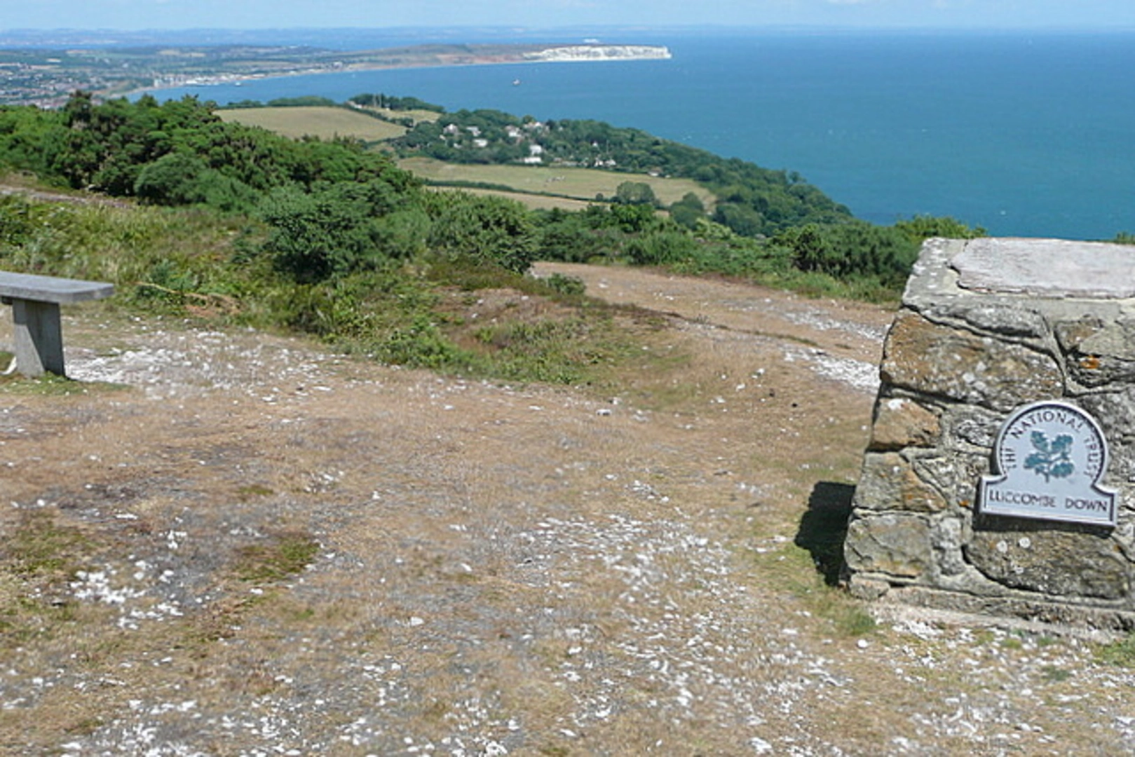
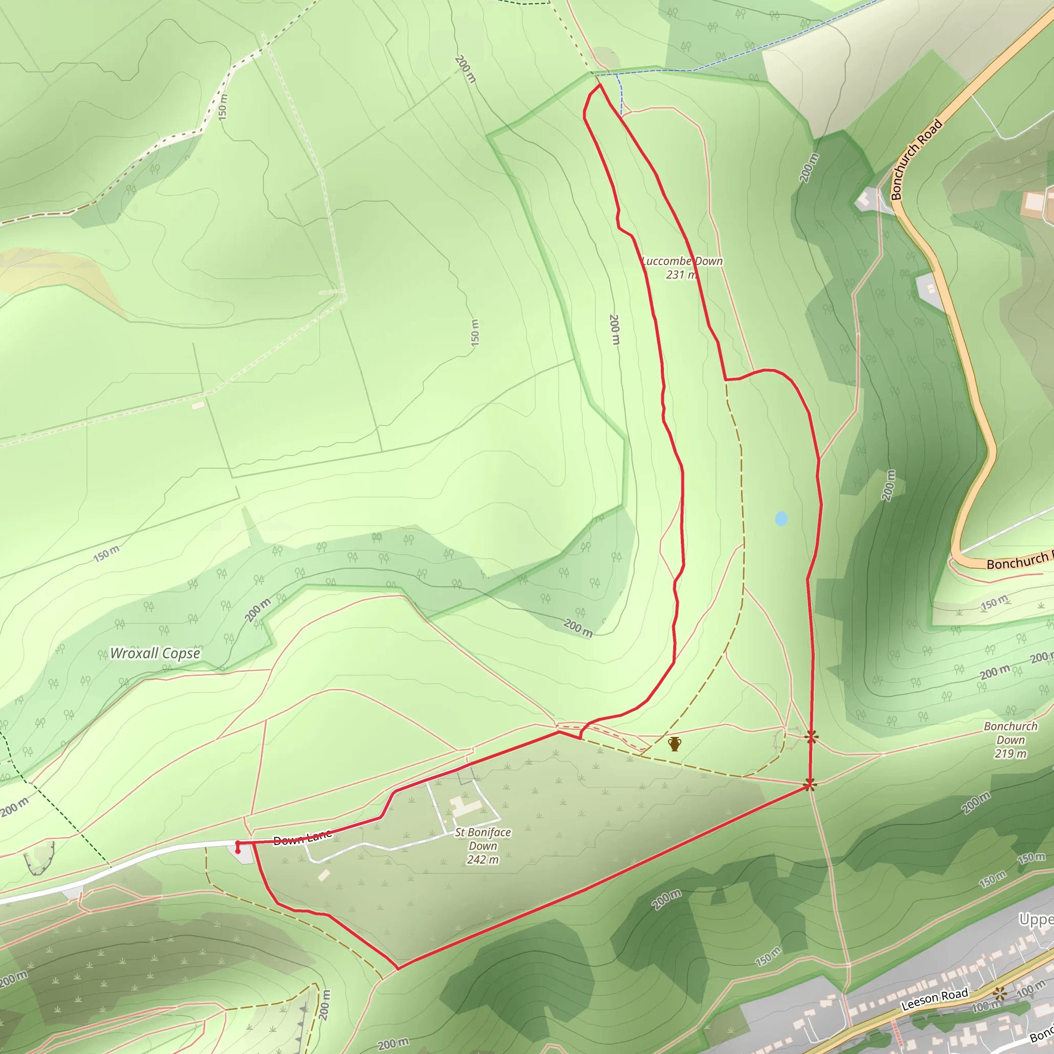
Starting near the Isle of Wight, England, the Vetnor Downs and Luccombe Down Loop is a delightful 4 km (2.5 miles) trail that offers a medium difficulty rating, making it suitable for moderately experienced hikers. The trailhead is conveniently accessible by both public transport and car. If you're driving, you can park near the Ventnor Downs National Trust Car Park. For those using public transport, the nearest bus stop is Ventnor, served by Southern Vectis buses.### Trail OverviewThe loop begins with a gentle ascent, leading you through a mix of open downland and wooded areas. Despite the elevation gain being minimal, the undulating terrain provides a good workout. The highest point on the trail is around 241 meters (791 feet) above sea level, offering panoramic views of the Isle of Wight and the English Channel.### Key Landmarks and Points of InterestVentnor Downs: As you start your hike, you'll traverse Ventnor Downs, the highest point on the Isle of Wight. This area is managed by the National Trust and is known for its rich biodiversity. Keep an eye out for rare butterflies like the Glanville Fritillary and various bird species, including kestrels and skylarks.Luccombe Down: Continuing on, you'll reach Luccombe Down, another high point that offers stunning views. This section of the trail is particularly scenic, with rolling hills and patches of ancient woodland. The area is also steeped in history, with remnants of Bronze Age burial mounds and old military installations from World War II.### Flora and FaunaThe trail is a haven for nature enthusiasts. In spring and summer, the downs are carpeted with wildflowers such as cowslips, orchids, and bluebells. The wooded areas are home to red squirrels, a species that is rare in other parts of the UK but thrives on the Isle of Wight. Birdwatchers will also enjoy spotting species like the Dartford warbler and the green woodpecker.### Historical SignificanceThe Isle of Wight has a rich history, and this trail offers glimpses into its past. The Bronze Age burial mounds on Luccombe Down are a testament to the island's ancient inhabitants. During World War II, Ventnor Downs was used as a radar station, part of the Chain Home system that played a crucial role in the Battle of Britain. Information boards along the trail provide fascinating insights into these historical landmarks.### Navigation and SafetyFor navigation, it's highly recommended to use the HiiKER app, which provides detailed maps and real-time updates. The trail is well-marked, but having a reliable navigation tool ensures you stay on track. Wear sturdy hiking boots, as the terrain can be uneven, especially after rain. Carry water and snacks, as there are no facilities along the trail.### Getting ThereTo reach the trailhead, if you're driving, head towards the Ventnor Downs National Trust Car Park. For public transport users, take a Southern Vectis bus to Ventnor. From the bus stop, it's a short walk to the start of the trail. The Isle of Wight is accessible by ferry from Portsmouth, Southampton, or Lymington, making it a convenient destination for a day hike or a longer stay.This trail offers a perfect blend of natural beauty, historical intrigue, and moderate physical challenge, making it a rewarding experience for any hiker.
What to expect?
Activity types
Comments and Reviews
User comments, reviews and discussions about the Vetnor Downs and Luccombe Down Loop, England.
4.33
average rating out of 5
3 rating(s)

