Download
Preview
Add to list
More
11.1 km
~2 hrs 24 min
120 m
Out and Back
“Embark on an 11 km journey through picturesque villages, lush meadows, and historical landmarks in the Cotswolds.”
Starting near the picturesque village of Lower Slaughter in Gloucestershire, England, this 11 km (approximately 6.8 miles) out-and-back trail offers a delightful mix of natural beauty and historical charm. The trailhead is conveniently located near the Lower Slaughter village, which is easily accessible by car or public transport. If you're driving, you can park at the Lower Slaughter car park. For those using public transport, the nearest train station is Moreton-in-Marsh, from where you can take a local bus or taxi to Lower Slaughter.
Trail Overview
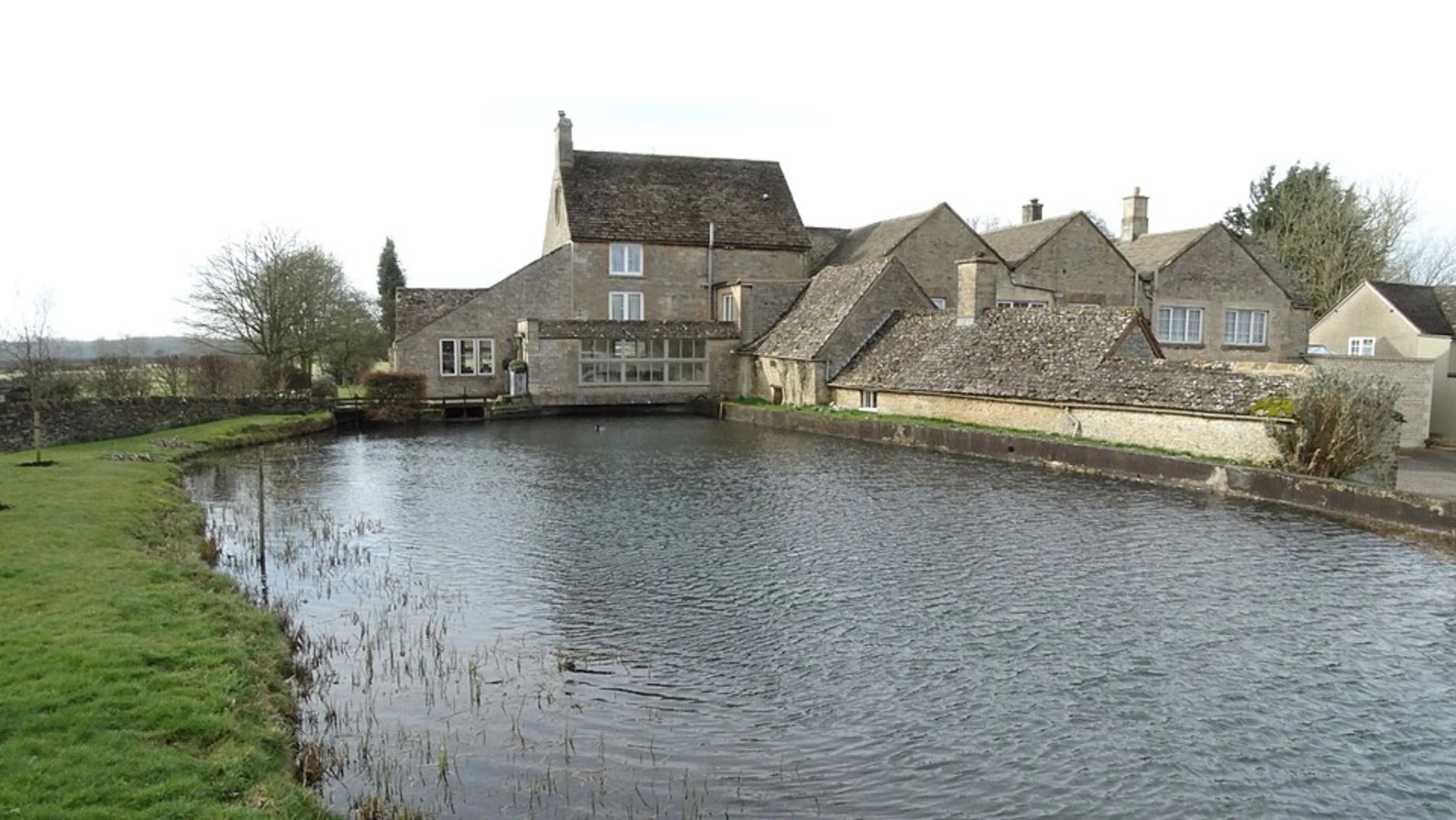
The trail begins in Lower Slaughter, a village renowned for its idyllic setting along the River Eye. As you start your hike, you'll immediately notice the charming stone cottages and the historic Lower Slaughter Mill, which dates back to the 19th century. The mill is a great spot for a quick photo or a brief exploration before you set off on your journey.
Nature and Wildlife
As you leave Lower Slaughter, the trail meanders through lush meadows and rolling hills. The elevation gain is moderate, around 100 meters (328 feet), making it a manageable hike for those with a reasonable level of fitness. Keep an eye out for local wildlife, including various bird species and small mammals. The meadows are often dotted with wildflowers, especially in the spring and summer months, adding a splash of color to your hike.
Historical Landmarks
About halfway along the trail, you'll come across the village of Upper Slaughter. This village is known for its "saintly" status, as it was one of the few villages in England that did not lose any residents during World War I. The village church, St. Peter's, is worth a visit for its beautiful architecture and serene atmosphere.
Continuing on, the trail leads you towards Upper Swell. This part of the hike offers more open landscapes and panoramic views of the Cotswolds. Upper Swell itself is a small, tranquil village with a few historical buildings, including the Upper Swell Manor.
Navigation and Safety
For navigation, it's highly recommended to use the HiiKER app, which provides detailed maps and real-time updates. The trail is well-marked, but having a reliable navigation tool can enhance your hiking experience and ensure you stay on track.
Return Journey
The return journey follows the same path back to Lower Slaughter, allowing you to enjoy the scenery from a different perspective. The gentle descent makes for a pleasant and less strenuous walk back to the trailhead.
Getting There
To reach the trailhead, if you're driving, set your GPS to Lower Slaughter, Gloucestershire. For public transport users, take a train to Moreton-in-Marsh and then a local bus or taxi to Lower Slaughter. The journey from Moreton-in-Marsh to Lower Slaughter is approximately 6 miles (9.6 km).
This trail offers a perfect blend of natural beauty, historical intrigue, and manageable terrain, making it an excellent choice for a day hike in the Cotswolds.

What to expect?
Activity types
Comments and Reviews
User comments, reviews and discussions about the Lower Slaughter to Upper Swell Walk, England.
4.5
average rating out of 5
4 rating(s)