Download
Preview
Add to list
More
9.9 km
~2 hrs 31 min
323 m
Loop
“The Breakheart Plantation trail offers a picturesque 10 km loop rich in nature and history.”
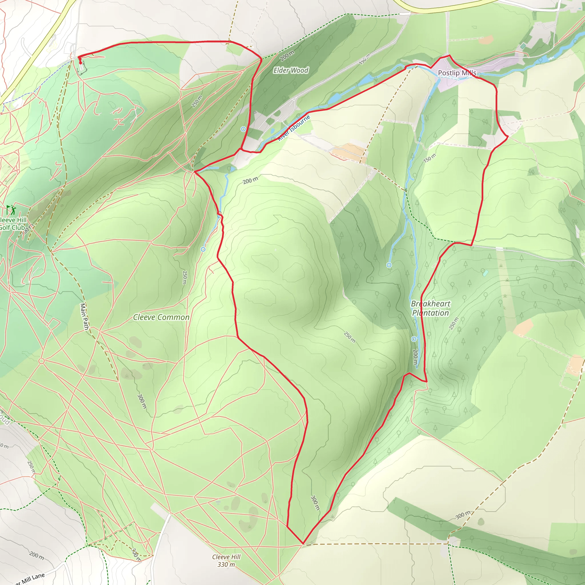
Starting your adventure near Gloucestershire, England, the Breakheart Plantation and Watery Bottom trail offers a delightful 10 km (6.2 miles) loop with an elevation gain of around 300 meters (984 feet). This medium-difficulty trail is perfect for those looking to immerse themselves in the natural beauty and historical richness of the area.
Getting There To reach the trailhead, you can drive or use public transport. If driving, set your GPS to the nearest known address: Breakheart Quarry, Dursley, Gloucestershire. For those using public transport, the closest major station is Dursley, from where you can take a local bus or taxi to the trailhead.
Trail Overview The trail begins at Breakheart Quarry, a site with a rich industrial history dating back to the 19th century. As you start your hike, you'll notice remnants of old quarrying equipment and structures, offering a glimpse into the area's past.
Flora and Fauna As you progress, the trail meanders through dense woodlands and open meadows. Keep an eye out for native wildlife such as deer, foxes, and a variety of bird species. The flora is equally impressive, with ancient oak and beech trees providing a canopy of shade, especially welcome during the warmer months.
Significant Landmarks Around the 3 km (1.9 miles) mark, you'll come across the Watery Bottom, a serene stream that winds its way through the landscape. This is a great spot to take a break and enjoy the tranquil surroundings. The elevation gain here is gradual, making it accessible for most hikers.
Historical Significance The trail also passes by several historical landmarks. One notable site is the old Breakheart Hill Fort, an Iron Age fortification that offers panoramic views of the surrounding countryside. This is located approximately 5 km (3.1 miles) into the hike and involves a moderate climb, contributing to the overall elevation gain.
Navigation and Safety Given the varied terrain, it's advisable to use a reliable navigation tool like HiiKER to stay on track. The trail is well-marked, but having a digital map can be invaluable, especially in the denser forest sections.
Final Stretch As you loop back towards the starting point, the trail descends gently, offering more open views and a chance to spot additional wildlife. The final 2 km (1.2 miles) are relatively flat, making for a pleasant end to your hike.
This trail offers a perfect blend of natural beauty, historical intrigue, and moderate physical challenge, making it a must-visit for any hiking enthusiast.
What to expect?
Activity types
Comments and Reviews
User comments, reviews and discussions about the Breakheart Plantation and Watery Bottom, England.
5.0
average rating out of 5
1 rating(s)

