Download
Preview
Add to list
More
12.5 km
~3 hrs 6 min
366 m
Loop
“Explore Tyneham Cap and Worbarrow Tout Loop: a 12 km hike of historical intrigue and stunning coastal views.”
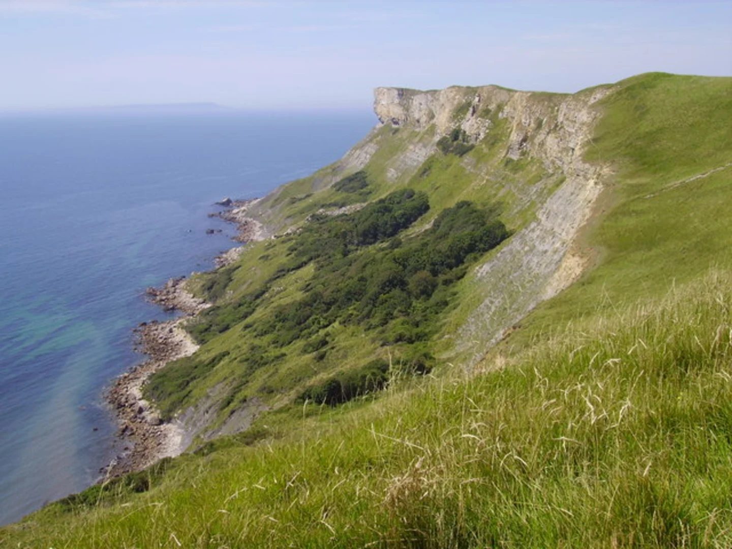
Starting near the picturesque village of Tyneham in Dorset, England, the Tyneham Cap and Worbarrow Tout Loop is a captivating 12 km (7.5 miles) trail with an elevation gain of approximately 300 meters (984 feet). This loop trail offers a blend of historical intrigue, stunning coastal views, and diverse wildlife, making it a rewarding hike for those seeking a medium-difficulty adventure.### Getting There To reach the trailhead, you can drive to Tyneham Village, which is accessible via the A351 and B3070 roads. There is a car park near the village, but be aware that it can fill up quickly, especially during weekends and holidays. For those using public transport, the nearest major town is Wareham, which is serviced by regular trains from London and other major cities. From Wareham, you can take a bus or taxi to Tyneham Village.### Trail Highlights#### Tyneham Village The trail begins at Tyneham Village, a fascinating historical site. The village was evacuated in 1943 during World War II and has remained uninhabited since. You can explore the remnants of the village, including the church and schoolhouse, which have been preserved as a poignant reminder of the past.#### Tyneham Cap As you ascend towards Tyneham Cap, you'll gain approximately 150 meters (492 feet) in elevation over the first 3 km (1.9 miles). The climb is steady but manageable, offering panoramic views of the surrounding countryside. The cap itself is a high point that provides breathtaking vistas of the Jurassic Coast, a UNESCO World Heritage Site known for its geological significance.#### Worbarrow Bay and Tout Continuing along the trail, you'll descend towards Worbarrow Bay, a secluded and stunning coastal area. The descent is about 100 meters (328 feet) over 2 km (1.2 miles). The bay is an excellent spot for a break, where you can enjoy the serene beach and perhaps even spot some marine wildlife. From here, the trail loops around Worbarrow Tout, a prominent headland offering dramatic cliffside views.### Flora and Fauna The trail is rich in biodiversity. Keep an eye out for various bird species, including peregrine falcons and kestrels, especially around the cliffs. The area is also home to wildflowers such as orchids and sea thrift, which add splashes of color to the landscape during the spring and summer months.### Navigation and Safety Given the trail's coastal nature, it's essential to be prepared for changing weather conditions. The path can be slippery after rain, so sturdy hiking boots are recommended. While the trail is well-marked, using a navigation tool like HiiKER can help ensure you stay on track, especially in foggy conditions.### Historical Significance The region is steeped in history, from the evacuated village of Tyneham to the ancient geological formations along the Jurassic Coast. The cliffs and rock formations date back millions of years, offering a glimpse into Earth's distant past. The area was also strategically significant during World War II, adding another layer of historical depth to your hike.### Final Stretch The final part of the loop takes you back inland, gradually ascending about 50 meters (164 feet) over the last 3 km (1.9 miles) to return to Tyneham Village. This section offers a peaceful walk through rolling hills and meadows, providing a gentle end to your hike.This trail offers a unique blend of natural beauty, historical intrigue, and moderate physical challenge, making it a must-visit for any hiking enthusiast exploring Dorset.

What to expect?
Activity types
Comments and Reviews
User comments, reviews and discussions about the Tyneham Cap and Worbarrow Tout Loop - Kimmeridge, England.
4.67
average rating out of 5
6 rating(s)