Download
Preview
Add to list
More
154.8 km
~7 days
981 m
Multi-Day
“Embark on the Teesdale Way to discover England's diverse landscapes, rich history, and vibrant wildlife.”
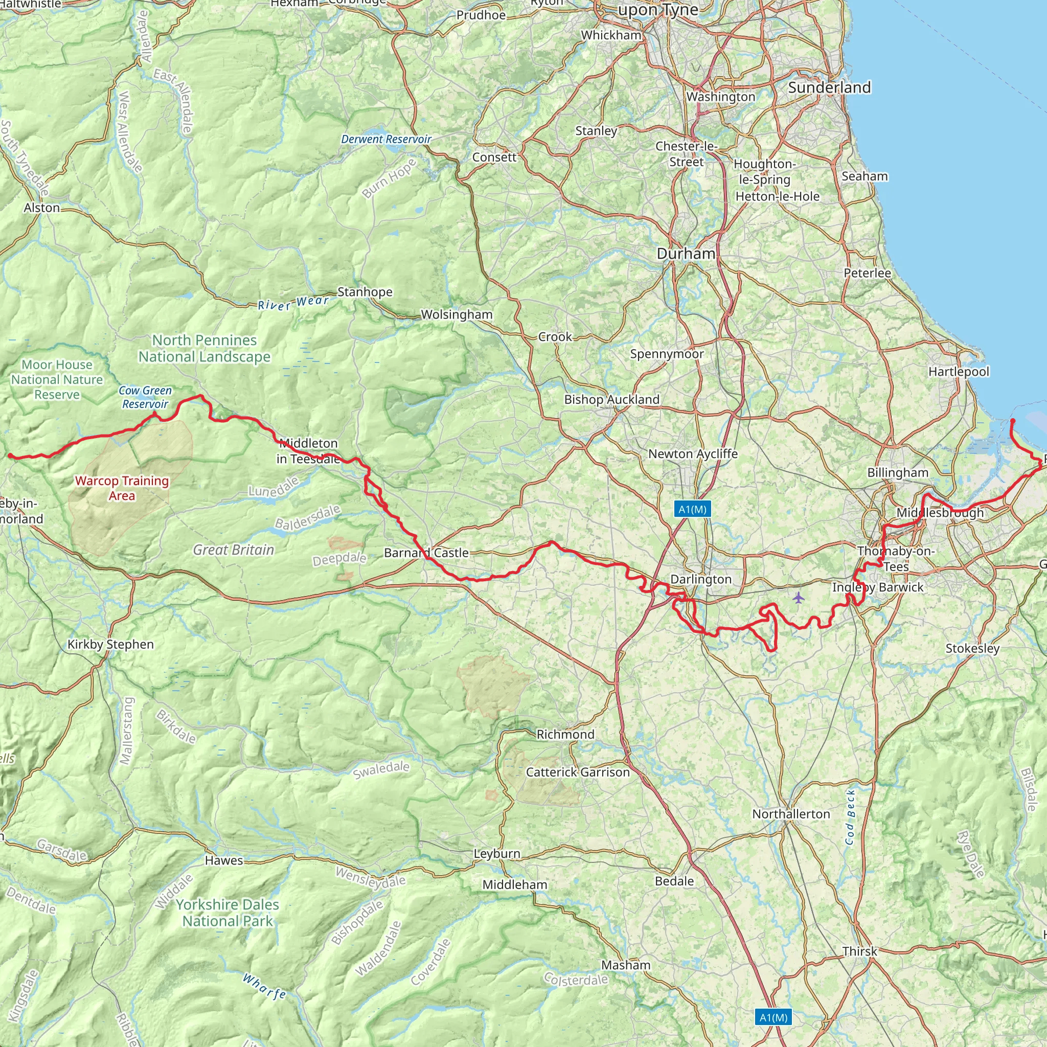
The Teesdale Way is a captivating journey that meanders alongside the River Tees, offering hikers a blend of serene riverbanks, dramatic waterfalls, and rich historical landscapes. Stretching approximately 155 kilometers (96 miles) with an elevation gain of around 900 meters (2953 feet), the trail begins near the quaint village of Dufton in Cumbria, England, and concludes at the North Sea in Redcar.
Getting to the Trailhead
To reach the starting point near Dufton, hikers can drive to the village, which is situated close to the A66 and A1(M) roads, providing easy access from various parts of the country. For those preferring public transport, the nearest train stations are in Appleby-in-Westmorland or Penrith, from where you can take a taxi or local bus services to Dufton.
Navigating the Trail
The Teesdale Way is well-marked, but carrying a detailed map or using a navigation tool like HiiKER is recommended to ensure you stay on the correct path. The trail is a point-to-point hike, so planning for transportation back from Redcar is essential.
Landmarks and Scenery
As you embark on the Teesdale Way, you'll be greeted by the rolling hills of the Pennines, often referred to as the "backbone of England." The trail offers a variety of landscapes, from pastoral farmland to rugged moorland. One of the early highlights is High Cup Nick, a dramatic geological formation known as a glacial valley, providing breathtaking views.
Further along, you'll encounter the historic market town of Barnard Castle, named after the castle it surrounds. This town is a perfect spot to rest and explore local shops and cafes. Approximately 32 kilometers (20 miles) from the start, the trail passes through Middleton-in-Teesdale, a charming village where you can find supplies and accommodations.
Wildlife and Nature
The River Tees will be your constant companion, and along its banks, you may spot a variety of wildlife, including otters, kingfishers, and the occasional glimpse of salmon leaping upstream. The trail also passes through the stunning Low Force and High Force waterfalls, where the river dramatically cascades over the Whin Sill, a geological feature unique to the area.
Historical Significance
The Teesdale region is steeped in history, with remnants of ancient settlements and industrial heritage. The trail takes you through areas that were once bustling with lead mining activity, and you can see evidence of this past in the old mine buildings and railways that dot the landscape.
Preparation and Planning
The Teesdale Way is rated as medium difficulty, with some challenging sections that require a good level of fitness. The weather can be unpredictable, so hikers should be prepared with appropriate clothing and gear. It's advisable to carry sufficient water and food, although there are opportunities to resupply in the towns and villages along the route.
Accommodation and Amenities
There are various accommodation options available, from camping sites to bed and breakfasts, allowing for a comfortable journey. It's wise to book accommodations in advance, especially during peak seasons.
Conclusion
The Teesdale Way is a trail that offers more than just a walk; it's an exploration of England's natural beauty, wildlife, and heritage. With careful planning and a spirit of adventure, hikers will find this trail to be a rewarding experience.
What to expect?
Activity types
Comments and Reviews
User comments, reviews and discussions about the Teesdale Way, England.
4.88
average rating out of 5
8 rating(s)

