Download
Preview
Add to list
More
6.5 km
~1 hrs 52 min
342 m
Loop
“Embark on a 7-kilometer scenic loop through Cinderdale Common, rich in natural beauty and historical intrigue.”
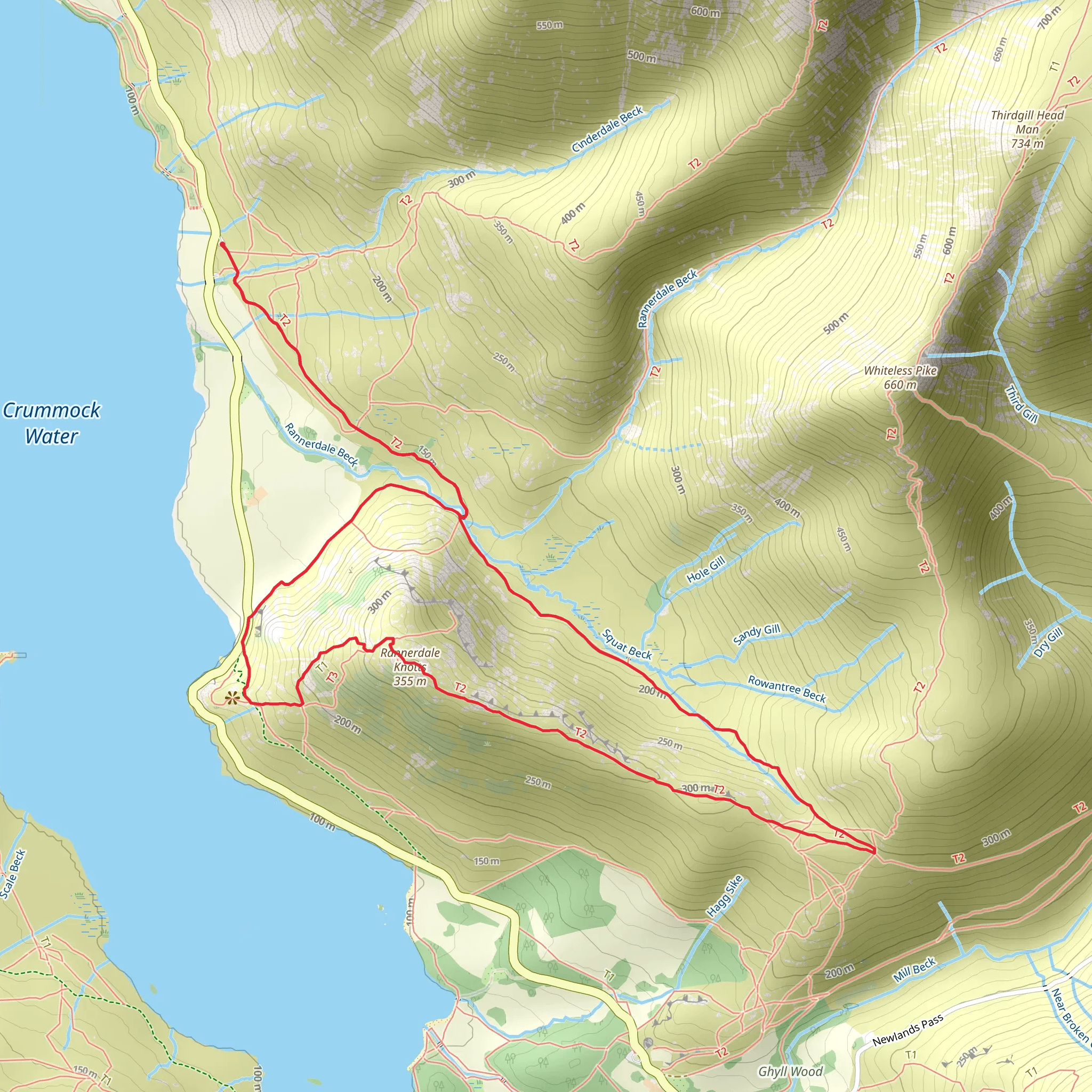
Starting your hike at Cinderdale Common, near the town of Buttermere in Cumberland, England, you'll embark on a scenic loop that spans approximately 7 kilometers (4.3 miles) with an elevation gain of around 300 meters (984 feet). This medium-difficulty trail offers a blend of natural beauty and historical significance, making it a rewarding experience for hikers.
Getting There To reach the trailhead, you can drive to Cinderdale Common, which is accessible via the B5289 road. There is a small car park at the starting point. If you prefer public transport, the nearest bus stop is in Buttermere, serviced by the Honister Rambler (77/77A) bus route, which connects Keswick and Buttermere. From Buttermere, it's a short walk to the trailhead.
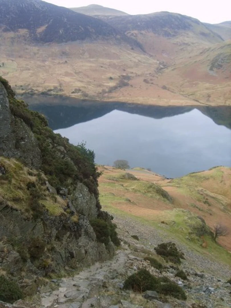
Initial Ascent The hike begins with a gentle ascent through open fields, offering panoramic views of Crummock Water to your left. As you climb, you'll pass through a mix of grassy terrain and rocky outcrops. The initial 1.5 kilometers (0.9 miles) will see you gaining about 150 meters (492 feet) in elevation, providing a good warm-up for the more challenging sections ahead.
Bluebell Valley One of the highlights of this trail is the famous Bluebell Valley, which you will encounter around the 2-kilometer (1.2-mile) mark. During late spring, this area is carpeted with vibrant bluebells, creating a stunning natural spectacle. The valley is also home to a variety of bird species, so keep an eye out for skylarks and meadow pipits.
Summit of Rannerdale Knotts Continuing your ascent, you'll reach the summit of Rannerdale Knotts at approximately 3 kilometers (1.9 miles) into the hike. The summit offers breathtaking 360-degree views of the surrounding fells, including Grasmoor and Mellbreak. This is a perfect spot to take a break and enjoy the scenery. The elevation gain to the summit is around 250 meters (820 feet) from the starting point.
Historical Significance Rannerdale Knotts is steeped in history, with local legends suggesting it was the site of a significant battle between the native Britons and Norse invaders. Known as the "Battle of Rannerdale," it is said that the bluebells bloom in memory of the fallen warriors. While the historical accuracy of this legend is debated, it adds a layer of intrigue to your hike.
Descent and Return The descent begins after the summit, leading you down a steep but manageable path. The terrain can be rocky, so take care with your footing. As you descend, you'll pass through more open fields and eventually rejoin the initial path near Cinderdale Common. The final 2 kilometers (1.2 miles) are relatively flat, allowing you to cool down as you make your way back to the car park.
Navigation and Safety For navigation, it's advisable to use the HiiKER app, which provides detailed maps and real-time tracking to ensure you stay on course. The trail is well-marked, but weather conditions can change rapidly, so be prepared with appropriate clothing and gear. Always check the weather forecast before setting out and inform someone of your plans.
This loop trail offers a perfect blend of natural beauty, wildlife, and historical intrigue, making it a must-visit for any hiking enthusiast exploring the Lake District.
What to expect?
Activity types
Comments and Reviews
User comments, reviews and discussions about the Rannerdale Knotts Loop from Cinderdale Common, England.
4.0
average rating out of 5
3 rating(s)

