Download
Preview
Add to list
More
6.7 km
~1 hrs 52 min
328 m
Loop
“A picturesque 7 km loop from Grange, blending natural beauty, historical landmarks, and moderate challenge with stunning views.”
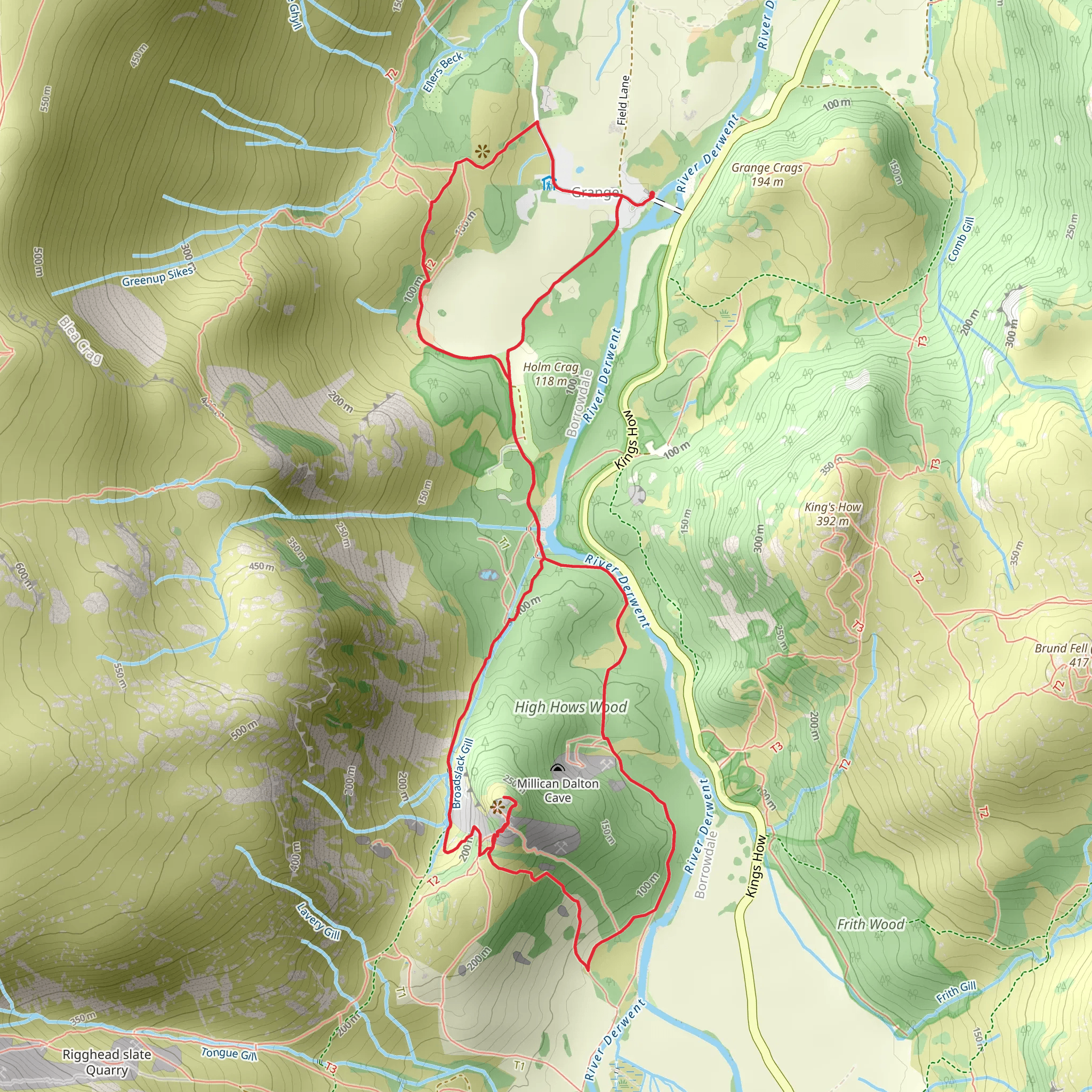
Starting near the picturesque village of Grange in Cumberland, England, this 7 km (approximately 4.3 miles) loop trail offers a delightful mix of natural beauty, historical landmarks, and moderate physical challenge. With an elevation gain of around 300 meters (approximately 984 feet), hikers can expect a moderately strenuous journey that rewards with stunning views and rich cultural history.
Getting There To reach the trailhead, you can drive or use public transport. If driving, head towards Grange, located in the Borrowdale Valley. There is limited parking available near the village, so arriving early is advisable. For those using public transport, the nearest major town is Keswick, which is well-connected by bus services. From Keswick, take a local bus towards Borrowdale and alight at Grange.
Trail Highlights #### Grange Village Starting from Grange, the trail immediately immerses you in the charm of this quaint village. Grange is known for its stone houses and the double-arched bridge over the River Derwent, which dates back to the 17th century. This is a great spot to take some initial photos and prepare for the hike ahead.
#### Castle Crag Approximately 2 km (1.2 miles) into the hike, you will reach Castle Crag, a small but prominent hill that stands at 290 meters (951 feet). The climb to the summit is steep but short, and the effort is well worth it. Castle Crag is historically significant as it was used as a lookout during the Iron Age and later during World War I. The summit offers panoramic views of the Borrowdale Valley and Derwentwater. Look out for the war memorial and the remnants of old quarries.
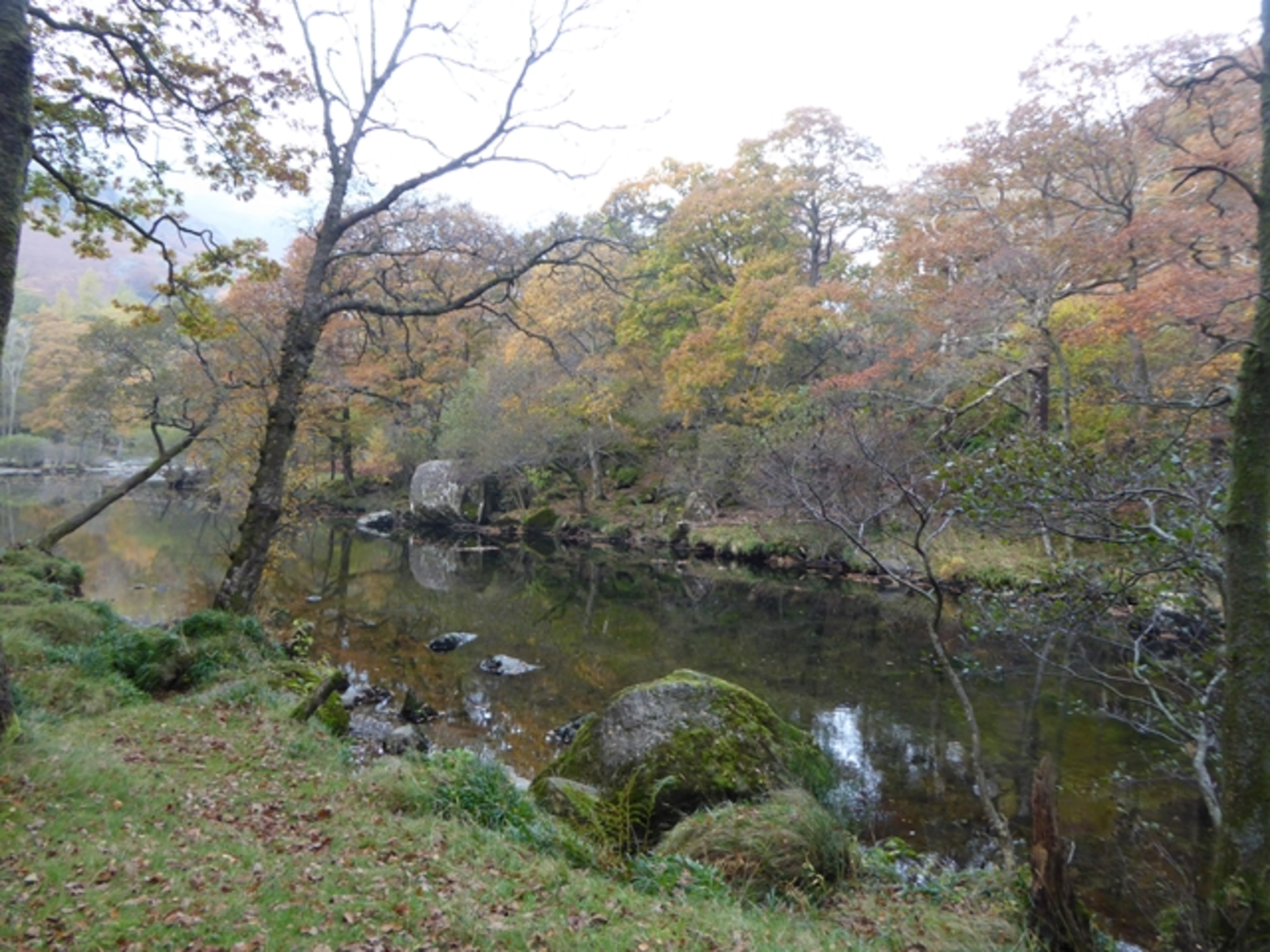
#### Low and High Hows Wood Continuing from Castle Crag, the trail leads you through Low and High Hows Wood. This section is about 3 km (1.9 miles) from the start and offers a serene woodland experience. The woods are home to a variety of wildlife, including red squirrels, deer, and numerous bird species. The path here is well-marked but can be muddy after rain, so appropriate footwear is recommended.
Navigation and Safety The trail is well-marked, but it's always a good idea to have a reliable navigation tool. HiiKER is an excellent app for this purpose, providing detailed maps and real-time location tracking. The terrain can be uneven, especially in the wooded sections and near Castle Crag, so sturdy hiking boots are essential. Carrying a basic first-aid kit and sufficient water is also advisable.
Historical Significance The Borrowdale Valley, where this trail is located, has a rich history. The area was heavily mined for graphite in the 16th century, which was used for making pencils—a craft that Keswick is famous for. The valley also played a role during the Roman occupation of Britain, with several Roman roads and forts in the vicinity.
Flora and Fauna The trail offers a diverse range of flora and fauna. In spring and summer, the woods are carpeted with bluebells and wild garlic. The open areas near Castle Crag are dotted with heather and bilberry bushes. Birdwatchers will enjoy spotting species like the pied flycatcher, woodpecker, and buzzard.
Final Stretch The final part of the loop brings you back towards Grange, passing through more open countryside and offering views of the surrounding fells. This section is relatively flat and provides a gentle end to the hike. As you approach Grange, you might want to stop by one of the local tea rooms for a well-deserved refreshment.
This trail offers a perfect blend of natural beauty, historical intrigue, and moderate physical challenge, making it a rewarding experience for hikers of all levels.
What to expect?
Activity types
Comments and Reviews
User comments, reviews and discussions about the Grange, Castle Crag and Low and High Hows Wood, England.
4.83
average rating out of 5
6 rating(s)

