Download
Preview
Add to list
More
23.8 km
~1 day 0 hrs
172 m
Point-to-Point
“Embark on a moderately challenging 24 km hike from Carlisle to Bowness on Solway, rich in history and natural beauty.”
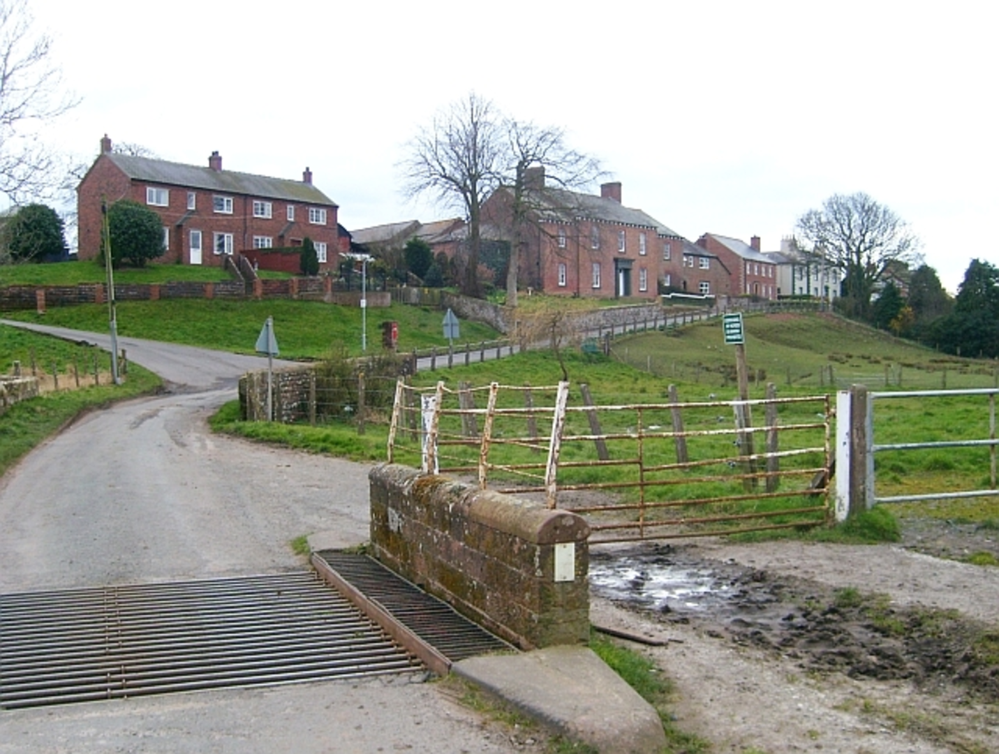
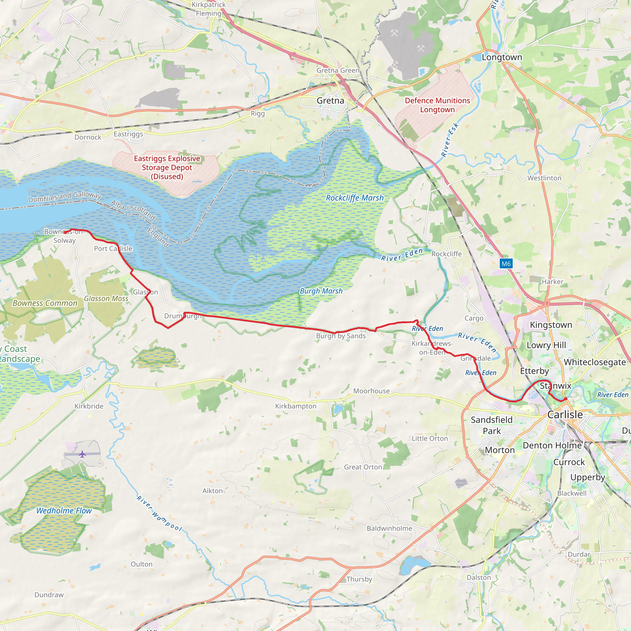
Starting near Cumberland, England, the Carlisle to Bowness on Solway Walk stretches approximately 24 km (15 miles) and offers a delightful journey through a region rich in history and natural beauty. The trail is a point-to-point route with an elevation gain of around 100 meters (328 feet), making it a moderately challenging hike suitable for most hikers with a reasonable level of fitness.### Getting There To reach the trailhead, you can take a train or bus to Carlisle, a well-connected city in Cumbria. From Carlisle, local buses or taxis can take you to the starting point near Cumberland. If driving, there are parking facilities available in Carlisle, and you can arrange for a taxi or shuttle to bring you back to your car at the end of the hike in Bowness on Solway.### Trail Overview The trail begins in the historic city of Carlisle, known for its impressive Carlisle Castle and the ancient Carlisle Cathedral. As you set off, you'll traverse a mix of urban and rural landscapes, starting with the bustling streets of Carlisle before transitioning into the serene countryside.### Significant Landmarks and Historical Sites - Carlisle Castle: Just a short distance from the trailhead, this medieval fortress has stood for over 900 years and played a crucial role in the history of the region. - Hadrian's Wall Path: The trail intersects with the famous Hadrian's Wall Path, offering glimpses of the ancient Roman wall that once marked the northern boundary of the Roman Empire. - St. Michael's Church, Burgh by Sands: Approximately 11 km (7 miles) into the hike, you'll encounter this historic church, which dates back to the 12th century and is built on the site of a Roman fort.### Nature and Wildlife As you leave the urban environment of Carlisle, the trail meanders through picturesque farmland and along the banks of the River Eden. Keep an eye out for a variety of bird species, including herons and kingfishers, especially near the river. The trail also passes through the Solway Coast Area of Outstanding Natural Beauty, where you can enjoy stunning views of the estuary and its diverse wildlife, including wading birds and seals.### Navigation and Terrain The terrain is relatively flat with gentle undulations, making it accessible for most hikers. However, the path can be muddy and uneven in places, particularly after rain, so sturdy hiking boots are recommended. To ensure you stay on track, use the HiiKER app for detailed maps and real-time navigation.### Final Stretch to Bowness on Solway As you approach the final stretch of the hike, the landscape opens up to reveal the expansive Solway Firth. The village of Bowness on Solway marks the end of the trail, where you can relax and take in the views across the estuary. This quaint village is also the western terminus of Hadrian's Wall Path, adding a sense of historical significance to your journey's end.### Practical Tips - Weather: The weather in this region can be unpredictable, so pack layers and waterproof gear. - Refreshments: There are limited facilities along the trail, so carry sufficient water and snacks. - Public Transport: Check the local bus schedules for return trips from Bowness on Solway to Carlisle if you are not using a car.This hike offers a blend of historical intrigue, natural beauty, and a touch of adventure, making it a rewarding experience for those who undertake it.
Comments and Reviews
User comments, reviews and discussions about the Carlisle to Bowness on Solway Walk, England.
5.0
average rating out of 5
2 rating(s)

