Download
Preview
Add to list
More
8.9 km
~2 hrs 8 min
225 m
Loop
“Explore the scenic River Tees and Romaldkirk Loop, a 9 km trail with riverside views and historic landmarks.”
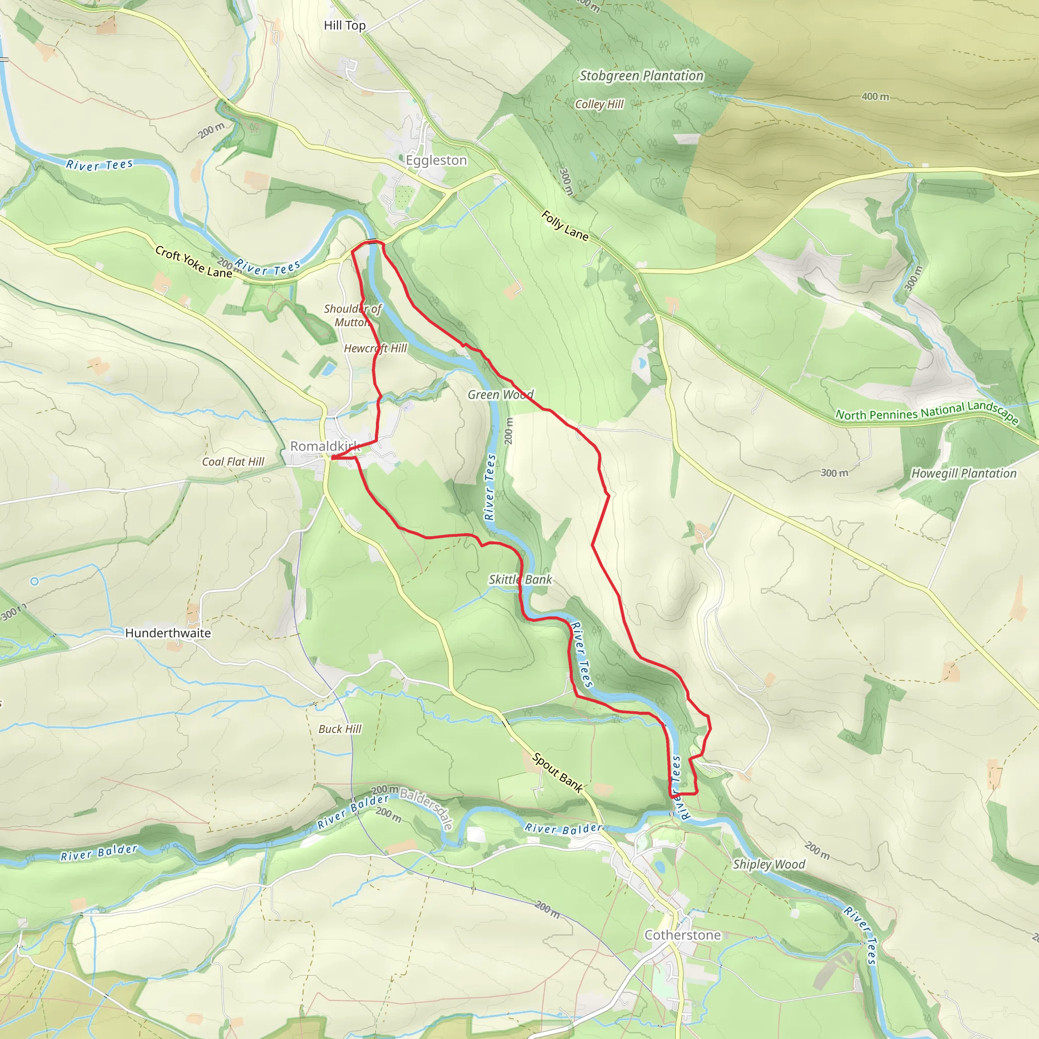
Starting near County Durham, England, the River Tees and Romaldkirk Loop is a picturesque 9 km (5.6 miles) trail with an elevation gain of approximately 200 meters (656 feet). This loop trail is rated as medium difficulty, making it suitable for moderately experienced hikers.### Getting There To reach the trailhead, you can drive or use public transport. If driving, head towards the village of Romaldkirk, which is well-signposted from the A66. There is parking available near the village center. For those using public transport, the nearest train station is in Darlington. From Darlington, you can take a bus to Barnard Castle and then a local bus or taxi to Romaldkirk.### Trail Overview The trail begins in the charming village of Romaldkirk, known for its historic St. Romald's Church, which dates back to the 12th century. As you set off, you'll follow the path along the River Tees, offering stunning riverside views and the soothing sounds of flowing water.### Key Landmarks and Sections#### Romaldkirk to Cotherstone The first section of the trail takes you from Romaldkirk to the nearby village of Cotherstone, approximately 3 km (1.9 miles) into the hike. This part of the trail is relatively flat and easy, making it a good warm-up. Along the way, you'll pass through lush meadows and woodlands, home to a variety of bird species and small mammals. Keep an eye out for the Cotherstone Castle ruins, a historical site dating back to the 11th century.#### Cotherstone to Eggleston Bridge From Cotherstone, the trail continues towards Eggleston Bridge, another 3 km (1.9 miles) stretch. This section involves a gentle climb, offering panoramic views of the Teesdale landscape. The bridge itself is a notable landmark, with its stone arches providing a picturesque crossing over the River Tees. This is a great spot for a short break and some photography.#### Eggleston Bridge to Romaldkirk The final leg of the loop brings you back to Romaldkirk, covering the remaining 3 km (1.9 miles). This part of the trail includes a mix of open fields and wooded areas, with a few moderate inclines. As you approach Romaldkirk, you'll pass through the scenic Teesdale Way, a long-distance footpath that offers additional hiking opportunities for those interested.### Nature and Wildlife The River Tees and Romaldkirk Loop is rich in natural beauty. The riverbanks are lined with wildflowers in the spring and summer, attracting butterflies and bees. You might also spot otters and kingfishers along the river. The woodlands are home to deer, foxes, and a variety of bird species, making it a rewarding hike for nature enthusiasts.### Historical Significance Romaldkirk itself is steeped in history, with its ancient church and traditional stone cottages. The area around the River Tees has been inhabited since Roman times, and the trail passes several historical landmarks, including the ruins of Cotherstone Castle and the old stone bridges that have stood the test of time.### Navigation For navigation, it's recommended to use the HiiKER app, which provides detailed maps and real-time tracking to ensure you stay on the right path. The trail is well-marked, but having a reliable navigation tool can enhance your hiking experience and provide peace of mind.This trail offers a perfect blend of natural beauty, historical landmarks, and moderate physical challenge, making it an excellent choice for a day hike in the County Durham area.
What to expect?
Activity types
Comments and Reviews
User comments, reviews and discussions about the River Tees and Romaldkirk Loop, England.
4.0
average rating out of 5
1 rating(s)

