Download
Preview
Add to list
More
32.5 km
~2 days
495 m
Multi-Day
“Trek the Pennine Way's scenic stretch, infused with waterfalls, moorlands, and a tapestry of history.”
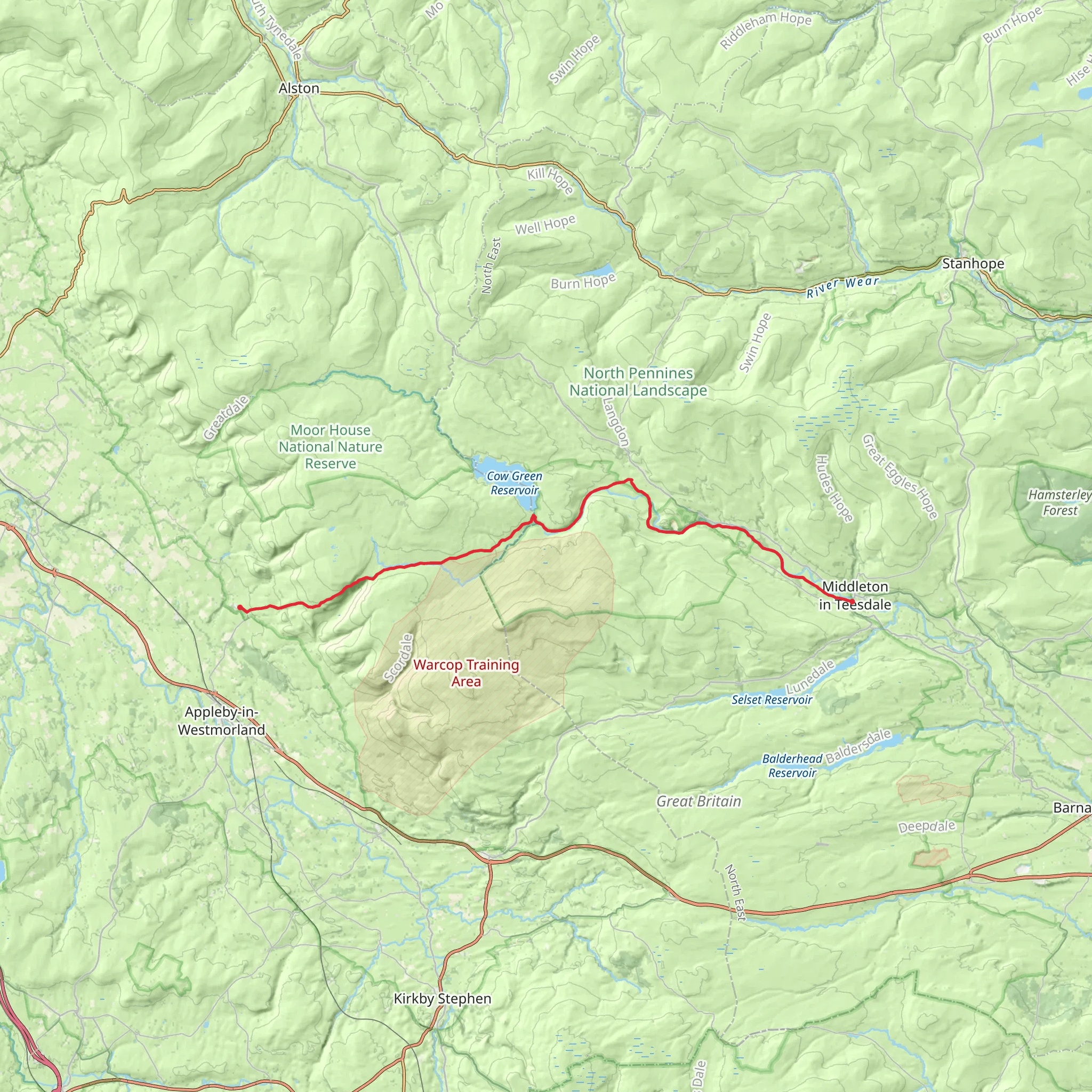
Embarking on the Pennine Way stretch from Middleton-in-Teesdale to Dufton, hikers will traverse approximately 32 kilometers (about 20 miles) of diverse landscapes, with an elevation gain of around 400 meters (roughly 1,300 feet). This point-to-point trail, rated as medium difficulty, offers a rich tapestry of natural beauty and historical significance.
Getting to the Trailhead The trailhead near Middleton-in-Teesdale, County Durham, England, is accessible by car or public transport. For those driving, parking is available in the town, which is a convenient starting point. Public transport users can catch a bus to Middleton-in-Teesdale from larger towns and cities in the region.
The Journey Begins Setting out from the quaint village of Middleton-in-Teesdale, hikers will follow the River Tees, enjoying the serene riverside walk. The path leads to the Low Force Waterfall, a stunning cascade that is a mere 4.8 kilometers (3 miles) into the hike. Continuing on, the trail reaches the High Force Waterfall after about 7.2 kilometers (4.5 miles), one of the most spectacular natural features in the area, where the River Tees plunges 21 meters (70 feet) into a plunge pool below.
Crossing the Moorlands As the trail leaves the river behind, it ascends into the moorlands, characterized by sweeping views and peat bogs. This section can be challenging due to the uneven terrain and the need for careful navigation. Hikers should be prepared for this part of the hike by having the HiiKER app downloaded for offline navigation, as mobile service can be spotty.
Historical Landmarks and Flora The Pennine Way is steeped in history, and as hikers approach the halfway mark, they pass by remnants of lead mining operations, a testament to the region's industrial past. The trail also winds through areas rich in flora, with heather-clad hillsides and rare wildflowers, providing a habitat for a variety of wildlife, including birds of prey.
Approaching Dufton The final stretch towards Dufton takes hikers through more pastoral landscapes, with classic English countryside views. Upon reaching Dufton, hikers will find themselves in a charming village at the foot of the Pennine range, known as the "roof of England." This marks the end of this particular section of the Pennine Way.
Preparation Tips Hikers should be prepared for changeable weather, as the region can experience all four seasons in a single day. Waterproof gear, good hiking boots, and layers are essential. Additionally, carrying a map and compass, alongside the HiiKER app for digital navigation, is recommended for safety.
Wildlife and Conservation The trail crosses through several Sites of Special Scientific Interest (SSSI), where conservation of the unique upland flora and fauna is a priority. Hikers are encouraged to respect these areas by sticking to the trail and leaving no trace.
Conclusion This section of the Pennine Way offers a memorable experience through some of the most beautiful and rugged landscapes in England. With historical sites, dramatic waterfalls, and expansive moorlands, it's a hike that showcases the natural and cultural heritage of the region.
What to expect?
Activity types
Comments and Reviews
User comments, reviews and discussions about the Pennine Way - Middleton-in-Teesdale to Dufton, England.
4.67
average rating out of 5
6 rating(s)

