Download
Preview
Add to list
More
12.4 km
~3 hrs 10 min
415 m
Loop
“The Mayland Bank and Low Retford Wood Loop offers stunning views, rich history, and diverse wildlife in County Durham.”
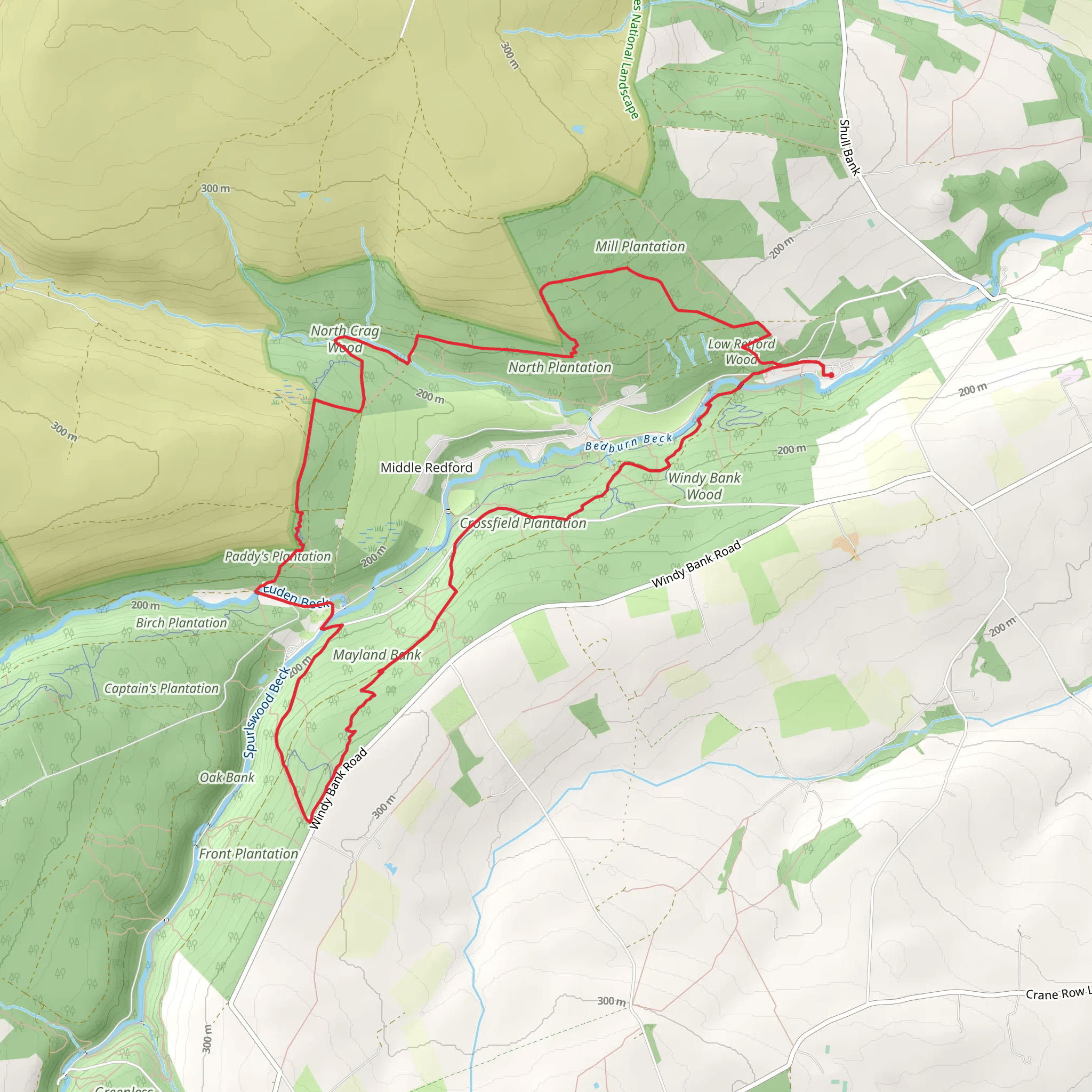
Starting near County Durham, England, the Mayland Bank and Low Retford Wood Loop is a captivating 12 km (7.5 miles) loop trail with an elevation gain of approximately 400 meters (1,312 feet). This medium-difficulty trail offers a blend of natural beauty, historical landmarks, and diverse wildlife, making it a rewarding experience for hikers.
Getting There To reach the trailhead, you can drive or use public transport. If driving, set your GPS to the nearest known address, which is close to the village of Hamsterley. For those using public transport, the nearest significant landmark is the Bishop Auckland railway station. From there, you can take a local bus or taxi to Hamsterley, where the trail begins.
Trail Overview The trail starts near Hamsterley and quickly immerses you in the serene beauty of the English countryside. As you begin your hike, you'll notice the gentle ascent through rolling hills and lush meadows. The first 2 km (1.2 miles) offer a gradual climb, gaining about 100 meters (328 feet) in elevation, making it a good warm-up for the more challenging sections ahead.
Mayland Bank Around the 3 km (1.9 miles) mark, you'll reach Mayland Bank, a prominent feature of the trail. This area provides stunning panoramic views of the surrounding landscape, including the distant Pennines. It's an excellent spot for a short break and some photography. The elevation gain here is more noticeable, adding another 150 meters (492 feet) to your climb.
Low Retford Wood Continuing on, the trail descends slightly as you approach Low Retford Wood at around the 6 km (3.7 miles) point. This ancient woodland is rich in biodiversity, home to a variety of bird species, deer, and small mammals. The dense canopy and the sound of rustling leaves create a tranquil atmosphere, perfect for nature enthusiasts. The trail here is relatively flat, allowing you to enjoy the surroundings without much effort.
Historical Significance The region around County Durham is steeped in history. As you hike, you'll come across remnants of old stone walls and farmsteads, some dating back to the medieval period. These historical markers offer a glimpse into the area's past, where agriculture and rural life once thrived. Keep an eye out for informational plaques that provide context and enrich your hiking experience.
Final Stretch The last 3 km (1.9 miles) of the trail loop back towards Hamsterley. This section includes a mix of gentle descents and flat terrain, making for a pleasant end to your hike. You'll pass through open fields and small streams, with the final kilometer offering a slight downhill gradient, easing you back to the trailhead.
Navigation and Safety For navigation, it's highly recommended to use the HiiKER app, which provides detailed maps and real-time updates. The trail is well-marked, but having a reliable navigation tool ensures you stay on track. Always carry sufficient water, snacks, and a basic first-aid kit. Weather in this region can be unpredictable, so dress in layers and bring waterproof gear.
Wildlife and Flora Throughout the hike, you'll encounter a variety of flora and fauna. In spring and summer, the meadows are adorned with wildflowers, while autumn brings a tapestry of colorful foliage. Birdwatchers will appreciate the diversity of species, including woodpeckers, owls, and songbirds. Deer sightings are common, especially in the early morning or late afternoon.
This trail offers a perfect blend of natural beauty, historical intrigue, and moderate physical challenge, making it an ideal choice for a day hike in County Durham.
What to expect?
Activity types
Comments and Reviews
User comments, reviews and discussions about the Mayland Bank and Low Retford Wood Loop, England.
4.0
average rating out of 5
1 rating(s)

