Download
Preview
Add to list
More
25.8 km
~1 day 1 hrs
792 m
Point-to-Point
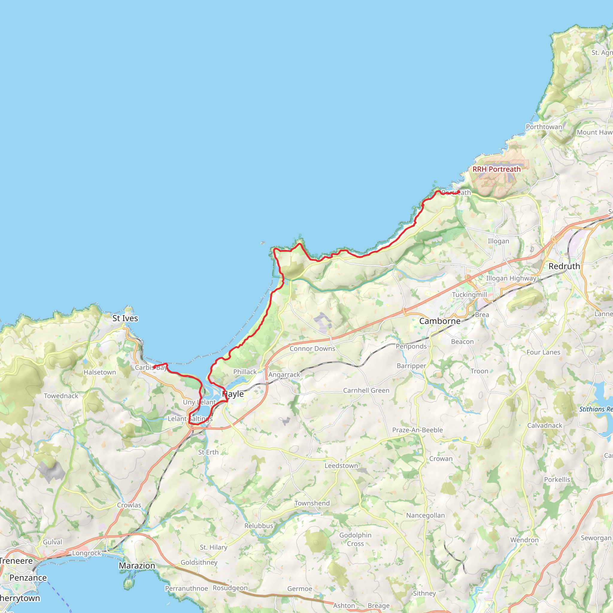
“Explore Cornwall’s coastal beauty, history, and wildlife on this 26 km trail from Portreath to Carbis Bay.”
Starting near the picturesque village of Portreath in Cornwall, England, this 26 km (approximately 16 miles) point-to-point trail to Carbis Bay offers a blend of coastal beauty, historical landmarks, and moderate physical challenge. With an elevation gain of around 700 meters (2,300 feet), hikers should prepare for a variety of terrains, including cliff paths, sandy beaches, and woodland trails.
Getting There To reach the trailhead in Portreath, you can take a train to Redruth Station, which is the nearest major railway station. From Redruth, local buses or taxis can take you directly to Portreath. If you're driving, there are parking facilities available in Portreath, but it's advisable to check for availability, especially during peak seasons.
Trail Overview The trail begins in Portreath, a charming coastal village known for its historic harbor and sandy beach. As you set off, you'll be greeted by the sight of the rugged Cornish coastline. The initial section of the trail is relatively gentle, allowing you to ease into the hike.
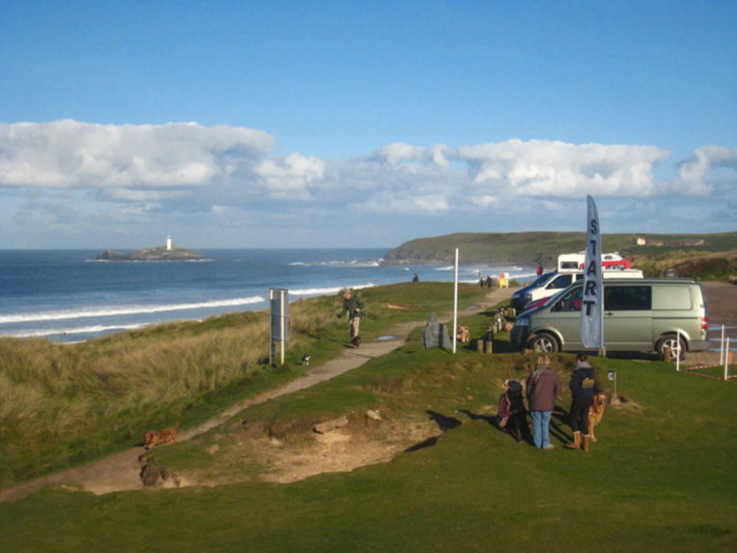
Landmarks and Points of Interest - **Basset's Cove (approx. 3 km / 1.9 miles from start):** Named after the Basset family, prominent local landowners, this cove offers stunning views and is a great spot for a short break. - **Godrevy Lighthouse (approx. 8 km / 5 miles from start):** This iconic lighthouse, built in 1858, stands on an island just off the coast and is a significant navigational aid. The surrounding area is also a haven for wildlife, including seals and various seabirds. - **Gwithian Towans (approx. 10 km / 6.2 miles from start):** A vast stretch of sandy dunes and beach, perfect for a longer rest or even a picnic. The dunes are home to diverse flora and fauna, making it a great spot for nature enthusiasts.
Elevation and Terrain As you continue, the trail becomes more undulating, with several ascents and descents. The highest point of the trail is near the village of Gwithian, where you will experience the most significant elevation gain. The path here can be narrow and steep, so caution is advised.
Historical Significance The region is steeped in history, from the mining heritage of Portreath to the maritime history surrounding Godrevy Lighthouse. The South West Coast Path, which this trail is part of, has been used for centuries by fishermen, smugglers, and coastguards.
Navigation Given the varied terrain and potential for coastal fog, it's advisable to use a reliable navigation tool like HiiKER to stay on track. The app provides detailed maps and real-time updates, ensuring you won't miss any key turns or landmarks.
Wildlife and Nature The trail offers ample opportunities to observe local wildlife. Keep an eye out for seals basking on the rocks near Godrevy and a variety of seabirds, including puffins and guillemots. The coastal flora is equally impressive, with seasonal blooms of wildflowers adding color to the landscape.
Final Stretch to Carbis Bay The final section of the trail takes you through the scenic Hayle Estuary, a birdwatcher's paradise, before arriving at the beautiful Carbis Bay. Known for its turquoise waters and sandy beach, Carbis Bay is a perfect place to relax and unwind after your hike.
Practical Tips - **Footwear:** Sturdy hiking boots are recommended due to the varied terrain. - **Weather:** The coastal weather can be unpredictable, so pack layers and waterproofs. - **Supplies:** Carry sufficient water and snacks, as there are limited facilities along the trail. - **Public Transport:** From Carbis Bay, you can take a train back to St Ives or other nearby towns.
This trail offers a rewarding experience for those prepared to tackle its challenges, with breathtaking views and rich history making every step worthwhile.
What to expect?
Activity types
Comments and Reviews
User comments, reviews and discussions about the Portreath to Carbis Bay Walk, England.
4.0
average rating out of 5
3 rating(s)

