Download
Preview
Add to list
More
15.8 km
~3 hrs 44 min
345 m
Loop
“Explore a scenic 16 km loop near Hambleden, blending natural beauty, historical landmarks, and moderate challenge.”
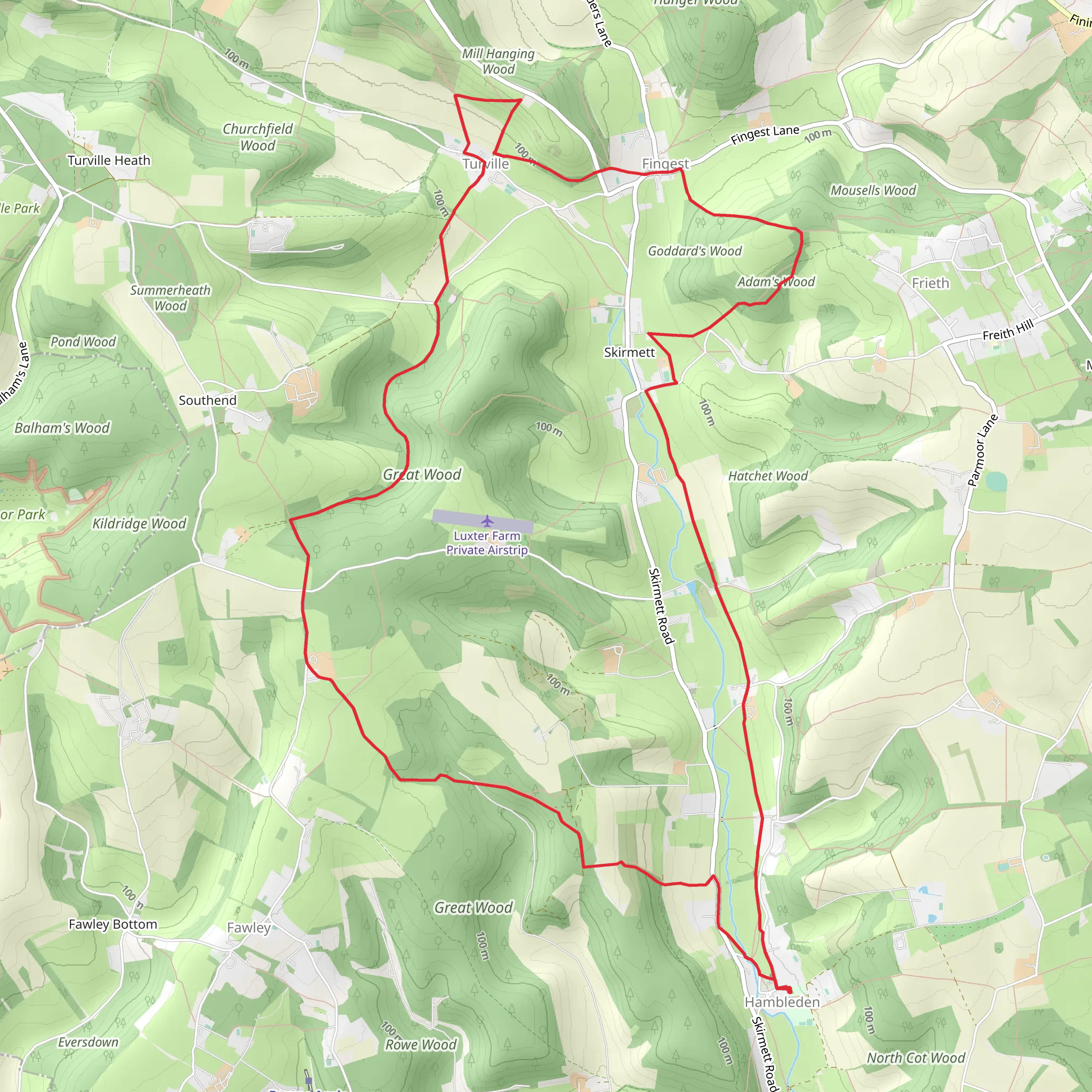
Starting near the picturesque village of Hambleden in Buckinghamshire, England, this 16 km (approximately 10 miles) loop trail offers a delightful mix of natural beauty, historical landmarks, and moderate physical challenge. With an elevation gain of around 300 meters (approximately 984 feet), this trail is rated as medium difficulty, making it suitable for hikers with a reasonable level of fitness.
Getting There
To reach the trailhead, you can drive to Hambleden, which is accessible via the M40 motorway. Parking is available in the village. For those using public transport, the nearest train station is Henley-on-Thames. From there, you can take a local bus or taxi to Hambleden.
Trail Overview
The trail begins in Hambleden, a quintessential English village known for its charming brick and flint cottages and the historic St. Mary the Virgin Church. As you set off, you'll be greeted by rolling hills and lush meadows, typical of the Chiltern Hills Area of Outstanding Natural Beauty.
Key Sections and Landmarks
#### Hambleden to Pheasant's Hill
The initial stretch takes you through Hambleden Valley, where you'll encounter a mix of farmland and woodland. About 3 km (1.9 miles) in, you'll reach Pheasant's Hill, a small hamlet with traditional English homes. The elevation gain here is gentle, making it a good warm-up for the more challenging sections ahead.
#### Pheasant's Hill to Fingest
Continuing on, the trail leads you towards Fingest, another charming village approximately 5 km (3.1 miles) from the start. Here, you'll find the 12th-century St. Bartholomew's Church, notable for its Norman architecture and unique twin-gabled roof. This section involves a moderate climb, adding about 100 meters (328 feet) to your elevation gain.
#### Fingest to Turville
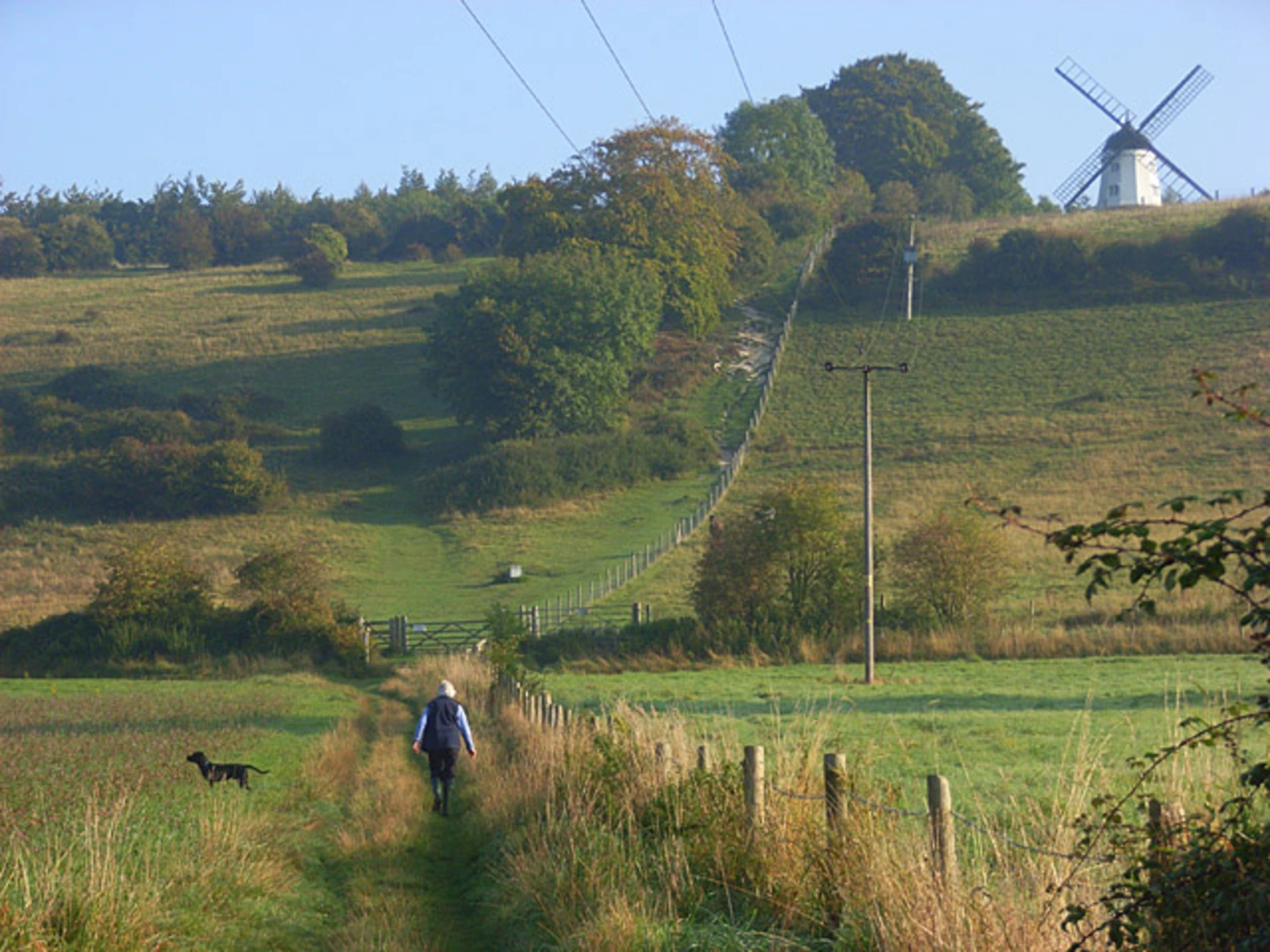
From Fingest, the trail ascends more steeply towards Turville, located around 8 km (5 miles) from the trailhead. Turville is famous for its windmill, which featured in the film "Chitty Chitty Bang Bang," and the village itself has appeared in numerous TV shows and movies. The climb to Turville Hill offers panoramic views of the surrounding countryside, making it a perfect spot for a rest and some photos.
#### Turville to Skirmett
After enjoying Turville, the trail descends towards Skirmett, a small village about 11 km (6.8 miles) into the hike. This section is relatively easier, with a gentle downhill slope. Skirmett is known for its traditional pub, The Frog, where you can take a break and enjoy some local fare.
#### Skirmett to Hambleden
The final leg of the journey takes you back to Hambleden, completing the loop. This section is about 5 km (3.1 miles) and involves a mix of flat and gently rolling terrain, making for a pleasant end to your hike.
Nature and Wildlife
Throughout the hike, you'll traverse a variety of landscapes, including ancient woodlands, open fields, and chalk grasslands. Keep an eye out for local wildlife such as red kites, deer, and a variety of songbirds. The Chiltern Hills are also home to rare plant species, so take the time to appreciate the flora along the way.
Historical Significance
The region is steeped in history, from the ancient churches in Hambleden and Fingest to the iconic windmill in Turville. The Chiltern Hills have been inhabited since prehistoric times, and you may come across remnants of ancient settlements and agricultural terraces.
Navigation
For navigation, it's highly recommended to use the HiiKER app, which provides detailed maps and real-time updates to ensure you stay on track. The trail is well-marked, but having a reliable navigation tool can enhance your hiking experience.
This loop trail offers a perfect blend of natural beauty, historical intrigue, and moderate physical challenge, making it a rewarding experience for any hiker.
What to expect?
Activity types
Comments and Reviews
User comments, reviews and discussions about the Hambleden to Turville Loop, England.
4.33
average rating out of 5
6 rating(s)

