Download
3D Flyover
Add to list
More
538.2 km
~19 days
1164 m
Multi-Day
“Embark on a scenic 334-mile trek through history and nature on the Great Allegheny Passage.”
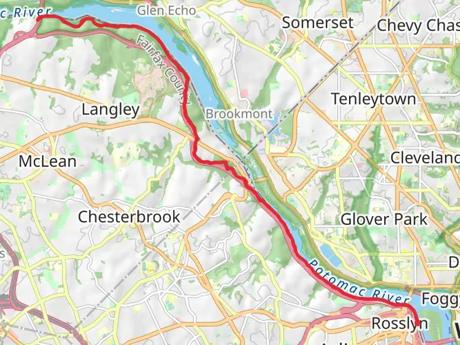
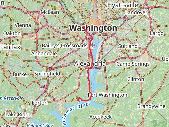
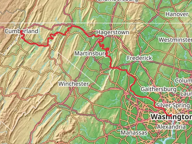
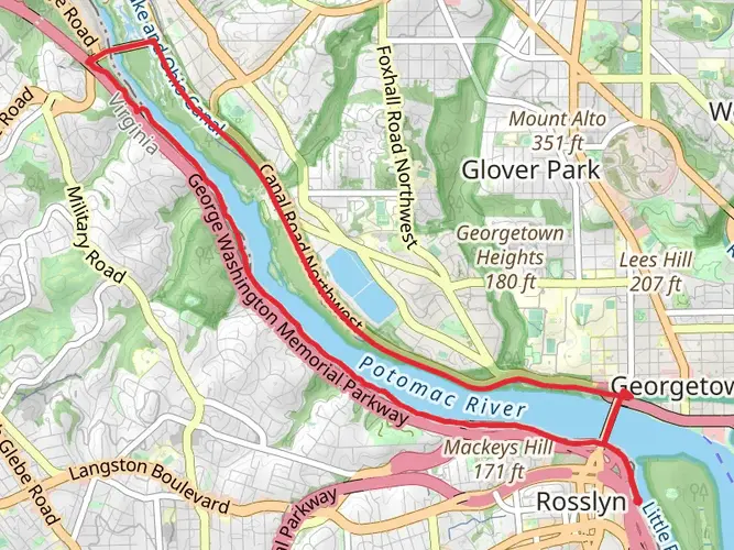
Spanning approximately 334 miles (538 kilometers) and with an elevation gain of around 3,600 feet (1,100 meters), the Great Allegheny Passage offers a unique journey through the varied landscapes of the eastern United States. This point-to-point trail begins near Columbia, in the District of Columbia, and stretches all the way to Pittsburgh, Pennsylvania, providing a medium-difficulty trek that can be enjoyed by hikers and cyclists alike.
Getting to the Trailhead To reach the starting point of the Great Allegheny Passage, you can drive to the area near Columbia, DC, where parking is available for those embarking on the trail. For those using public transportation, there are bus and train services that can get you close to the trailhead, from where you may need a short taxi or ride-share service to reach the exact starting location.
Navigating the Trail The trail is well-marked and maintained, making it accessible for hikers of various skill levels. Hikers can use the HiiKER app to navigate the trail, ensuring they stay on the correct path and can plan their stops accordingly. The app provides detailed maps and information about the trail, which is especially useful for the longer stretches where amenities are sparse.
Landmarks and Historical Significance As you traverse the Great Allegheny Passage, you'll encounter numerous landmarks and sites of historical significance. One of the most notable is the Eastern Continental Divide, which you'll cross at around the 24-mile (39-kilometer) mark. This geographical feature marks the point at which water flows either towards the Atlantic Ocean or the Gulf of Mexico.
Further along, the trail takes you through the Big Savage Tunnel, an impressive 3,294-foot (1,004-meter) long tunnel that was once a part of the historic Western Maryland Railway. The trail also passes through several quaint towns and cities, each with its own unique history and charm.
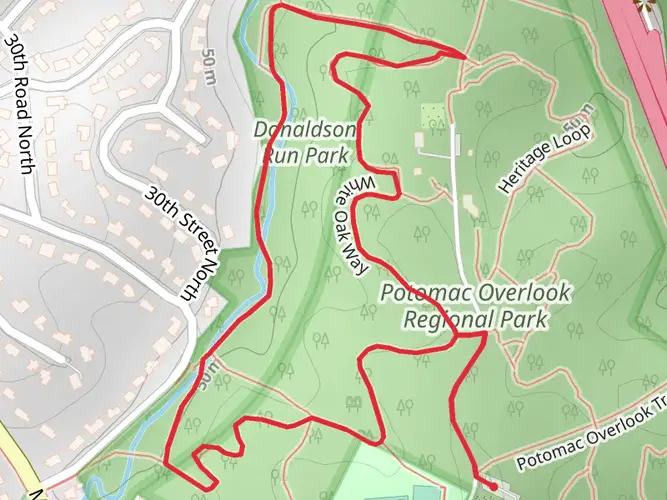
Nature and Wildlife The Great Allegheny Passage is a haven for nature lovers. The trail meanders through lush forests, alongside serene rivers, and through state parks, offering a chance to see a variety of wildlife. Deer, black bears, and numerous bird species are common sights. The changing seasons bring a dynamic backdrop to the trail, with vibrant autumn leaves or blooming spring wildflowers enhancing the experience.
Preparation and Planning Given the length of the trail, it's important to plan your journey in stages, especially if you intend to hike the entire route. There are campgrounds and lodging options along the way, but it's wise to book these in advance, particularly during peak seasons. Water and food resupply points are available in the towns you'll pass through, but carrying enough supplies to last between these points is crucial.
For those looking to complete the trail in sections, there are numerous access points along the route, allowing for shorter day hikes or weekend adventures. The trail's surface is primarily crushed limestone, which is gentle on the feet and suitable for both walking and biking.
Elevation and Terrain The trail's elevation gain is gradual, with the steepest incline occurring as you approach the Eastern Continental Divide. After this point, the trail is predominantly downhill or flat, making for a less strenuous journey as you head towards Pittsburgh.
In conclusion, the Great Allegheny Passage is a trail rich in natural beauty and historical significance. Whether you're looking for a multi-day adventure or a leisurely day hike, this trail offers something for everyone. With proper planning and preparation, it's a journey that will leave you with lasting memories.

What to expect?
Activity types
Frequently asked questions
How long is the Great Allegheny Passage and where does the full route go?
The Great Allegheny Passage is about 538.22 km, or roughly 334 miles, end to end. The GAP itself runs between Cumberland, Maryland, and Downtown Pittsburgh, Pennsylvania, and it is commonly paired with the C&O Canal Towpath to create the full Pittsburgh-to-Washington, D.C. journey.
How many days does it take to complete the Great Allegheny Passage?
A full end-to-end trip on the Great Allegheny Passage usually takes several days because the route covers about 538 km. Strong hikers or bikepackers often break it into roughly 5 to 10 days depending on daily mileage, overnight stops, and whether the trip includes the connected C&O Canal Towpath section toward Washington, D.C.
Is the Great Allegheny Passage difficult for beginners?
The Great Allegheny Passage is generally considered easy, with a long but gradual profile and about 1,164 m of total elevation gain spread across the route. Much of the trail follows former rail corridors, which keeps grades relatively gentle compared with mountain hiking trails.
What is the trail surface like on the Great Allegheny Passage?
Nearly all of the Great Allegheny Passage has an evenly topped crushed-limestone surface, with short paved sections in places such as Connellsville and Cumberland and a longer paved stretch between McKeesport and Downtown Pittsburgh. That rail-trail surface is one reason the route feels approachable despite its length.
Where can you park for the Great Allegheny Passage?
Parking is available in trail towns and at multiple trailheads along the Great Allegheny Passage, including Cumberland, Frostburg, Meyersdale, Rockwood, Ohiopyle, Connellsville, West Newton, Homestead, Pittsburgh’s South Side, and Downtown Pittsburgh. Overnight parking is more limited, and parking in Georgetown, Downtown Pittsburgh, and Pittsburgh’s South Side may require payment.
Are dogs allowed on the Great Allegheny Passage?
Dogs are allowed on the Great Allegheny Passage, but they should be kept on a leash at all times. On a long shared-use trail like this one, leash control matters especially on busier sections near Pittsburgh, Cumberland, Ohiopyle, and the Washington, D.C. end of the broader trail corridor.
What are the main landmarks on the Great Allegheny Passage?
One of the best-known landmarks on the Great Allegheny Passage is the Eastern Continental Divide, the highest point on the route at 2,392 feet above sea level. It sits between Meyersdale and Frostburg near McKenzie Hollow Road and marks the divide between the Chesapeake Bay and Mississippi River watersheds.
Comments and Reviews
User comments, reviews and discussions about the Great Allegheny Passage, District of Columbia.
5.0
average rating out of 5
7 rating(s)