Download
Preview
Add to list
More
28.0 km
~2 days
473 m
Multi-Day
“The Natchaug Trail: a scenic and historic medium-difficulty hike through Connecticut's diverse landscapes.”
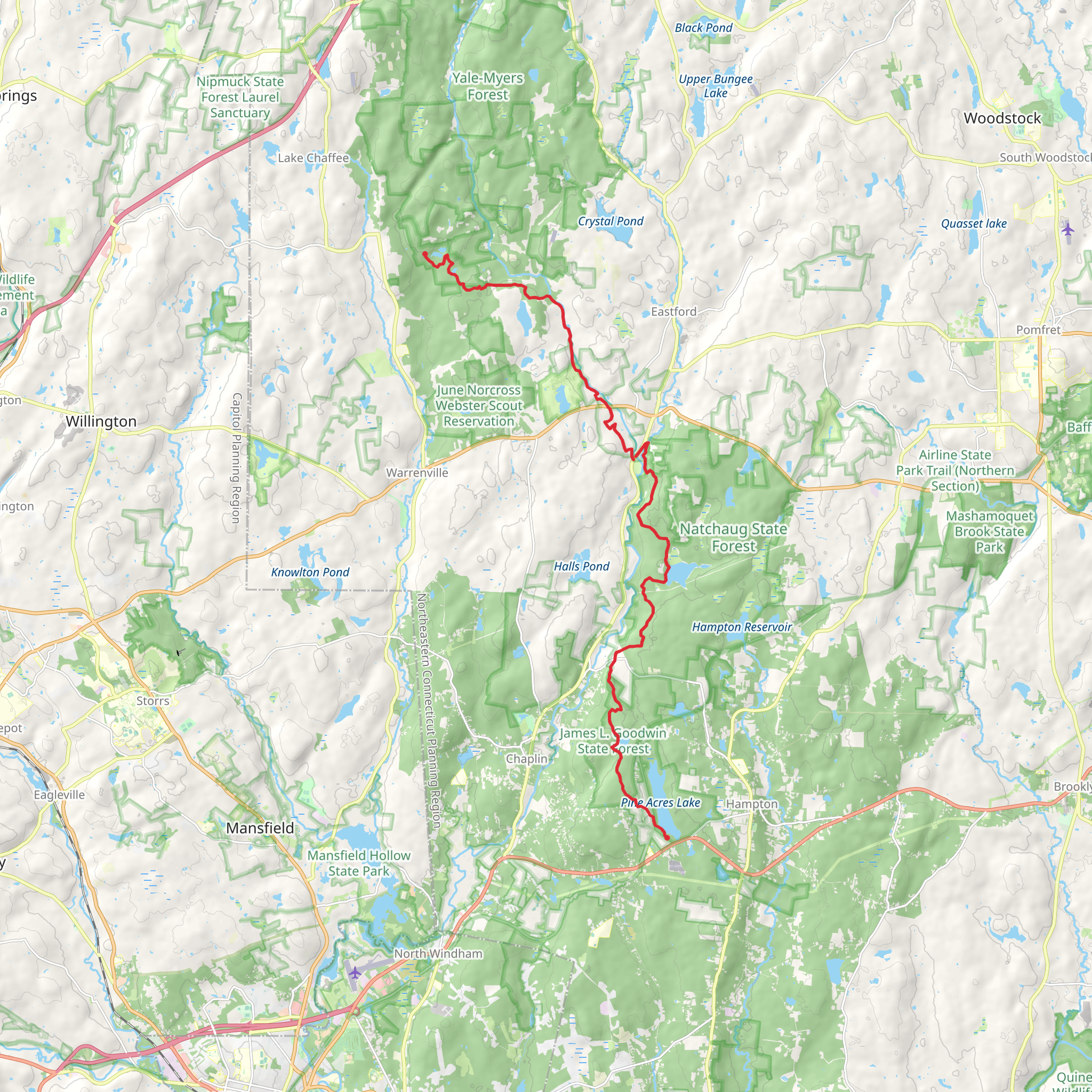
The Natchaug Trail, spanning approximately 28 kilometers (about 17.4 miles) with an elevation gain of around 400 meters (roughly 1312 feet), offers a diverse hiking experience through the heart of Windham County, Connecticut. This point-to-point trail is rated as medium difficulty, making it accessible to hikers with some experience looking for a day hike or a challenging run.
Getting to the Trailhead
To reach the starting point of the Natchaug Trail, hikers can drive to the trailhead located near Eastford, Connecticut. If you're coming from Hartford, take I-84 E to exit 69 for CT-74 E toward US-44 E. Follow US-44 E and CT-198 S to your destination in Eastford. There is no direct public transportation to the trailhead, so a personal vehicle or taxi service is necessary for access.
Trail Experience
As you embark on the Natchaug Trail, you'll find yourself immersed in the lush forests of Connecticut. The trail meanders through a mix of hardwood and coniferous trees, with the early miles introducing you to gentle hills and serene streams. The path is well-marked, but carrying a navigation tool like HiiKER is recommended to keep track of your progress and waypoints.
Historical Significance and Landmarks
The Natchaug Trail is rich in history, running through an area once inhabited by Native American tribes and later by European settlers. Hikers will encounter historical landmarks such as the remains of old mills and homesteads. Around the 6-mile mark, you'll come across the James L. Goodwin State Forest, which offers a glimpse into Connecticut's conservation efforts and forest management practices.
Flora and Fauna
Nature enthusiasts will appreciate the diverse wildlife along the trail, including white-tailed deer, wild turkeys, and a variety of bird species. The trail also boasts a wide array of plant life, from mountain laurel and wildflowers in the spring to vibrant foliage in the autumn months.
Trail Navigation and Terrain
The terrain varies throughout the hike, with some sections featuring rocky outcrops and others covered in soft pine needles. The elevation gain is gradual, with no excessively steep climbs, but be prepared for a few moderate ascents and descents. Around the halfway point, the trail crosses several small brooks, which can be particularly full during the spring melt or after heavy rains.
Preparation and Safety
Before setting out, ensure you have adequate water, snacks, and layers for changing weather conditions. It's also wise to inform someone of your hiking plans and expected return time. Cell service can be spotty, so download offline maps on HiiKER before you go.
Conclusion
The Natchaug Trail offers a rewarding experience for those looking to explore the natural beauty and historical richness of Windham County. With its moderate difficulty and engaging terrain, it's a trail that promises a fulfilling day out for any avid hiker.
What to expect?
Activity types
Comments and Reviews
User comments, reviews and discussions about the Natchaug Trail, Connecticut.
4.5
average rating out of 5
1709 rating(s)

