Download
3D Flyover
Add to list
More
91.6 km
~4 days
1583 m
Multi-Day
“Embark on the Mattabesett Trail's scenic 57-mile journey through history, nature, and Connecticut's rolling landscapes.”
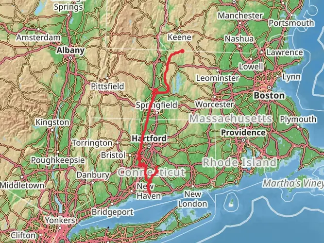
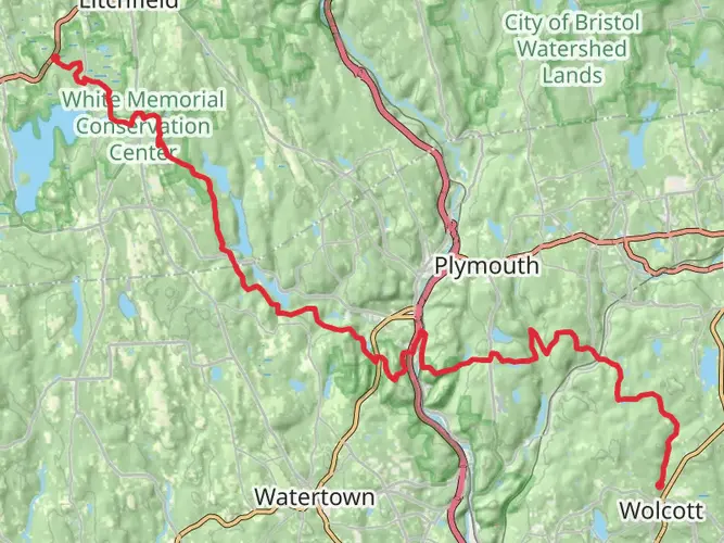
The Mattabesett Trail, spanning approximately 92 kilometers (around 57 miles) with an elevation gain of about 1500 meters (nearly 4921 feet), is a point-to-point trail that offers a medium difficulty level for hikers. This trail is part of the New England National Scenic Trail and is known for its scenic ridgelines and unique geologic features.
Getting to the Trailhead
The trailhead is located near Hartford County, Connecticut. For those driving, you can start at the northern end of the trail near the intersection of Route 9 and Route 77 in Guilford. There is parking available near the trailhead. If you're using public transportation, you can take a bus from Hartford to Middletown and then a short taxi or ride-share to the trailhead.
Navigating the Trail
Hikers can rely on the HiiKER app for detailed maps and navigation assistance throughout the hike. The trail is well-marked with blue blazes, but having a digital tool can help keep you on track and informed about upcoming terrain and points of interest.
Landmarks and Scenery
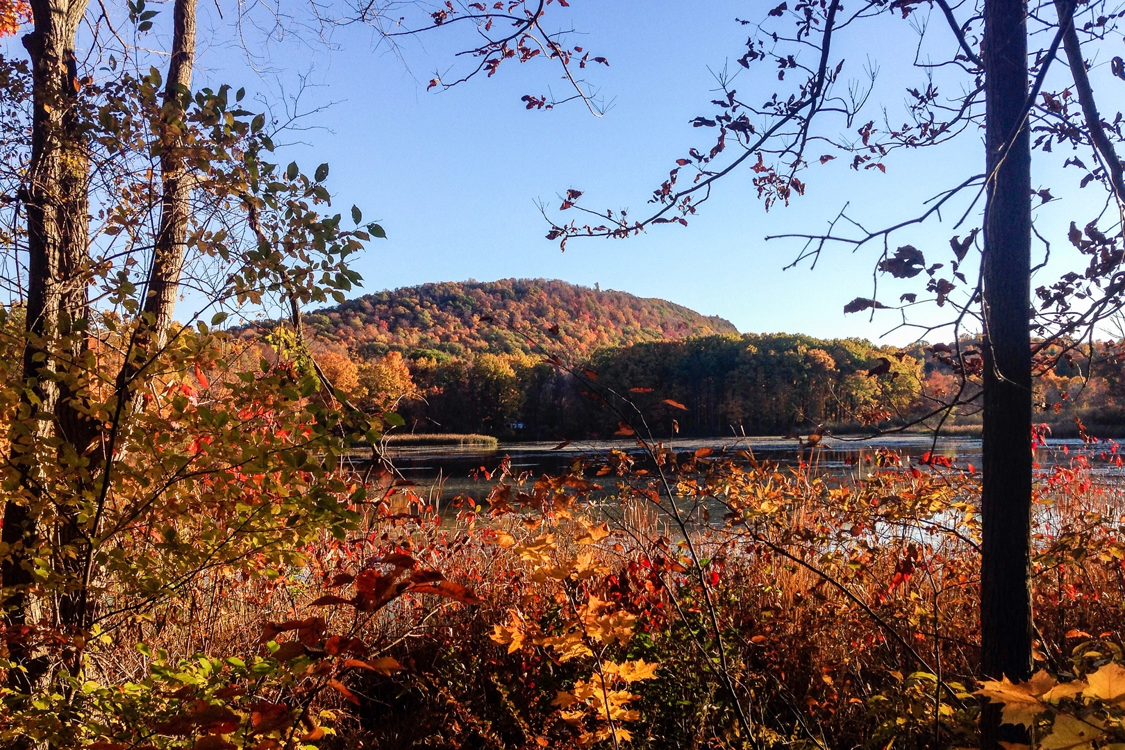
As you embark on the Mattabesett Trail, you'll traverse through a variety of landscapes including dense forests, open meadows, and rocky ledges. Notable landmarks include the striking Chauncey Peak and the impressive Bear Rock, which provide panoramic views of the surrounding area.
Historical Significance
The region is steeped in history, with the trail itself following paths that were likely used by Native American tribes. The area was also significant during the colonial period and has remnants of old quarries and farms.
Flora and Fauna
The trail is home to a diverse range of wildlife and plant species. Hikers may spot white-tailed deer, red-tailed hawks, and a variety of songbirds. The forested areas are rich with oak, maple, and birch trees, and in the spring and summer, the trail is lined with wildflowers.
Preparation and Planning
Before setting out, ensure you have adequate water, food, and clothing for the journey. The trail can be rocky and steep in places, so sturdy hiking boots are recommended. Weather can change rapidly, so be prepared with rain gear and layers for warmth.
Safety and Etiquette
Always stay on marked trails to protect the environment and your own safety. Be mindful of local wildlife, and practice Leave No Trace principles to keep the trail pristine for future hikers.
By following these guidelines and preparing accordingly, hikers can enjoy the natural beauty and historical richness of the Mattabesett Trail.

What to expect?
Activity types
Frequently asked questions
How long does it take to hike the Mattabesett Trail end to end?
The Mattabesett Trail is 91.64 km, or about 57 miles, so most hikers treat it as a multi-day route rather than a single-day outing. A typical end-to-end hike takes around 4 to 6 days, depending on pace, weather, and how much time is spent on steeper ridge sections and viewpoint stops such as Chauncey Peak and Mount Higby.
How difficult is the Mattabesett Trail in Connecticut?
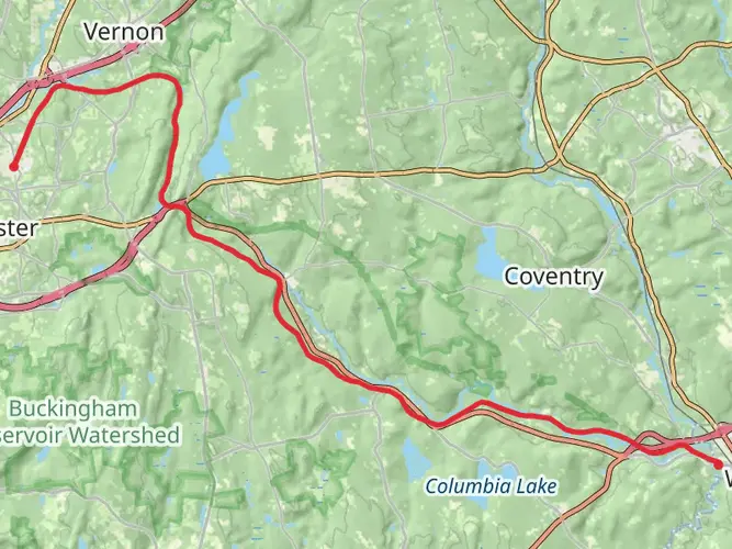
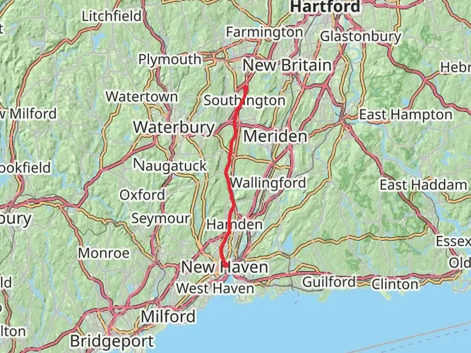
The Mattabesett Trail is generally rated medium difficulty, but that does not mean flat or easy. It packs about 1,583 m of elevation gain into 91.64 km, with repeated climbs onto traprock ridges, rocky ledges, and uneven footing across sections in towns including Meriden, Middletown, Durham, and Guilford.
What are the best viewpoints and landmarks on the Mattabesett Trail?
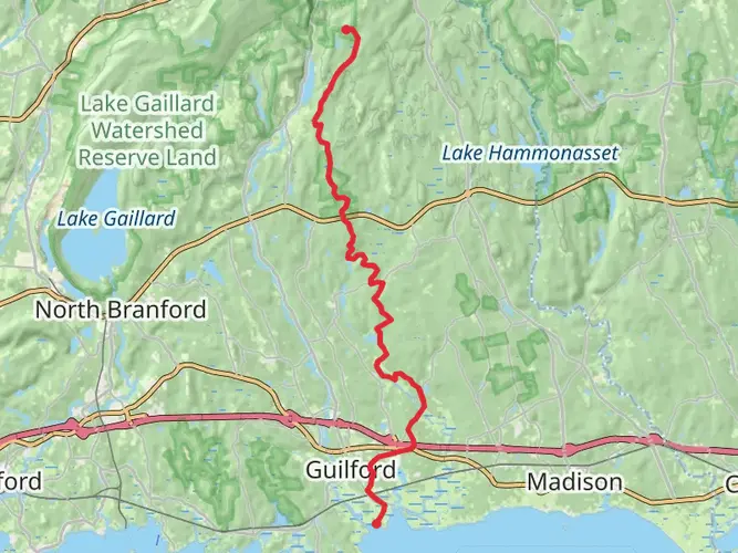
Some of the best-known highlights on the Mattabesett Trail include Chauncey Peak and Lamentation Mountain in Meriden, Mount Higby in Middletown, Pisgah Mountain in Durham, Bluff Head in Guilford, and Beseck Mountain in Middlefield. The route is also known for features such as the Chinese Wall in Middletown and long ridge views over the Connecticut River valley.
Is the Mattabesett Trail part of the New England Trail, and how is it marked?
Yes. The Mattabesett Trail is one of the historic trail sections that make up the New England National Scenic Trail in Connecticut and Massachusetts. In Connecticut, the route is marked with blue blazes as part of the Connecticut Forest and Park Association Blue-Blazed Hiking Trail System, which helps distinguish it from the white-blazed sections used farther north in Massachusetts.
Where does the Mattabesett Trail start and end?
The Mattabesett Trail is commonly described as running in a broad horseshoe across central Connecticut, beginning at River Road in Middletown and extending to the Berlin Turnpike in Berlin. The trail passes through 10 towns: Guilford, Durham, Madison, Haddam, Middletown, North Branford, Wallingford, Middlefield, Meriden, and Berlin.
Are there any closures or reroutes on the Mattabesett Trail?
Yes, hikers should check current conditions before setting out because parts of the Mattabesett Trail have had recent changes. Notices posted in 2024 and 2026 include a relocation near Chauncey Peak in Meriden and a trail section closure for accessibility improvements, so the exact line on the ground may differ from older guide descriptions.
Comments and Reviews
User comments, reviews and discussions about the Mattabesett Trail, Connecticut.
4.5
average rating out of 5
1694 rating(s)