Download
Preview
Add to list
More
7.2 km
~1 hrs 37 min
110 m
Out and Back
“Embark on a moderate Pawnee Buttes Trail adventure, where history meets stunning plains and wildlife.”
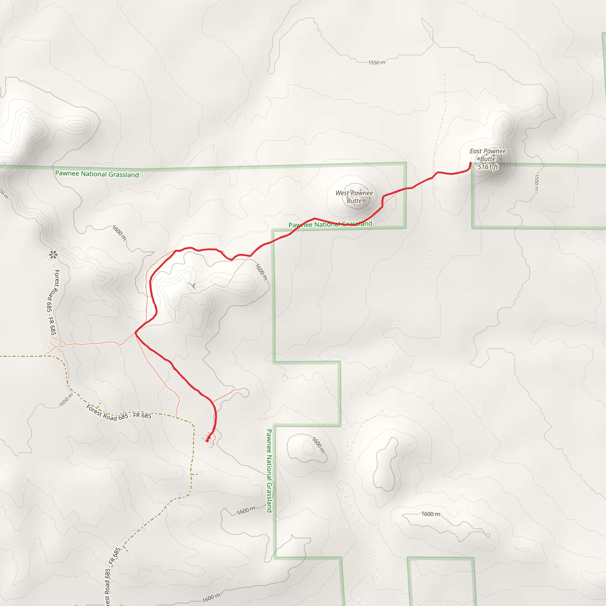
The Pawnee Buttes Trail, nestled in the Pawnee National Grassland near Weld County, Colorado, offers hikers a unique journey through the high plains with a round trip distance of approximately 7 kilometers (4.3 miles) and an elevation gain of about 100 meters (328 feet). This out-and-back trail is rated as medium difficulty, making it accessible to hikers with a moderate level of fitness.
Getting to the Trailhead
To reach the trailhead, if you're driving, head towards Keota, Colorado, and from there, follow the signs to the Pawnee National Grassland. The trailhead is located off of County Road 685. There is a parking area near the trailhead where you can leave your vehicle. Public transport options are limited in this region, so driving is the most feasible way to access the start of the hike.
Trail Experience
As you embark on the Pawnee Buttes Trail, you'll be greeted by the wide-open spaces of the Colorado plains. The trail is well-marked and begins with a gentle descent into the grassland. The path is mostly flat, with the 100-meter elevation gain spread out over the course of the hike, making it a relatively easy ascent.
Landmarks and Wildlife
One of the most striking features of this hike is the two prominent buttes that rise dramatically from the otherwise flat landscape. These buttes, made of sedimentary rock, are remnants of the High Plains' geological past and serve as the trail's namesake. The first butte is reached after approximately 2.5 kilometers (1.5 miles), with the second butte a short distance further.
The area is rich in wildlife, and it's not uncommon to see pronghorn antelope and mule deer grazing in the distance. Birdwatchers will also appreciate the variety of bird species that call this grassland home, including larks, hawks, and the occasional golden eagle.
Flora and Historical Significance
The trail passes through a landscape dotted with prairie grasses and wildflowers, particularly vibrant in the spring and early summer. The Pawnee National Grassland itself is a testament to the Dust Bowl of the 1930s, which led to the establishment of the national grassland system to rehabilitate and protect the prairie ecosystem.
Navigation and Preparation
For navigation, hikers can rely on the HiiKER app to keep track of their progress along the trail and to ensure they remain on the correct path. It's advisable to carry plenty of water, as the arid climate and lack of shade can lead to dehydration. Sun protection is also crucial, so bring sunscreen, a hat, and sunglasses.
Trail Etiquette and Conservation
As with any natural area, it's important to practice Leave No Trace principles. Stay on the designated trail to protect the fragile grassland ecosystem, and pack out all trash. The trail is open year-round, but the best times to visit are in the spring and fall to avoid the extreme heat of the summer and the cold winds of the winter.
By preparing adequately and respecting the natural environment, hikers can enjoy a memorable experience on the Pawnee Buttes Trail, taking in the historical and natural beauty of the Colorado plains.
Comments and Reviews
User comments, reviews and discussions about the Pawnee Buttes Trail, Colorado.
4.0
average rating out of 5
3 rating(s)

