Download
Preview
Add to list
More
5.1 km
~1 hrs 22 min
209 m
Out and Back
“Embark on a historic, wildlife-rich hike through the Rockies on the Straight Creek Southside Trail.”
Nestled in the scenic landscape of Summit County, Colorado, the Straight Creek Southside Trail offers an invigorating outdoor experience for hikers looking to explore the Rocky Mountains. Spanning approximately 5 kilometers (3.1 miles) with an elevation gain of around 200 meters (656 feet), this out-and-back trail is rated as medium difficulty, making it accessible to hikers with some experience.
Getting to the Trailhead
To reach the trailhead, visitors can drive to the vicinity of Dillon, Colorado. From the town, take the Dillon Dam Road and look for parking areas near the Straight Creek Trail System. If you're relying on public transportation, check the local Summit County transit schedules for routes that stop near Dillon, and plan for a short walk or taxi ride to the trailhead.
The Hike Itself
As you embark on the Straight Creek Southside Trail, you'll be greeted by a mix of dense forest canopies and open meadows. The trail begins with a gentle incline, weaving through stands of lodgepole pine, which are a common sight in this region. The path is well-defined and marked, but hikers should always carry a reliable navigation tool like HiiKER to ensure they stay on track.
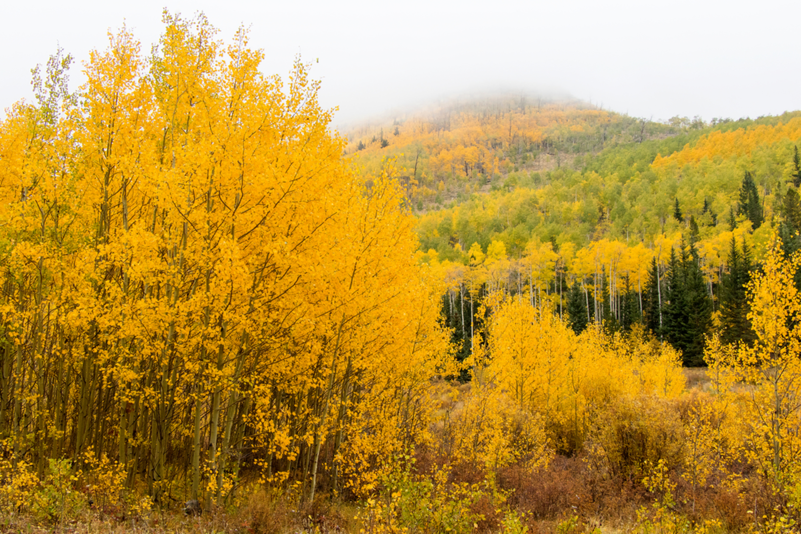
About 1.5 kilometers (0.9 miles) in, the trail starts to ascend more steeply, offering hikers a moderate challenge. As you gain elevation, keep an eye out for aspen groves, which provide a stunning display of color in the fall. The local wildlife is abundant, with chances to spot mule deer, red foxes, and a variety of bird species, including the mountain chickadee and the Clark's nutcracker.
Historical Significance and Landmarks
The Straight Creek Southside Trail is not only a journey through nature but also a passage through history. The area around Summit County was historically significant during Colorado's mining boom in the late 19th century. While hiking, you may notice remnants of this era, such as old mining structures or railroad grades, which are silent witnesses to the region's rich past.
As you approach the 2.5-kilometer (1.55-mile) mark, the trail culminates at a viewpoint that offers panoramic vistas of the surrounding mountains. This is a perfect spot to rest and enjoy a snack before beginning the descent back to the trailhead.
Preparation and Safety
Before setting out, hikers should be prepared for the mountain environment. Weather can change rapidly, so it's essential to bring layers of clothing, rain gear, and plenty of water. Also, be sure to inform someone of your hiking plans and expected return time.
The Straight Creek Southside Trail is a rewarding hike that provides a blend of natural beauty, wildlife viewing opportunities, and a touch of Colorado's historical landscape. Whether you're a seasoned hiker or someone looking to delve into the heart of the Rockies, this trail is a splendid choice for an outdoor adventure.

Comments and Reviews
User comments, reviews and discussions about the Straight Creek Southside Trail, Colorado.
5.0
average rating out of 5
1 rating(s)