Download
Preview
Add to list
More
4.8 km
~1 hrs 21 min
232 m
Out and Back
“Embark on a steep, scenic journey into Colorado's mining history on the rugged Horseshoe Basin Trail.”
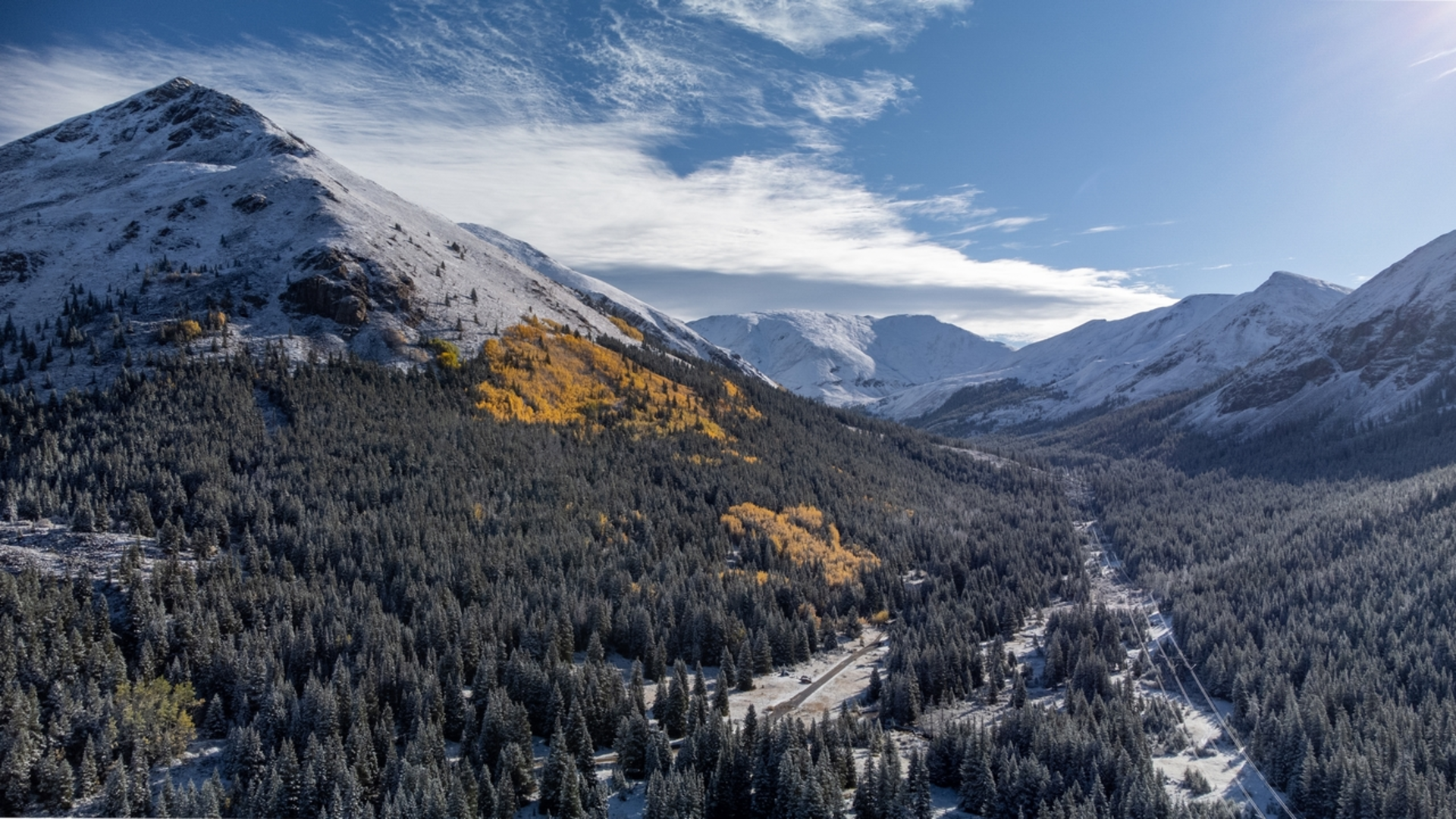
Nestled in the heart of Summit County, Colorado, the Horseshoe Basin Trail is a challenging yet rewarding out-and-back hike that spans approximately 5 kilometers (3.1 miles) with an elevation gain of around 200 meters (656 feet). This trail is considered difficult due to its steep sections and rugged terrain, so it's essential for hikers to be well-prepared with proper gear and a good level of fitness.
Getting to the Trailhead
To reach the trailhead, hikers can drive to the nearest significant landmark, which is the town of Breckenridge. From there, follow the signs leading towards the Continental Divide, where the trailhead is located just off a minor road branching from Highway 9. There is a parking area where you can leave your car. For those relying on public transport, the Summit Stage bus service offers routes that get you close to Breckenridge, and from there, a taxi or a local shuttle can be taken to the trailhead.
Navigating the Trail
Once on the trail, hikers can use the HiiKER app to navigate the path, which is well-marked but can be tricky to follow in places due to the rocky landscape. The trail begins with a moderate incline through subalpine forests, offering glimpses of the surrounding peaks. As you ascend, the vegetation thins, and the path becomes rockier.
Landmarks and Scenery
About 1.5 kilometers (just under a mile) in, you'll encounter the remains of an old mining operation, a nod to the region's rich history during the Colorado Gold Rush. This area is a good spot to take a break and imagine the bustling activity that once took place here.
Continuing on, the trail opens up to reveal the expansive Horseshoe Basin. The basin is a geological wonder, shaped by glacial activity, and it's here that the trail reaches its highest point, offering panoramic views of the surrounding peaks and valleys. The basin is also home to a variety of alpine flora and fauna, including wildflowers in the summer and the occasional sighting of mule deer or elk.
Wildlife and Nature
As you hike, keep an eye out for the American pika and marmots, which are often seen among the rocks. Birdwatchers may also spot species such as the white-tailed ptarmigan and the Clark's nutcracker. The trail is also known for its wildflowers, especially in late July and August, when the basin is awash with color.
Preparation and Safety
Given the trail's difficulty, it's crucial to wear sturdy hiking boots and bring plenty of water, as well as snacks or a packed lunch. The weather can change rapidly in the mountains, so layered clothing and a waterproof jacket are advisable. Also, be sure to check the weather forecast before setting out, as the trail can become dangerous in poor conditions.
Historical Significance
The Horseshoe Basin played a significant role during the mining boom in the late 1800s. The area is dotted with remnants of this era, including old mine shafts and machinery. These historical artifacts serve as a reminder of the region's contribution to Colorado's development and the enduring legacy of the pioneers who sought fortune in these mountains.
Conclusion
In conclusion, the Horseshoe Basin Trail offers a glimpse into Colorado's natural beauty and historical past. It's a hike that challenges the body and stimulates the mind, providing an unforgettable experience for those who take on its steep paths and rocky terrain. Remember to respect the environment and leave no trace to preserve this area for future generations of hikers.

Comments and Reviews
User comments, reviews and discussions about the Horseshoe Basin Trail, Colorado.
average rating out of 5
0 rating(s)