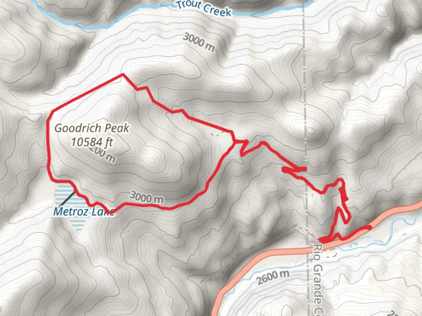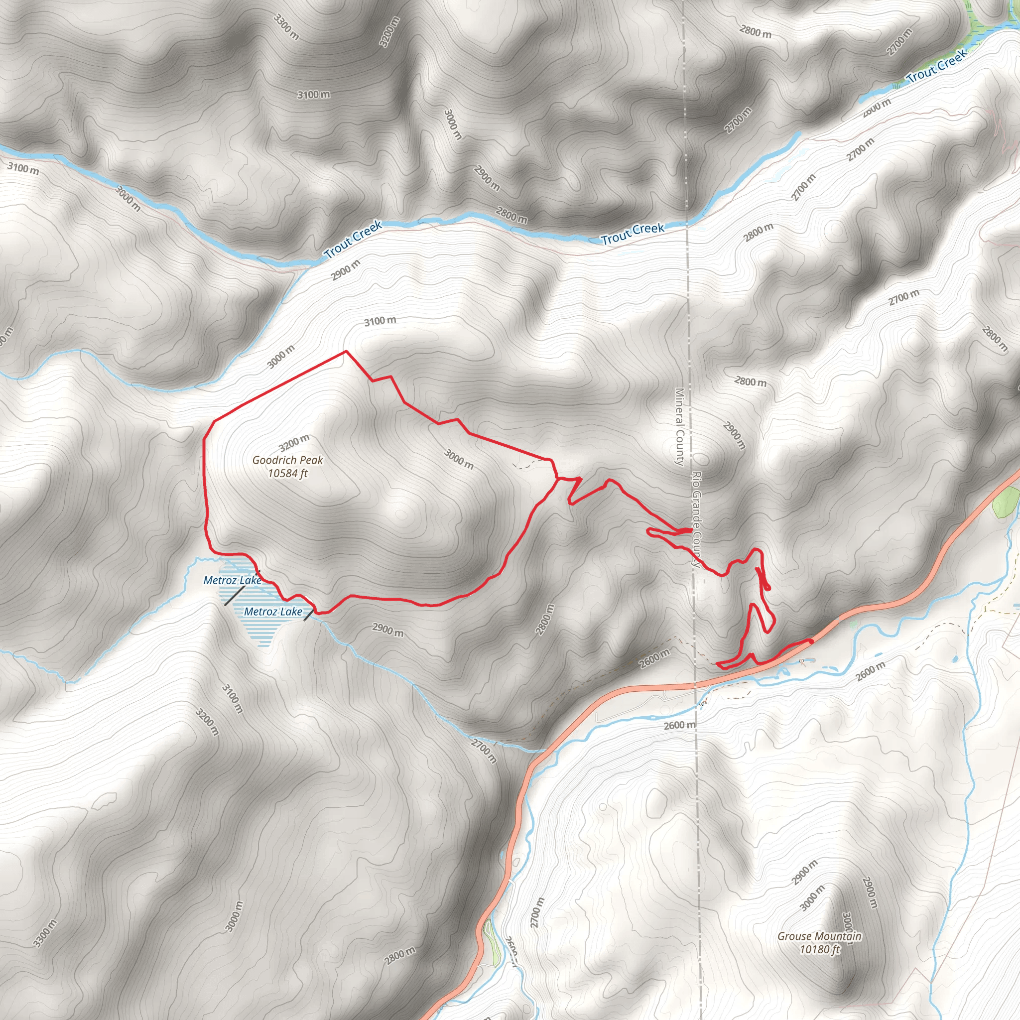
Loop around Goodrich Park, Goodrich Peak and Metroz Lake
Download
Preview
Add to list
More
19.3 km
~1 day 0 hrs
853 m
Loop
“Explore a scenic 19 km loop with rich history, wildflowers, panoramic views, and diverse wildlife near Rio Grande County.”
Starting near Rio Grande County, Colorado, this 19 km (approximately 11.8 miles) loop trail offers a moderately challenging hike with an elevation gain of around 800 meters (2,625 feet). The trailhead is conveniently accessible by car, with parking available near the intersection of County Road 14 and Forest Road 250. For those relying on public transport, the nearest significant landmark is the town of Del Norte, from where you can arrange a taxi or shuttle service to the trailhead.
Initial Ascent and Goodrich Park
The hike begins with a gradual ascent through dense pine forests, providing ample shade and a cool start to your journey. After about 3 km (1.9 miles), you will reach Goodrich Park, a serene meadow that offers a perfect spot for a short break. The park is known for its vibrant wildflowers in the spring and early summer, making it a picturesque location for photography enthusiasts.
Climbing Goodrich Peak
Continuing from Goodrich Park, the trail becomes steeper as you approach Goodrich Peak. This section covers approximately 5 km (3.1 miles) and includes an elevation gain of about 400 meters (1,312 feet). The climb is strenuous but rewarding, with panoramic views of the San Juan Mountains and the Rio Grande National Forest. Keep an eye out for the diverse wildlife, including mule deer and the occasional black bear.
Descent to Metroz Lake
After summiting Goodrich Peak, the trail descends towards Metroz Lake, covering around 4 km (2.5 miles) with a descent of approximately 300 meters (984 feet). The lake is a tranquil spot, ideal for a longer rest or even a picnic. Anglers might want to bring a fishing rod, as the lake is stocked with trout. The surrounding area is rich in birdlife, so birdwatchers should keep their binoculars handy.
Historical Significance
The region around Goodrich Peak and Metroz Lake has a rich history. It was once inhabited by the Ute tribes, and you may come across ancient petroglyphs on some of the rock faces. During the late 19th century, the area saw a surge in mining activity, remnants of which can still be seen along the trail. Old mining cabins and equipment offer a glimpse into the past and make for interesting exploration points.
Final Stretch and Return
The final leg of the hike is a gentle descent back to the trailhead, covering the remaining 7 km (4.3 miles). This section is relatively easy, allowing you to enjoy the lush forest and the sounds of the Rio Grande River flowing nearby. The trail is well-marked, but it's advisable to use the HiiKER app for navigation to ensure you stay on track.
Preparation and Safety
Given the moderate difficulty of the trail, it's essential to come prepared. Wear sturdy hiking boots, bring plenty of water, and pack layers as the weather can change rapidly at higher elevations. A first-aid kit and a map downloaded from HiiKER are also recommended. Be aware of wildlife and practice Leave No Trace principles to preserve the natural beauty of the area.
This loop around Goodrich Park, Goodrich Peak, and Metroz Lake offers a diverse and enriching hiking experience, blending natural beauty with historical intrigue.
What to expect?
Activity types
Comments and Reviews
User comments, reviews and discussions about the Loop around Goodrich Park, Goodrich Peak and Metroz Lake, Colorado.
5.0
average rating out of 5
3 rating(s)
