Download
Preview
Add to list
More
24.4 km
~2 days
1172 m
Multi-Day
“Embark on the challenging Hawkhurst Trail, an exhilarating trek to the serene reservoir amid Colorado's historic, wildlife-rich landscape.”
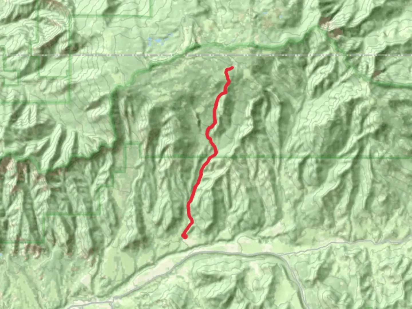
Embarking on the Hawkhurst Reservoir via Hawkhurst Trail presents an invigorating challenge for seasoned hikers. With a total distance of approximately 24 kilometers (about 15 miles) and an elevation gain of around 1100 meters (roughly 3600 feet), this out-and-back trail is not for the faint of heart. The trailhead is conveniently located near Mesa County, Colorado, which is accessible by car. For those relying on public transportation, options may be limited due to the trail's remote location, so it's advisable to check local transit resources for the latest information.Getting to the TrailheadTo reach the starting point of the Hawkhurst Trail, you'll want to navigate towards Mesa County. If you're driving, the nearest significant landmark is the Grand Mesa Visitor Center, which is a useful reference point for those unfamiliar with the area. From there, detailed directions to the trailhead can be plotted using the HiiKER app, ensuring you're on the right path from the get-go.Navigating the TrailAs you commence your hike, the trail will lead you through a diverse landscape, offering a mix of dense forested areas and open meadows. The initial segment introduces a moderate incline, allowing you to warm up before the more strenuous ascents ahead. Approximately 5 kilometers (3 miles) in, you'll encounter the first major viewpoint, which offers a panoramic vista of the surrounding valley.Continuing onward, the trail becomes more challenging, with steeper sections that will test your endurance. The path is well-marked, but it's always wise to have the HiiKER app handy for real-time navigation and to track your progress.Flora and FaunaThe Hawkhurst Trail is a haven for wildlife enthusiasts. As you ascend, keep an eye out for local inhabitants such as mule deer, elk, and an array of bird species, including the majestic golden eagle. The trail is also rich in plant life, with wildflowers blooming in the spring and summer months, adding a splash of color to the landscape.Historical SignificanceThe region around the Hawkhurst Trail is steeped in history. The area was once the homeland of the Ute people before European settlers arrived. As you hike, consider the historical significance of the land and the various cultures that have traversed and lived in these mountains.Reaching the ReservoirThe culmination of the hike is the serene Hawkhurst Reservoir. Situated at roughly the 12-kilometer (7.5-mile) mark, the reservoir is a perfect spot to rest and enjoy the tranquility of nature. The area around the reservoir offers stunning views and is an ideal location for a well-deserved break before beginning your descent.Preparation and SafetyGiven the trail's difficulty rating and remote nature, it's essential to come prepared. Ensure you have adequate water, food, and layers to adapt to changing weather conditions. It's also prudent to inform someone of your hiking plans and expected return time.Remember, the elevation gain is significant, so pace yourself and be mindful of altitude sickness. Always check the weather forecast before setting out, and start early in the day to avoid being caught on the trail after dark.ConclusionThe Hawkhurst Reservoir via Hawkhurst Trail offers a rewarding experience for those looking to push their limits and enjoy the rugged beauty of Colorado's wilderness. With the right preparation and respect for the natural environment, this hike can be a memorable adventure.

Comments and Reviews
User comments, reviews and discussions about the Hawkhurst Reservoir via Hawkhurst Trail, Colorado.
4.75
average rating out of 5
4 rating(s)