Download
Preview
Add to list
More
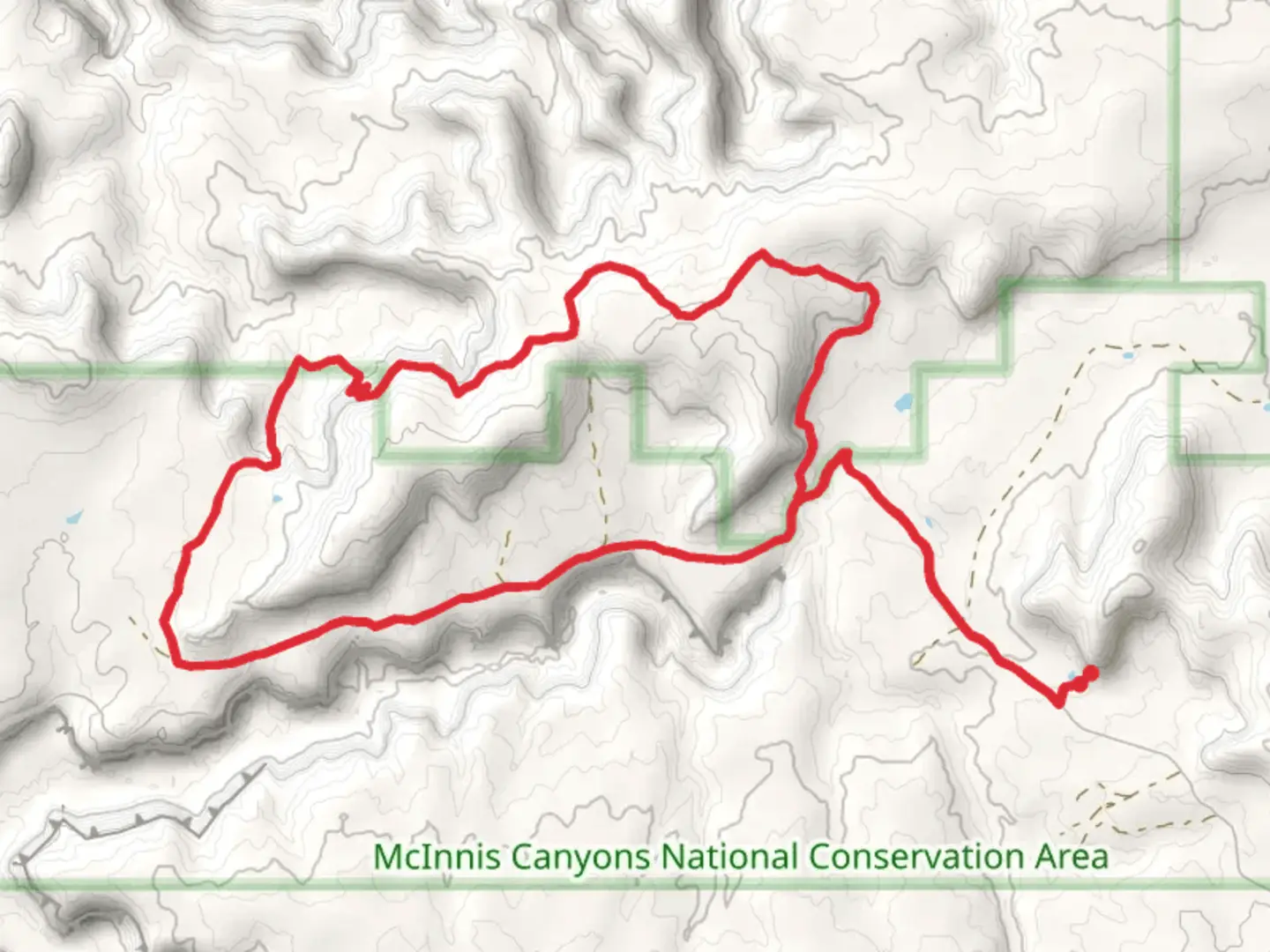
14.6 km
~3 hrs 32 min
369 m
Loop
“Experience Colorado’s diverse landscapes and historical intrigue on the moderately challenging 15 km BS Road and Gore Loop.”
Starting near Mesa County, Colorado, the BS Road and Gore Loop is a captivating 15 km (approximately 9.3 miles) loop trail with an elevation gain of around 300 meters (about 984 feet). This trail is rated as medium difficulty, making it suitable for moderately experienced hikers looking for a rewarding adventure.
Getting There To reach the trailhead, you can drive or use public transport. If driving, head towards the nearest significant landmark, the Colorado National Monument Visitor Center, located at 1750 Rim Rock Dr, Fruita, CO 81521. From there, it's a short drive to the trailhead. For those using public transport, the nearest bus stop is in Fruita, from where you can take a taxi or rideshare service to the trailhead.
Trail Overview The BS Road and Gore Loop offers a diverse hiking experience, featuring a mix of open meadows, dense forests, and rocky outcrops. The trail starts with a gentle ascent, allowing hikers to warm up before tackling more challenging sections.
Key Landmarks and Sections - **First 3 km (1.9 miles):** The initial stretch of the trail takes you through a series of rolling meadows. Keep an eye out for mule deer and various bird species that frequent this area. The elevation gain here is minimal, making it a pleasant start. - **3 km to 6 km (1.9 to 3.7 miles):** As you progress, the trail begins to ascend more steeply. This section is characterized by rocky terrain and offers stunning views of the surrounding mesas. The elevation gain in this segment is around 150 meters (492 feet). - **6 km to 9 km (3.7 to 5.6 miles):** This part of the trail takes you through a dense forested area. The canopy provides ample shade, making it a great spot to take a break. Look out for signs of local wildlife, including black bears and mountain lions, although sightings are rare. - **9 km to 12 km (5.6 to 7.5 miles):** The trail continues to climb, reaching its highest point at around 12 km. Here, you'll be rewarded with panoramic views of the Colorado River and the distant La Sal Mountains. The elevation gain in this section is another 100 meters (328 feet). - **12 km to 15 km (7.5 to 9.3 miles):** The final stretch of the loop descends gradually back to the trailhead. This section is less strenuous and allows you to enjoy the diverse flora, including wildflowers in the spring and summer months.
Historical Significance The region around Mesa County has a rich history, with evidence of Native American habitation dating back thousands of years. The Ute tribes were the primary inhabitants before European settlers arrived. The area also played a significant role during the westward expansion of the United States, with many pioneers passing through on their way to California.
Navigation and Safety For navigation, it's highly recommended to use the HiiKER app, which provides detailed maps and real-time updates. Ensure you have enough water, especially during the hotter months, as the trail can be quite exposed in certain sections. Weather can change rapidly, so be prepared for sudden shifts in conditions.
This trail offers a blend of natural beauty, moderate challenges, and historical intrigue, making it a must-visit for any hiking enthusiast exploring Colorado.

What to expect?
Activity types
Comments and Reviews
User comments, reviews and discussions about the BS Road and Gore Loop, Colorado.
4.4
average rating out of 5
10 rating(s)