Download
Preview
Add to list
More
761.0 km
~41 days
18871 m
Multi-Day
“Embark on the Colorado Trail, a scenic and challenging trek through America's rugged mountain wilderness.”
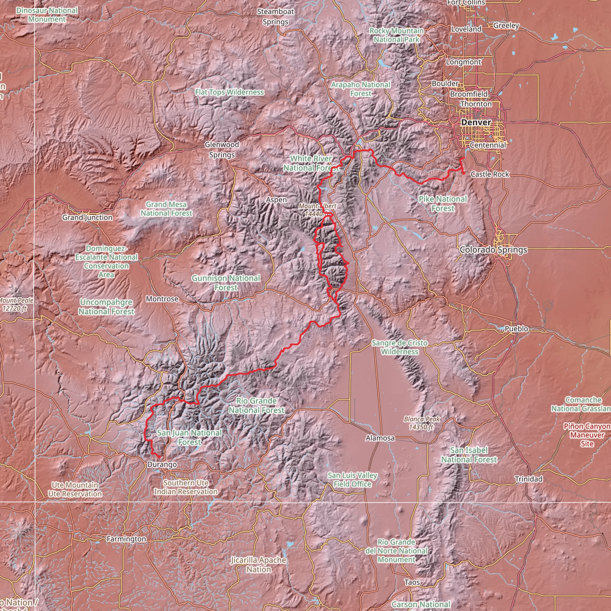
Spanning approximately 761 kilometers (473 miles) and with an elevation gain of around 18,800 meters (61,680 feet), the Colorado Trail is a remarkable point-to-point trek that traverses some of the most stunning landscapes in the United States. Starting near La Plata County, Colorado, the trailhead can be accessed by car or public transport. For those arriving by car, the trailhead is located near Durango, which is the nearest significant landmark. Public transport options may include a combination of buses and shuttles from major Colorado cities to Durango, followed by a taxi or local shuttle to the trailhead itself.
Navigating the Trail
As you embark on this journey, it's essential to have reliable navigation tools. HiiKER is a recommended app for tracking your progress, locating campsites, and identifying key waypoints along the trail. The Colorado Trail is well-marked with a series of trail markers and signs, but having a digital tool can be invaluable, especially in areas where the trail may be less distinct.
Terrain and Scenery
The trail offers a diverse range of terrains, from high mountain passes and dense forests to wide-open meadows and arid desert sections. You'll traverse through eight mountain ranges, six national forests, and six wilderness areas. The highest point of the trail is at 4,023 meters (13,200 feet) above sea level, offering breathtaking views and challenging high-altitude hiking.
Wildlife and Nature
As you hike, you'll likely encounter a variety of wildlife, including elk, mule deer, mountain lions, and black bears. Birdwatchers will be delighted by the array of bird species that call this region home. The trail also boasts a rich display of wildflowers, especially in the late spring and early summer months.
Historical Significance
The Colorado Trail crosses paths with history, including old mining towns and ancient Native American routes. The region's past is etched into the landscape, and hikers can sense the echoes of the pioneers and indigenous peoples who once traveled these mountains.
Preparation and Planning
Given the trail's length and varying elevations, hikers should prepare for a long-distance trek that can take several weeks to complete. It's crucial to plan resupply points, as there are towns and outposts along the trail where you can restock on food and other essentials. Water sources are generally plentiful, but always carry a filter or purification method.
Access to the Trailhead
To reach the southern terminus of the Colorado Trail near La Plata County, the nearest address for navigation purposes is Durango, Colorado. From Durango, you can drive to the trailhead, which is located just outside of town. If you're using public transportation, take a bus to Durango and then a local shuttle or taxi to reach the trailhead.
Remember, the Colorado Trail is a journey of both physical and mental endurance. It offers an opportunity to disconnect from the modern world and immerse yourself in the natural beauty of the Colorado wilderness. Whether you're a seasoned hiker or embarking on your first long-distance trek, the Colorado Trail is a path that promises adventure, solitude, and a deep connection with the great outdoors.
What to expect?
Activity types
Comments and Reviews
User comments, reviews and discussions about the Colorado Trail, Colorado.
4.2
average rating out of 5
10 rating(s)

