Download
Preview
Add to list
More
20.8 km
~2 days
1081 m
Multi-Day
“Embark on the challenging Bonholder Trail for a breathtaking high-altitude trek through Colorado's rugged beauty.”
The Bonholder Trail, nestled in the scenic landscape near Hinsdale County, Colorado, offers an invigorating point-to-point hike spanning approximately 21 kilometers (13 miles) with an elevation gain of around 1000 meters (3280 feet). This trail is considered difficult due to its challenging terrain and significant elevation changes, making it a rewarding endeavor for seasoned hikers.
Getting to the Trailhead To reach the starting point of the Bonholder Trail, hikers can drive to the nearest landmark, the Silver Thread Scenic Byway, which is accessible from State Highway 149. There is a designated parking area for hikers near the trailhead. For those relying on public transportation, options may be limited due to the remote nature of the region, so it's advisable to check local resources for the latest information on shuttle services or public transit routes that may get you close to the trailhead.
Navigating the Trail As you embark on the Bonholder Trail, you'll traverse through diverse landscapes, including dense forests, alpine meadows, and rocky ridges. The trail is well-marked, but due to its remote location and challenging terrain, it's essential to have a reliable navigation tool. HiiKER is an excellent resource for trail maps and navigation, ensuring you stay on the correct path throughout your hike.
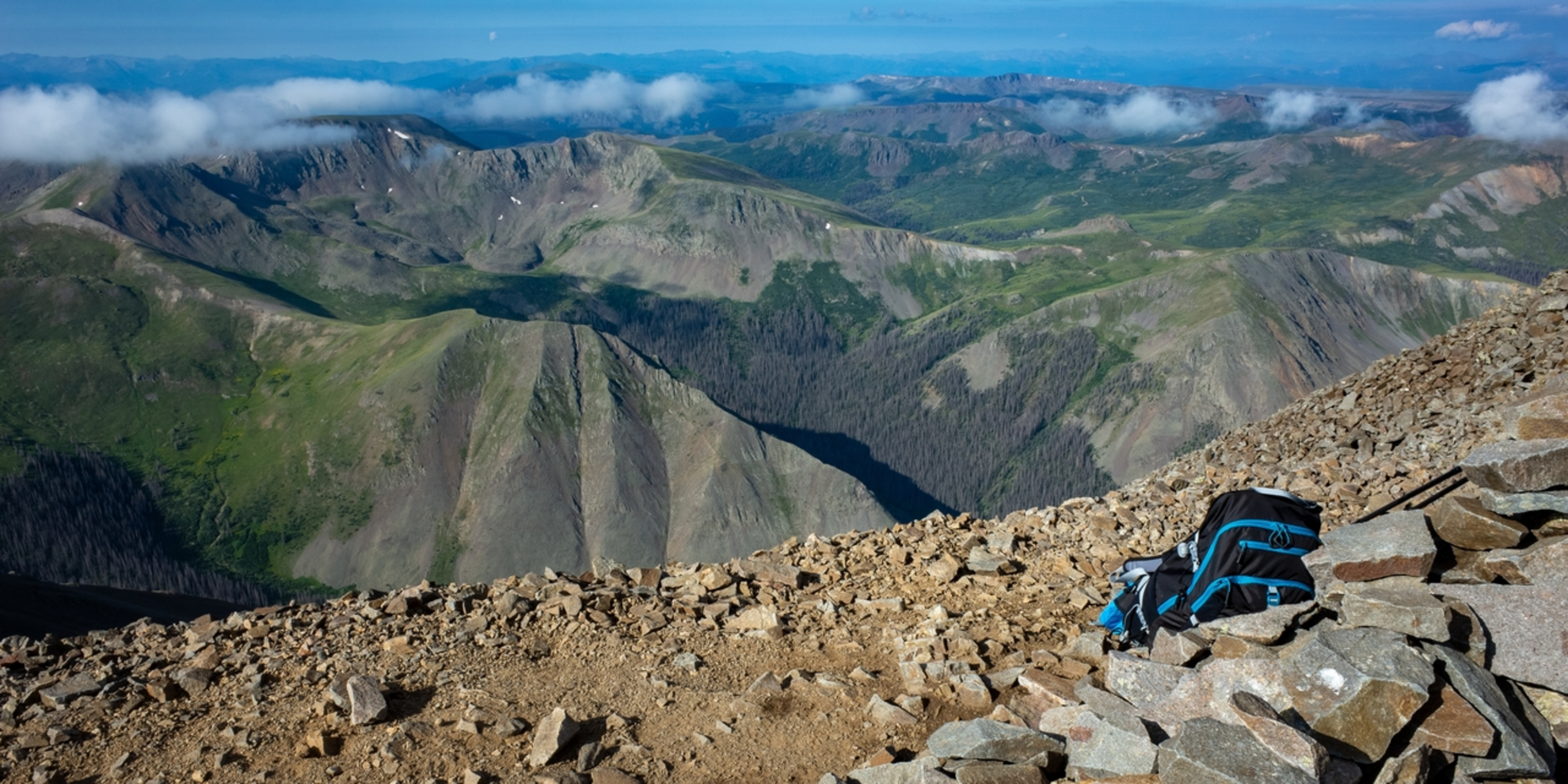
Landmarks and Natural Features The trail offers a variety of natural landmarks and breathtaking vistas. In the first few kilometers, you'll encounter a series of switchbacks that gradually ascend through a coniferous forest. As you gain elevation, the forest canopy opens up to reveal expansive views of the surrounding mountains.
Around the halfway mark, at approximately 10 kilometers (6.2 miles), you'll reach a prominent ridge that provides a panoramic view of the San Juan Mountains. This is an ideal spot to rest and take in the scenery before continuing your ascent.
Wildlife and Flora The Bonholder Trail is home to a rich array of wildlife. Keep an eye out for mule deer, elk, and if you're fortunate, you may even spot the elusive Colorado black bear from a safe distance. The area is also known for its diverse bird population, including raptors and songbirds. The trail's flora is equally impressive, with wildflowers such as columbines and Indian paintbrushes adding splashes of color during the warmer months.
Historical Significance The region around the Bonholder Trail is steeped in history, with Hinsdale County being a focal point during Colorado's mining boom in the late 19th century. As you hike, you'll be walking in the footsteps of early prospectors and settlers who once traversed these mountains in search of fortune and a new life.
Preparation and Safety Given the trail's difficulty and remote location, it's crucial to be well-prepared. Ensure you have adequate water, food, and layers of clothing to adapt to the unpredictable mountain weather. It's also wise to inform someone of your hiking plans and expected return time.
Remember, the Bonholder Trail is a high-elevation hike, so acclimatization is key to preventing altitude sickness. Take the time to acclimate if you're not used to high altitudes and be prepared for a physically demanding journey.
By respecting the trail and its natural inhabitants, and with the right preparation, your hike on the Bonholder Trail will be a memorable adventure through one of Colorado's most beautiful and rugged landscapes.

Comments and Reviews
User comments, reviews and discussions about the Bonholder Trail, Colorado.
4.25
average rating out of 5
4 rating(s)