Download
Preview
Add to list
More
10.3 km
~2 hrs 54 min
501 m
Out and Back
“Explore the enchanting Forest Lakes trail, a historical and wildlife-rich hiking adventure amidst Colorado's rugged beauty.”
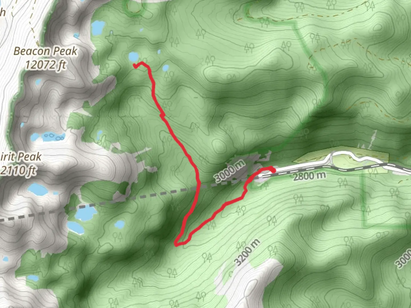
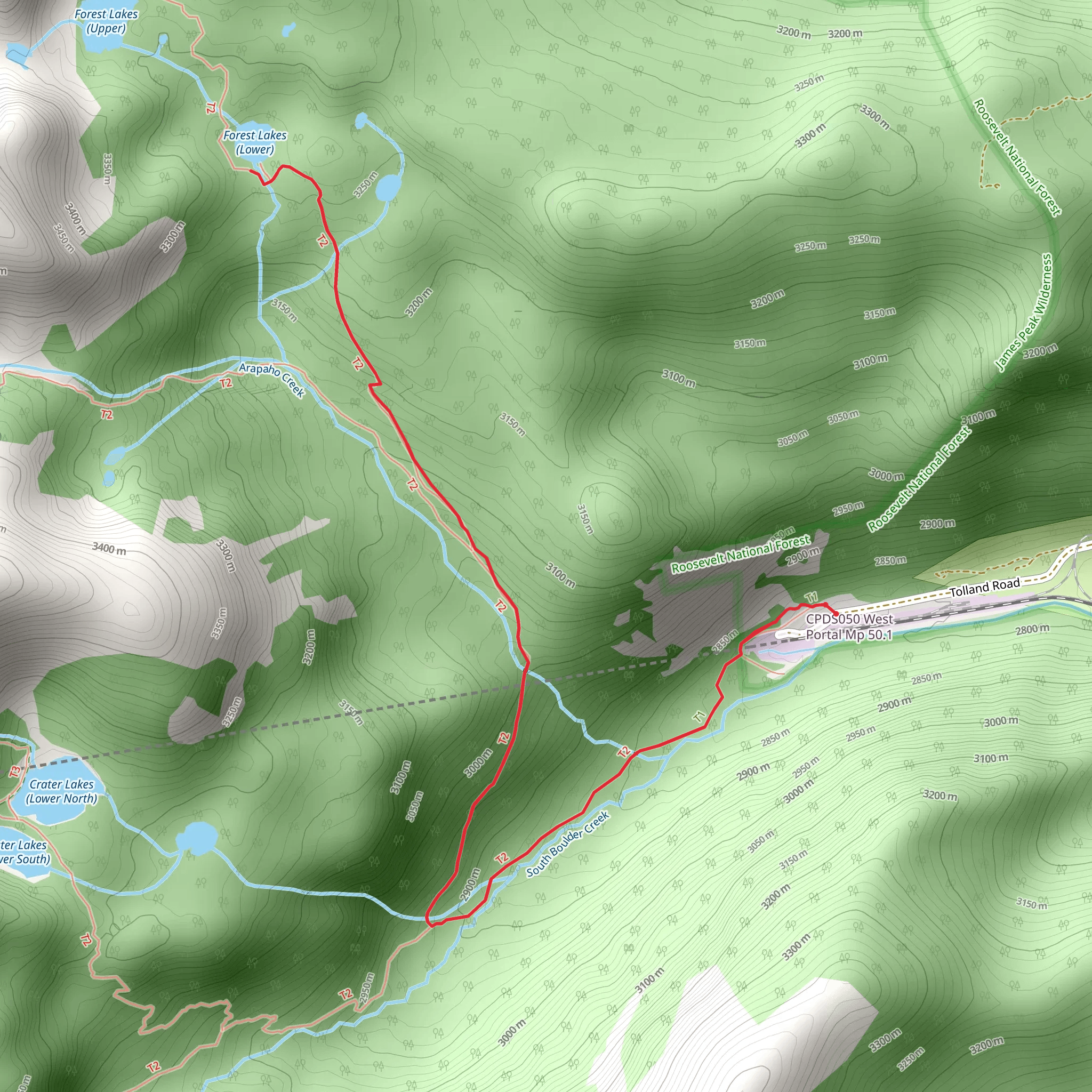
Nestled in the heart of Gilpin County, Colorado, the Forest Lakes trail offers an immersive experience into the wilderness, spanning approximately 10 kilometers (6.2 miles) with an elevation gain of around 500 meters (1640 feet). This out-and-back trail is rated medium in difficulty, making it accessible to hikers with some experience looking for a day hike with rewarding views.
Getting to the Trailhead
To reach the trailhead, you can drive to the vicinity of Gilpin County, where parking is available near the start of the trail. For those opting for public transportation, check local transit schedules for the nearest routes that approach the area, and be prepared for a short walk or taxi ride to the trailhead itself.
The Hike
As you embark on your journey, the trail begins with a gentle incline through a mixed conifer forest, where the scent of pine and the sound of rustling leaves accompany you. The path is well-defined and meanders alongside a babbling creek, which you'll cross several times via small wooden bridges. Keep an eye out for beaver dams, which are common in this area.
Flora and Fauna
The Forest Lakes trail is a haven for wildlife enthusiasts. You might spot mule deer, elk, and even moose in the more secluded areas. Birdwatchers can look forward to seeing a variety of species, including the Steller's jay and the mountain chickadee. The trail is also rich in flora, with wildflowers such as columbines and Indian paintbrush adding splashes of color in the spring and summer months.
Historical Significance
The region around Gilpin County is steeped in history, once bustling with activity during the Colorado Gold Rush. As you hike, you'll be walking in the footsteps of miners who traversed these mountains in the 19th century. Keep an eye out for abandoned mine shafts and relics from the past, but remember to respect these historical sites and not disturb them.
Navigating the Trail
For navigation, HiiKER is an excellent tool to keep you on track. It provides detailed maps and waypoints that can help you locate your position and plan your rest stops. As you approach the halfway mark, the trail begins to ascend more steeply, leading you to the first of the Forest Lakes. This is a good spot to rest and enjoy the serene alpine setting.
The Final Ascent and Lakes
The last stretch to the upper lake is the most challenging, with a series of switchbacks and a steeper incline. However, your efforts are rewarded with stunning views of the upper Forest Lake, nestled against a backdrop of rugged mountain peaks. This is the perfect place for a picnic and to take in the tranquility of the high-altitude landscape.
Safety and Preparation
Before setting out, ensure you're prepared with adequate water, snacks, and layers of clothing to adapt to the changing mountain weather. It's also wise to inform someone of your hiking plans and expected return time. Remember that cell service may be spotty, so download offline maps on HiiKER and carry a physical map and compass as backups.
Return Journey
After you've soaked in the beauty of the Forest Lakes, retrace your steps back down the trail to the trailhead. The descent will be faster, but remain cautious as the terrain can be slippery, especially after rain or snowmelt.
This hike is a wonderful way to experience the natural beauty of Gilpin County, with its rich history and abundant wildlife. Whether you're looking for a peaceful retreat or an opportunity to observe Colorado's diverse ecosystems, the Forest Lakes trail is a journey worth taking.
What to expect?
Activity types
Comments and Reviews
User comments, reviews and discussions about the Forest Lakes, Colorado.
4.58
average rating out of 5
12 rating(s)
