Download
Preview
Add to list
More
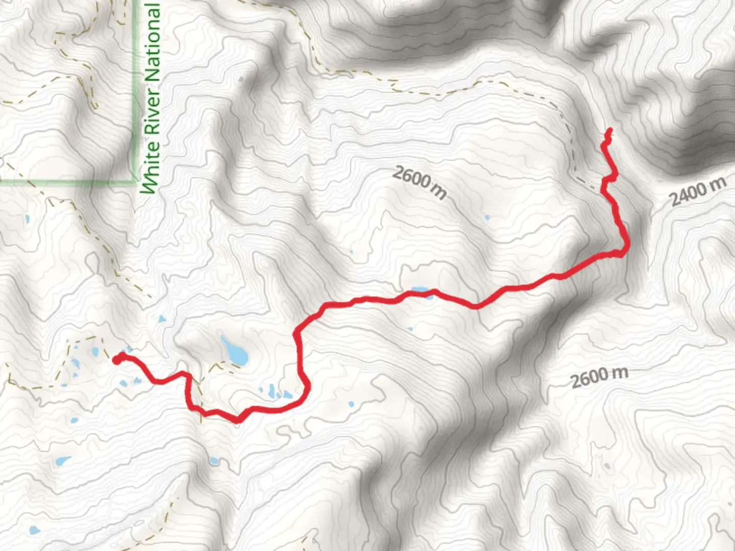
13.5 km
~3 hrs 51 min
697 m
Out and Back
“Embrace the rugged beauty of South Fork Piney Trail, a challenging journey through Colorado's majestic wilderness.”
The South Fork Piney Trail, nestled in the scenic landscape near Eagle County, Colorado, offers an invigorating hiking experience for those seeking a challenge amidst nature's splendor. Spanning approximately 14 kilometers (about 8.7 miles) with an elevation gain of around 600 meters (nearly 2000 feet), this out-and-back trail is not for the faint of heart, earning its 'Difficult' rating due to steep inclines and rugged terrain.
Getting to the Trailhead To reach the trailhead, hikers can drive to the vicinity of Red Sandstone Road in Vail, Colorado. There is no direct public transportation to the trailhead, so a personal vehicle or a taxi service is necessary. Parking is available near the trailhead, but it's advisable to arrive early during peak season to secure a spot.
The Hike Itself As you embark on the South Fork Piney Trail, the first section introduces you to a mixed forest environment, where the sounds of Piney River accompany your journey. The trail is well-defined, but hikers should always be prepared with a reliable navigation tool like HiiKER to track their progress and ensure they stay on the correct path.
Landmarks and Scenery After the initial 2 kilometers (1.2 miles), the trail opens up to reveal stunning vistas of the Gore Range. Here, the incline becomes more pronounced, and the landscape shifts to subalpine and alpine ecosystems as you ascend. Keep an eye out for the remnants of old mining operations, a nod to the region's historical significance during Colorado's mining boom in the late 19th century.
Flora and Fauna Throughout the hike, the diversity of flora and fauna is evident. You might spot mule deer, elk, and various bird species, including the majestic bald eagle. Wildflowers, such as columbines and Indian paintbrush, add splashes of color in the summer months, while aspen and pine trees provide a shady canopy.
Challenges and Considerations The trail's most challenging section comes as you approach the halfway mark, where the terrain becomes steeper and more technical. Loose rocks and uneven ground call for careful footing and a steady pace. At around 7 kilometers (4.3 miles), you'll reach the turnaround point, marked by the breathtaking sight of the Piney River cascading down from the high peaks.
Preparation and Safety Given the trail's difficulty, it's crucial to come prepared with adequate water, high-energy snacks, and layers of clothing to adapt to the unpredictable mountain weather. A first-aid kit, map, and compass, alongside your HiiKER app, are essential for navigation and safety. Always let someone know your hiking plans and expected return time.
Environmental Stewardship As with any natural area, it's important to practice Leave No Trace principles. Stay on designated trails, pack out all trash, and be respectful of wildlife by observing from a distance.
Seasonal Accessibility The South Fork Piney Trail is best tackled from late spring to early fall when the snow has melted, and the trail is most accessible. Snow and ice can linger on higher sections well into the summer, so check local conditions before setting out.
Remember, the South Fork Piney Trail offers a rewarding experience for those prepared for its challenges. With its combination of natural beauty, historical intrigue, and the satisfaction of conquering a demanding hike, it's a journey well worth the effort for seasoned hikers.

Comments and Reviews
User comments, reviews and discussions about the South Fork Piney Trail, Colorado.
5.0
average rating out of 5
1 rating(s)