Download
Preview
Add to list
More
8.7 km
~2 hrs 29 min
456 m
Out and Back
“Embark on Antones Trail for a rugged and historically-rich Colorado hiking adventure amidst diverse flora and fauna.”
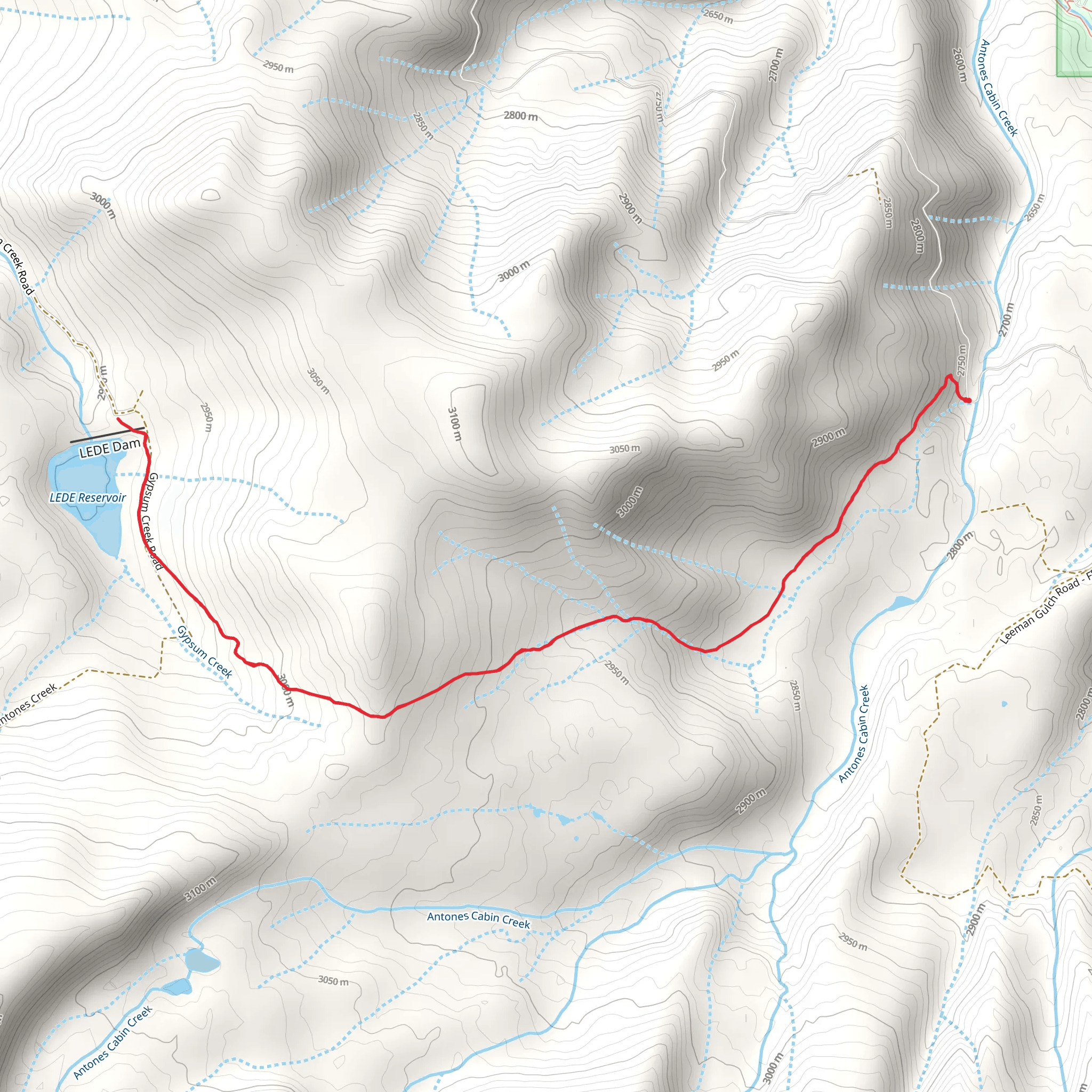
Antones Trail, nestled in the scenic region near Eagle County, Colorado, offers a challenging yet rewarding experience for avid hikers. The trail spans approximately 9 kilometers (about 5.6 miles) and features an elevation gain of around 400 meters (roughly 1,312 feet), presenting a difficult trek that requires good physical condition and proper preparation.
Getting to the Trailhead
To reach the trailhead, if you're driving, you can navigate towards Eagle County and follow the local roads leading to the starting point of Antones Trail. For those opting for public transportation, check the local transit schedules for buses that service the area closest to the trailhead. Once you arrive, you'll find the trailhead conveniently located near a significant landmark or address, which can be pinpointed using the HiiKER app for precise navigation.
The Hike Itself
As you embark on your hike, the initial section of the trail will take you through a mix of dense forest areas and open meadows, allowing you to immerse yourself in the diverse flora of the region. The path is well-defined but can be rocky and steep in places, so wearing sturdy hiking boots is advisable.
Flora and Fauna
Throughout your journey, you'll be surrounded by a variety of plant life, including wildflowers that bloom in the warmer months, adding a splash of color to the landscape. Keep an eye out for local wildlife, such as deer, elk, and an array of bird species. Remember to maintain a safe distance from any animals you encounter and to respect their natural habitat.
Historical Significance
The area around Antones Trail is steeped in history, with Eagle County being a region that saw a flurry of activity during Colorado's mining boom in the late 19th century. As you hike, you may come across remnants of this bygone era, such as old mine shafts or settlers' cabins, which serve as a silent testament to the area's rich past.
Navigational Tips
For navigation, the HiiKER app will be an invaluable tool on this trail. It will help you keep track of your progress and ensure you stay on the correct path. The trail is marked, but due to its challenging nature, it's essential to have a reliable navigation aid, especially in areas where the trail may become less distinct.
Elevation and Terrain
The trail's elevation gain is gradual but persistent, and you'll find the steepest sections as you approach the higher elevations. The terrain can be rugged, with loose stones and uneven ground, so it's important to watch your step. Trekking poles can be a great asset on this hike, providing extra stability and support.
Preparation and Safety
Given the trail's difficulty rating, it's crucial to prepare adequately before setting out. Ensure you have enough water, as there are no guaranteed water sources along the route, and pack high-energy snacks to keep your stamina up. Weather conditions can change rapidly in the mountains, so bring layered clothing to adapt to any shifts in temperature or precipitation.
By taking the necessary precautions and respecting the natural environment, your hike on Antones Trail will be a memorable adventure that offers both physical challenges and the serene beauty of the Colorado wilderness.
Comments and Reviews
User comments, reviews and discussions about the Antones Trail, Colorado.
4.0
average rating out of 5
1 rating(s)

