Download
Preview
Add to list
More
7.0 km
~2 hrs 1 min
373 m
Out and Back
“Trek the Burro Bridge Trail's rugged ascent through history and nature for a true Colorado wilderness challenge.”
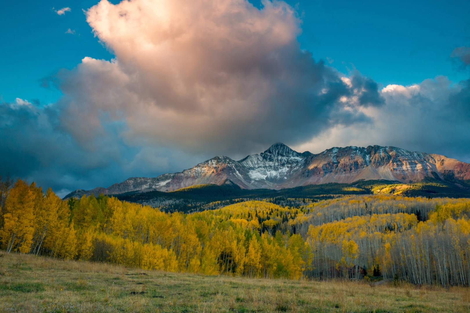
The Burro Bridge Trail, nestled in the heart of Dolores County, Colorado, offers a challenging yet rewarding experience for avid hikers. Spanning approximately 7 kilometers (about 4.3 miles) with an elevation gain of around 300 meters (roughly 984 feet), this out-and-back trail is not for the faint-hearted, earning its 'Difficult' rating due to the steep and rugged terrain.
Getting to the Trailhead
To reach the trailhead, you can drive from the nearby town of Dolores. Take Highway 145 north to the town of Rico, then turn onto County Road 38 (also known as the Dunton Road), which leads to the Burro Bridge Campground. The trailhead is located near this campground, and parking is available for those arriving by car. For those relying on public transportation, options may be limited, and it's advisable to check local resources for the latest schedules and routes to get as close to the trailhead as possible.
Navigating the Trail
As you embark on your hike, it's essential to have a reliable navigation tool. HiiKER is a useful app to help you stay on track, offering detailed maps and GPS coordinates to ensure you don't stray from the path. The trail begins with a steady incline, weaving through a dense forest of aspen and spruce trees. The sound of nearby streams creates a serene ambiance as you make your way up the trail.
Natural Landmarks and Wildlife
Approximately 2 kilometers (1.2 miles) into the hike, you'll encounter a series of switchbacks that offer glimpses of the surrounding peaks. Keep an eye out for local wildlife, including deer, elk, and an array of bird species. The trail continues to ascend, and as you gain elevation, the forest canopy opens up to reveal stunning views of the Lizard Head Wilderness.
Historical Significance
The region is steeped in history, with the San Juan Mountains having been a hub for mining activities in the late 19th and early 20th centuries. As you hike, you may notice remnants of this era, including abandoned mine shafts and old logging roads that crisscross the area. The trail itself is a testament to the ruggedness of the landscape that early settlers and miners had to navigate.
Preparation and Safety
Given the trail's difficulty, it's crucial to come prepared with adequate supplies, including water, food, and layers of clothing to adapt to the unpredictable mountain weather. Sturdy hiking boots are a must, as the terrain can be rocky and uneven. It's also wise to inform someone of your hiking plans and expected return time.
Flora and Fauna
As you approach the 3.5-kilometer (2.2-mile) mark, the trail culminates at a high alpine meadow, where wildflowers bloom in the warmer months, adding a splash of color to the landscape. This is also a good spot to rest and perhaps enjoy a picnic while taking in the panoramic views before beginning your descent back to the trailhead.
Remember, the Burro Bridge Trail is a remote and rugged hike that requires physical fitness and preparation. Always check the weather before heading out, and be mindful of the signs of altitude sickness. With the right planning and respect for the natural environment, this trail promises an unforgettable adventure in the heart of the Colorado wilderness.

Comments and Reviews
User comments, reviews and discussions about the Burro Bridge Trail, Colorado.
4.0
average rating out of 5
1 rating(s)