Download
Preview
Add to list
More
14.0 km
~4 hrs 0 min
728 m
Loop
“Traverse the challenging Summit Flats Trail for breathtaking mountain vistas and a taste of Colorado's gold rush history.”
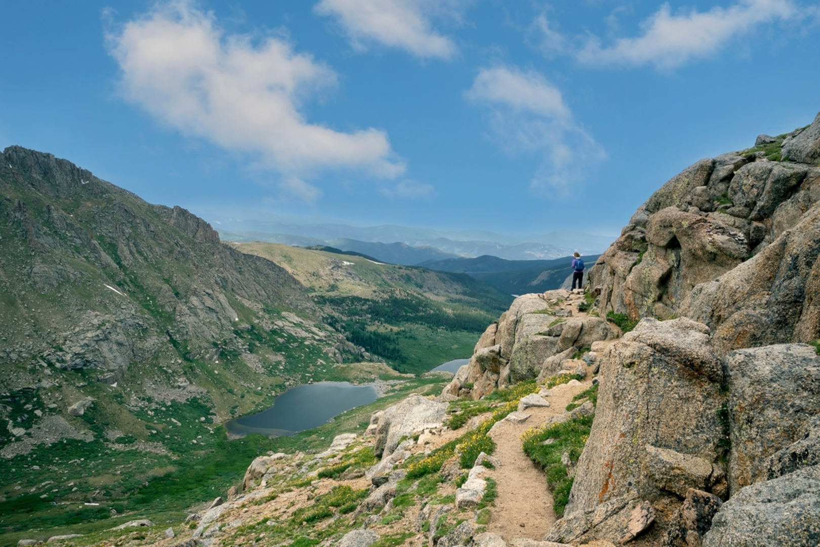
The Summit Flats Trail, nestled near Clear Creek County in Colorado, offers a challenging yet rewarding experience for avid hikers. Spanning approximately 14 kilometers (about 8.7 miles) and featuring an elevation gain of roughly 700 meters (around 2300 feet), this loop trail is not for the faint of heart. Its difficulty rating is justly estimated to be difficult, demanding a good level of fitness and preparation from those who dare to tackle it.
Getting to the Trailhead
To reach the trailhead, if you're driving, head towards Clear Creek County on I-70 and take the exit that leads to the nearest town. From there, follow local roads, keeping an eye out for trailhead signs. For those relying on public transport, check the local bus schedules as services may vary seasonally, and be prepared for a walk from the nearest bus stop to the trailhead.
Navigating the Trail
Once you embark on your hike, it's advisable to use a reliable navigation tool like HiiKER to keep track of your progress and ensure you're on the right path. The trail begins with a steady incline, weaving through dense forests of pine and aspen, which in the fall, turn into a spectacular display of golden hues.
Landmarks and Scenery
As you ascend, you'll be treated to intermittent views of the surrounding mountains, which become more impressive as you gain elevation. Around the halfway mark, the trail opens up to Summit Flats, a wide expanse where the terrain levels out for a while, offering a respite from the climb. This area is a great spot to catch your breath and enjoy the panoramic views.
Flora and Fauna
The diverse ecosystem along the trail is home to a variety of wildlife, including deer, elk, and if you're lucky, you might spot a black bear in the distance. Remember to keep a safe distance from all wildlife and practice Leave No Trace principles to protect their natural habitat.
Historical Significance
The region is steeped in history, with Clear Creek County being a focal point during the Colorado Gold Rush. As you hike, imagine the prospectors who once traversed these mountains in search of fortune. Some old, abandoned mines can still be seen from the trail, serving as a reminder of the area's rich past.
Preparing for the Hike
Given the trail's difficulty, it's essential to come prepared with adequate water, high-energy snacks, and layers of clothing to adapt to the changing conditions at higher elevations. The weather can shift rapidly in the mountains, so be ready for anything from bright sunshine to a sudden snow flurry, even in the summer months.
Safety and Etiquette
Always let someone know your hiking plan and expected return time. Cell service can be spotty, so don't rely on it as your primary safety net. It's also important to stay on the marked trail to prevent erosion and protect the fragile alpine environment.
By respecting these guidelines and coming prepared, hikers can fully enjoy the rugged beauty and challenge that the Summit Flats Trail has to offer.

Comments and Reviews
User comments, reviews and discussions about the Summit Flats Trail, Colorado.
average rating out of 5
0 rating(s)