Download
3D Flyover
Add to list
More
463 m
~7 min
22 m
Loop
“Embark on the Bristlecone Loop Trail to traverse ancient forests and savor majestic Rocky Mountain panoramas.”
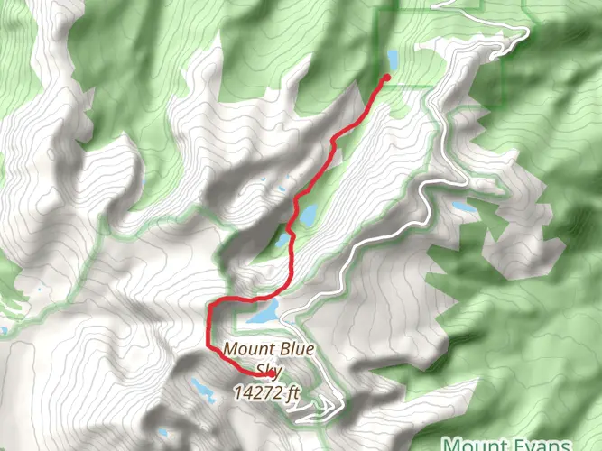
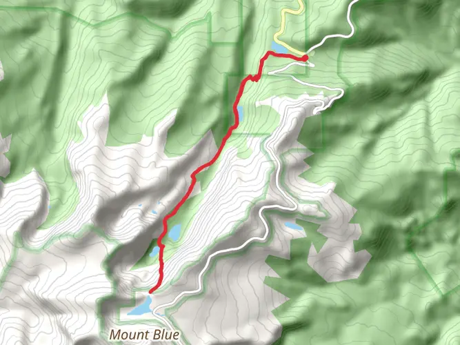
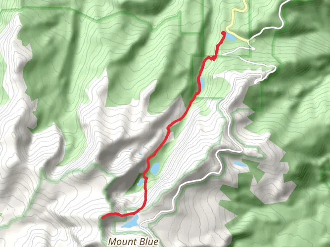
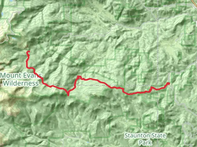
Nestled in the rugged landscape near Clear Creek County, Colorado, the Bristlecone Loop Trail offers hikers a chance to immerse themselves in the beauty of ancient forests and expansive mountain vistas. This moderately challenging loop spans approximately 6 kilometers (about 3.7 miles) and features an elevation gain of roughly 305 meters (1000 feet), providing a workout that's accessible to hikers with a reasonable level of fitness.
Getting to the Trailhead
To reach the trailhead, visitors can drive to the Mount Evans area, which is the nearest significant landmark. From Denver, take I-70 west to Exit 240 and then follow Colorado Highway 103 to Echo Lake. The trailhead is located near the Echo Lake Campground, which is a well-known spot for both locals and visitors. Parking is available in designated areas near the campground. For those relying on public transportation, options may be limited, and it's advisable to check the latest schedules and routes for any available shuttle services or buses that approach the Echo Lake region.
Navigating the Trail
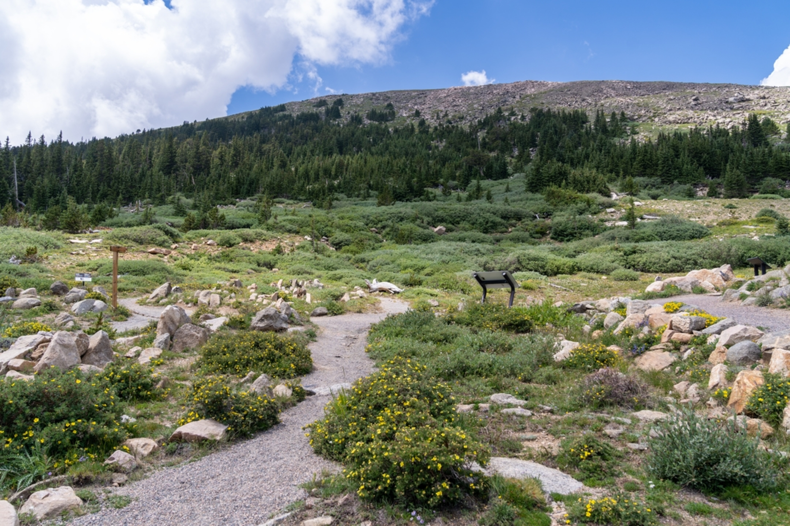
Once at the trailhead, hikers can begin their journey on the Bristlecone Loop Trail, which is well-marked and easy to follow. It's recommended to use a navigation tool like HiiKER to keep track of your progress and ensure you stay on the correct path. The trail meanders through a forest of ancient bristlecone pines, some of which are over a thousand years old, offering a living connection to the past.
Landmarks and Scenery
As you hike, you'll be treated to stunning views of the surrounding Rocky Mountains, with opportunities to spot Mount Evans and Mount Bierstadt on clear days. The trail also features several scenic overlooks that provide panoramic views of the alpine landscape. Keep an eye out for the diverse array of wildlife that inhabits the area, including mule deer, elk, and a variety of bird species.
Historical Significance
The region holds significant historical value, as the bristlecone pines are among the oldest living organisms on earth. Their resilience and longevity have made them a subject of scientific study and a symbol of the enduring natural heritage of the Rockies. The trail itself is a testament to the conservation efforts that have preserved these majestic trees for future generations to appreciate.
Preparation and Planning
Before setting out, hikers should be prepared for variable weather conditions, as the high altitude can lead to sudden temperature changes and storms. It's important to bring adequate water, sun protection, and layers of clothing. Additionally, the trail can be rocky and uneven in places, so sturdy hiking boots are recommended.
Remember to leave no trace and respect the natural environment by staying on the designated trail and disposing of waste properly. By doing so, you'll help ensure that the Bristlecone Loop Trail remains a pristine and enjoyable experience for all who visit.

Comments and Reviews
User comments, reviews and discussions about the Bristlecone Loop Trail, Colorado.
4.67
average rating out of 5
3 rating(s)