Download
Preview
Add to list
More
8.1 km
~2 hrs 21 min
435 m
Out and Back
“Embark on a rugged and historic hike through Colorado's Rocky Mountains to the serene Boss Lake Reservoir.”
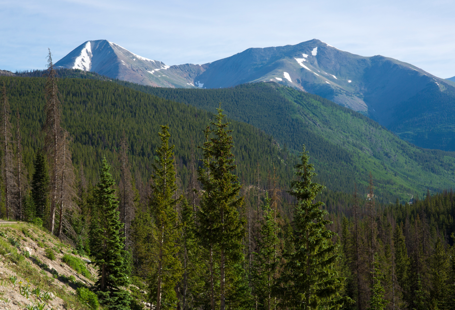
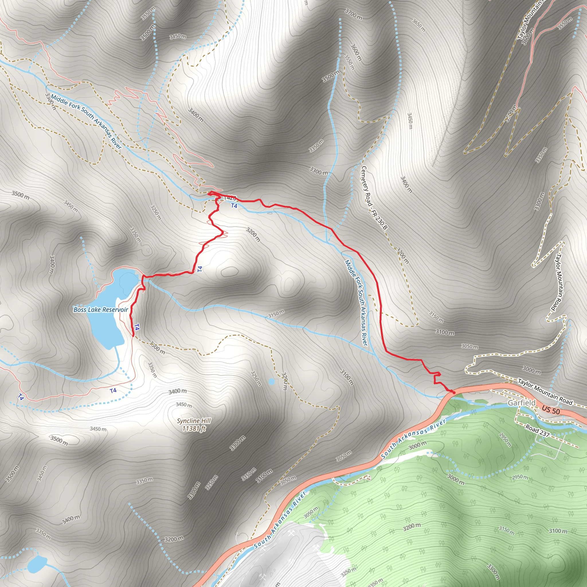
Nestled in the scenic heart of Chaffee County, Colorado, the Boss Lake Reservoir Trail offers an invigorating hiking experience for those seeking a challenge amidst the beauty of the Rocky Mountains. This approximately 8 km (5 miles) out-and-back trail boasts a significant elevation gain of around 400 meters (1,312 feet), presenting a strenuous journey that is best suited for seasoned hikers.
Getting to the Trailhead
To reach the trailhead, hikers can drive to the vicinity of Monarch Pass, which is accessible via U.S. Highway 50. The starting point is located near the Monarch Mountain ski area, a well-known landmark in the region. For those relying on public transportation, options may be limited, and it's advisable to check local resources for the latest schedules and routes to the Monarch Pass area. Once at the pass, parking is available, and the trailhead is easily identifiable.
The Hike Itself
As you embark on the Boss Lake Reservoir Trail, the path begins with a moderate incline through dense forests of spruce and aspen. The sound of nearby streams creates a tranquil ambiance as you navigate the well-marked trail. Approximately 2 km (1.2 miles) in, the incline becomes more pronounced, and the terrain may require careful footing.
Flora and Fauna
Throughout the hike, the region's diverse ecosystem is on full display. Wildflowers, including Colorado's famed columbines, dot the landscape in the warmer months. Wildlife is abundant, with the possibility of encountering mule deer, elk, and various bird species. Hikers should be aware that this area is also home to black bears and mountain lions, so knowledge of wildlife safety is essential.
Historical Significance
The area around the Boss Lake Reservoir Trail is steeped in history, with the nearby town of Salida known for its rich mining past. As you hike, you're traversing paths that miners may have used in the late 19th and early 20th centuries in search of precious metals. The reservoir itself, a key feature of the trail, serves as a reminder of the region's development and the importance of water management in the arid Colorado landscape.
Navigating the Trail
For those seeking to navigate the trail with precision, HiiKER is an excellent tool to ensure you stay on the right path. The app provides detailed maps and waypoints that can be invaluable, especially as the trail becomes more rugged and the elevation increases.
Reaching the Reservoir
The final stretch to the Boss Lake Reservoir is the most challenging, with steep switchbacks leading to the water's edge. Upon arrival, hikers are rewarded with stunning views of the reservoir, surrounded by towering peaks. The serene waters reflect the surrounding mountains, offering a picturesque spot for a well-deserved rest before the return journey.
Preparation and Safety
Given the trail's difficulty rating, it's crucial to prepare adequately. Hikers should bring plenty of water, high-energy snacks, and layers to adapt to changing weather conditions, which can be quite variable at high altitudes. Sturdy hiking boots are a must, as the terrain can be rocky and uneven. Always let someone know your hiking plans and expected return time, and be prepared with a first-aid kit and the knowledge of how to use it.
Conclusion
The Boss Lake Reservoir Trail is a rewarding adventure for those looking to immerse themselves in the rugged beauty of the Colorado Rockies. With its challenging terrain, rich history, and breathtaking natural scenery, it's a hike that offers both physical and spiritual rewards.
Comments and Reviews
User comments, reviews and discussions about the Boss Lake Reservoir Trail, Colorado.
5.0
average rating out of 5
1 rating(s)

