Download
Preview
Add to list
More
28.4 km
~2 days
882 m
Multi-Day
“Trek the Skyline to Big Basin trail for a challenging and historic journey through California's majestic redwoods.”
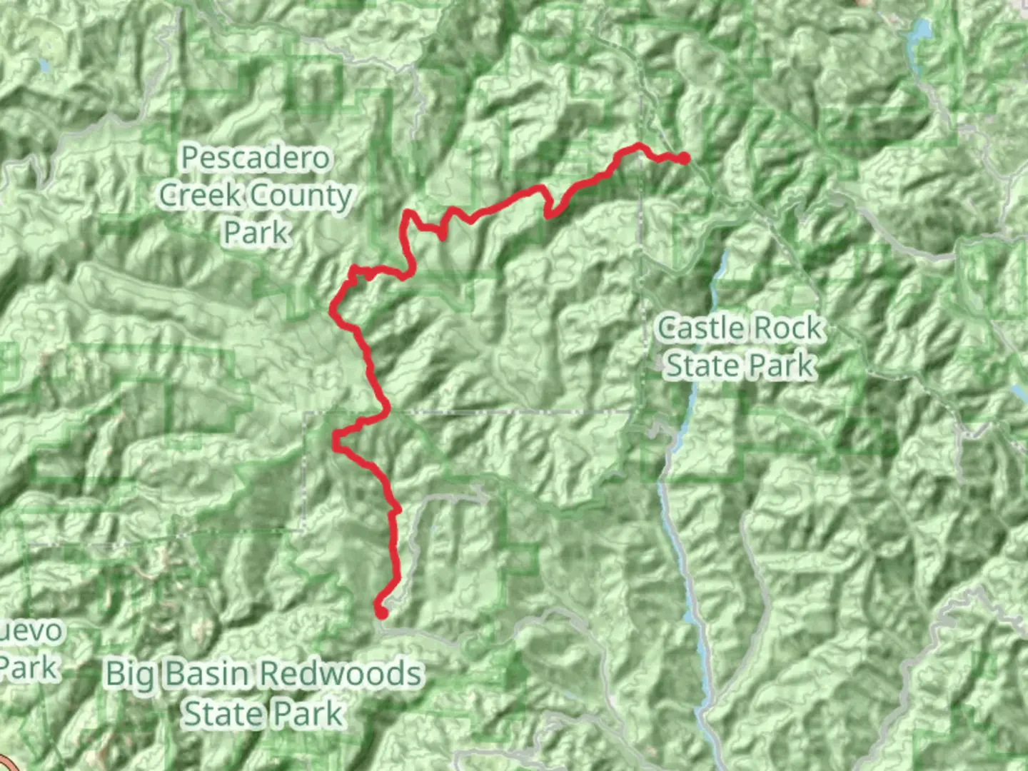
Embarking on the Skyline to Big Basin trail, hikers will traverse a scenic route that spans approximately 28 kilometers (about 17.4 miles) with an elevation gain of around 800 meters (roughly 2625 feet). This point-to-point trail is nestled near Santa Cruz County, California, and is known for its challenging terrain and breathtaking vistas, earning it a difficult rating.
Getting to the Trailhead To reach the starting point of the Skyline to Big Basin hike, adventurers can drive to the trailhead located near Castle Rock State Park. For those relying on public transportation, options may be limited due to the trail's remote nature, so checking local transit resources for the latest schedules and routes is advisable. Once at Castle Rock State Park, the trailhead is accessible from the main parking area.
Navigating the Trail As you set out on your journey, ensure you have the HiiKER app downloaded for up-to-date trail maps and navigation assistance. The trail begins with a descent into the lush forests of the Santa Cruz Mountains, where the canopy of redwoods and Douglas firs provides a serene backdrop.
Landmarks and Natural Beauty After the initial descent, you'll encounter the first significant landmark, the Castle Rock Falls, which is about 3 kilometers (nearly 2 miles) from the start. The trail continues to wind through the forest, offering occasional clearings that reveal the vast expanse of the Pacific Ocean and the surrounding valleys.
As you progress, the trail will lead you to the intersection with the Saratoga Gap Trail, approximately 8 kilometers (5 miles) in. This is a good spot to rest and take in the views before continuing on the Skyline to the Sea Trail, which will guide you towards Big Basin Redwoods State Park.
Flora and Fauna Throughout the hike, you'll be enveloped by the diverse ecosystem of the region. Keep an eye out for the banana slugs that are native to the area, as well as black-tailed deer and perhaps even a bobcat. Birdwatchers will delight in the variety of species that call these woods home, from the Steller's jay to the occasional red-tailed hawk soaring above.
Historical Significance The Skyline to Big Basin trail is steeped in history, as it traverses through California's oldest state park, Big Basin Redwoods State Park, established in 1902. This park is home to ancient coast redwoods, some of which are over 1,000 years old, serving as a living reminder of the region's rich natural heritage.
Preparing for the Hike Given the trail's difficulty and length, it is essential to be well-prepared with adequate water, food, and layers of clothing to accommodate the microclimates you may encounter. The trail can be cooler and more humid within the forested sections and warmer in exposed areas.
Conclusion of the Trail As you approach the end of the Skyline to Big Basin trail, the terrain will become more rugged, and you'll experience the majority of the elevation gain. The final stretch leads you into the heart of Big Basin Redwoods State Park, where you can explore further or arrange for transportation back to your starting point. Remember to leave no trace and preserve the beauty of this trail for future hikers.

Comments and Reviews
User comments, reviews and discussions about the Skyline to Big Basin, California.
4.2
average rating out of 5
5 rating(s)